Pennsylvania Avenue

Tax Assessment Block Map, Kansas City, MO, District 17, Block 287

Map of block in the Ward Parkway neighborhood, from 76th Street south to 77th Street, and Jefferson Street east to Washington Street, including a section of Pennsylvania Avenue, containing information about tax assessment values of included properties, and illustrating lot numbers for the block. Photographs of properties on the block can be viewed below.

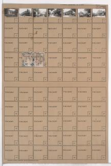
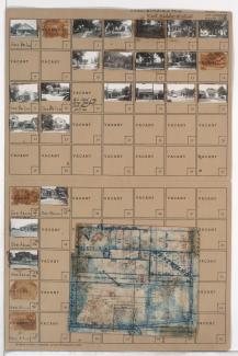
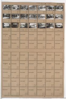
Tax Assessment Block Folder, Kansas City, MO, District 17, Block 287

Folder contains photographs of residences in the Ward Parkway neighborhood, from 76th Street south to 77th Street, and Jefferson Street east to Washington Street, including a section of Pennsylvania Avenue. Folder also includes a plat map of the block, which can be viewed below.