Foundries

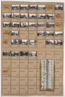
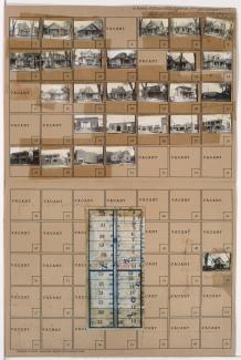
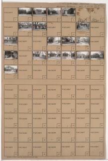
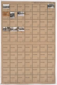
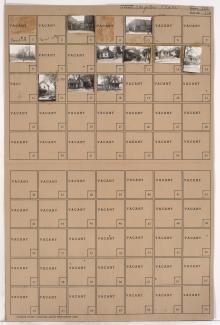
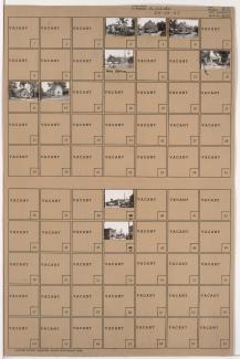
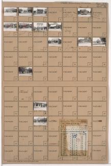
Tax Assessment Block Folder, Kansas City, MO, District 11, Block 9

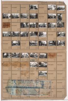
Folder contains photographs of residences, businesses, and other buildings in the Old Hyde Park neighborhood, from 31st Street south to Linwood Boulevard, and McGee Street east to Oak Street. Linwood Ice Cream, at 3100 Oak, is among the buildings pictured. Folder also includes a plat map of the block.

Tax Assessment Block Folder, Kansas City, MO, District 8, Block 170

Folder contains photographs of residences and businesses in the Washington Wheatley neighborhood, from 26th Street south to 27th Street, and Indiana Avenue east to Bales Avenue. The E. H. Zirkle Company, at 3718 East 27th, Cohen's Shoe Shop, and Wilson's Tavern, at 3414 East 27th, are among the buildings pictured. at 3416 East 27th, Folder also includes a plat map of the block.

Tax Assessment Block Folder, Kansas City, MO, District 8, Block 169

Folder contains photographs of residences, businesses, and apartment buildings in the Washington Wheatley neighborhood, from 25th Street south to 26th Street, and Indiana Avenue east to Bales Avenue. Indiana Avenue M. E. Church, at 2501 Indiana, and Meiners Market, at 3408 East 26th, are among the buildings pictured. Folder also includes a plat map of the block.

Tax Assessment Block Folder, Kansas City, MO, District 6, Block 337

Folder contains photographs of residences, businesses, and other buildings in the Washington Wheatley neighborhood, from 18th Street south to 19th Street, and Agnes Avenue east to Walrond Avenue. A. O. Thompson Lumber Company, at 18th and Walrond, and Hayes Tavern, at 3023 East 18th, are among the buildings pictured.

Tax Assessment Block Folder, Kansas City, MO, District 6, Block 327

Folder contains photographs of businesses and other buildings in the East Community Team neighborhood, from 18th Street south to 19th Street, and Askew Avenue east to Monroe Avenue. Kansas City Aluminum Foundry, at 18th and Askew, and the Galilee Baptist Church, at 19th and Askew, are among the buildings pictured.

Tax Assessment Block Folder, Kansas City, MO, District 7, Block 266

Folder contains photographs of residences and other buildings in the Leeds neighborhood, from 39th Street south to the Blue River and the railroad tracks, and Fremont Avenue east to Fuller Avenue and the railroad tracks, including a section of 40th Street. Clay and Bailey Manufacturing Company, on 40th Street, is among the buildings pictured.

Tax Assessment Block Folder, Kansas City, MO, District 7, Block 121

Folder contains photographs of businesses and other buildings in the East Blue Valley neighborhood, from 15th Street (later Truman Road) south to 16th Street, and Corrington Avenue east to Crystal Avenue. Milgram Grocery Store, at 7217 East 15th, and W. A. Turley Sheet Metal Works, at 1524 Crystal, are among the buildings pictured.