Laundries

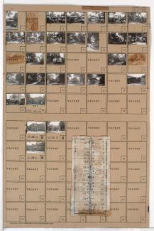
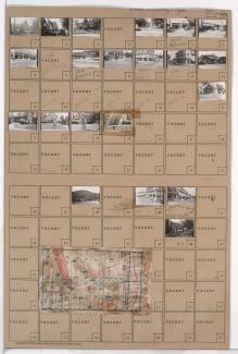
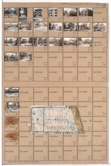
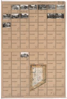
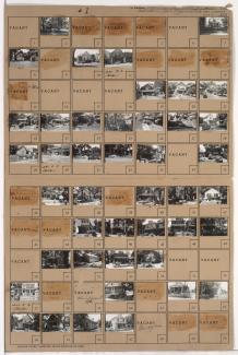
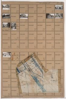
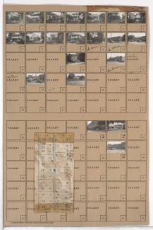
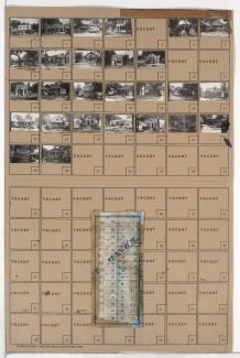
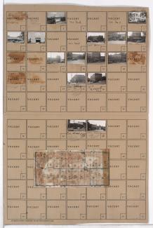
Tax Assessment Block Folder, Kansas City, MO, District 14, Block 235

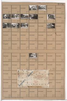
Folder contains photographs of residences and businesses in the Swope Parkway neighborhood, from 58th Terrace south to 59th Street, and Swope Parkway east to Myrtle Avenue. Stofer's Drug Store, at 59th and Myrtle, is among the buildings pictured. Folder also includes a plat map of the block.

Tax Assessment Block Folder, Kansas City, MO, District 13, Block 185

Folder contains photographs of residences and businesses in the Eastern 49-63 neighborhood, from 57th Street south to 58th Street, and Troost Avenue east to Forest Avenue. Southtown Theater, at 5705-5707 Troost, and Crown Drugstore, at 5701 Troost, are among the buildings pictured. Folder also includes a plat map of the block.

Tax Assessment Block Folder, Kansas City, MO, District 17, Block 209

Folder contains photographs of residences and businesses in the Waldo neighborhood, from 74th Terrace south to 75th Street, and Wornall Road east to Wyandotte Street. The 8th Ward Democratic Club, at 212 West 75th, Kahle Grocery, at 214 West 75th, and Velvet Freeze Ice Cream, at 75th and Wornall, are among the buildings pictured. Folder also includes a plat map of the block.

Tax Assessment Block Folder, Kansas City, MO, District 12, Block 2

Folder contains photographs of residences, businesses, and apartment buildings in the Park Central neighborhood, from 47th Street south to 48th Street, and Campbell Street east to Harrison Street. Jewel Laundry, at 912 East 48th, is among the buildings pictured. Folder also includes a plat map of the block.

Tax Assessment Block Folder, Kansas City, MO, District 12, Block 1

Folder contains photographs of residences and businesses in the Park Central neighborhood, from 47th Street south to 48th Street, and Harrison Street east to Troost Avenue. Rockhill Tavern, at 1007 East 48th, is among the buildings pictured. Folder also includes a plat map of the block.

Tax Assessment Block Folder, Kansas City, MO, District 11, Block 316

Folder contains photographs of residences, businesses, and other buildings in the Plaza/Westport neighborhood, from 42nd Street south to 43rd Street, and Wornall Road east to Mill Creek Parkway (later Broadway), including a section of Pennsylvania Avenue. R. L. Sweet Lumber Company, at 200 West 43rd, Plaza Laundry, at 501 West 42nd, and the Penn School, at 4237 Pennsylvania, are among the buildings pictured. Folder also includes a plat map of the block.

Tax Assessment Block Folder, Kansas City, MO, District 13, Block 72

Folder contains photographs of businesses and other buildings in the Eastern 49-63 neighborhood, from 47th Street south to 48th Street, and Troost Avenue east to Forest Avenue. Dascomb-Daniels Lumber Company, on 48th Street, is among the buildings pictured. Folder also includes a plat map of the block.