Schools

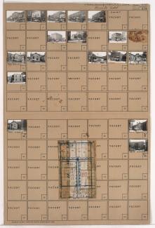
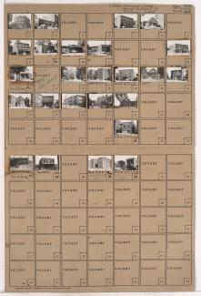
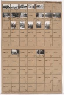
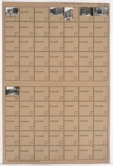
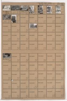
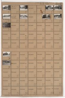
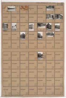
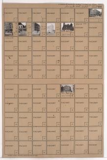
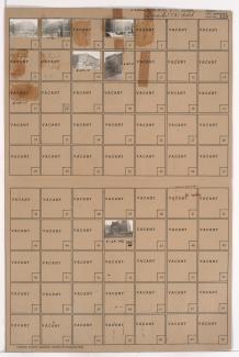
Tax Assessment Block Folder, Kansas City, MO, District 5, Block 189

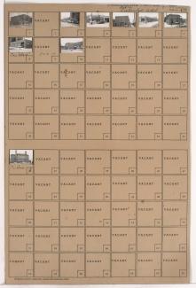
Folder contains photographs of businesses and other buildings in the Downtown East neighborhood, from 18th Street south to 19th Street, and Tracy Avenue east to Lydia Avenue. Ritz Ice Cream, at 1301 East 18th, and R. T. Coles School, on Tracy, are among the buildings pictured.

Tax Assessment Block Folder, Kansas City, MO, District 5, Block 187

Folder contains photographs of residences, businesses, and other buildings in the Downtown East neighborhood, from 18th Street south to 19th Street, and Grove Street east to Paseo Boulevard. DeLuxe Cafe, at 1421 East 18th, the Madame C. J. Walker School of Beauty, at 1834 Paseo, and the Paseo YMCA, at 1822-1828 Paseo, are among the buildings pictured.

Tax Assessment Block Folder, Kansas City, MO, District 5, Block 183

Folder contains photographs of residences, businesses, and other buildings in the Wendell Phillips neighborhood, from 18th Street south to 19th Street, and Woodland Avenue east to Euclid Avenue. Attucks School, on 19th Street, and Charles Bryant Barbecue, 1921 E. 18th Street, are among the buildings pictured.

Tax Assessment Block Folder, Kansas City, MO, District 5, Block 161

Folder contains photographs of residences, businesses, and other buildings in the Downtown East neighborhood, from 15th Street (later Truman Road) south to 16th Street, and Lydia Avenue east to Paseo Boulevard. The Fountain View Apartments, at 1512-1514 Paseo, Doehler Funeral Home, at 1415 East 15th, and the De LaSalle Academy school, at 16th and Paseo, are among the buildings pictured.

Tax Assessment Block Folder, Kansas City, MO, District 5, Block 158

Folder contains photographs of apartments and other buildings in the Downtown East neighborhood, from 15th Street (later Truman Road) south to 16th Street), and Forest Avenue east to Tracy Avenue. Manual High School, at 1215 East 15th, and the Leonard Apartments, at 1212-1214 East 16th, are among the buildings pictured.

Tax Assessment Block Folder, Kansas City, MO, District 4, Block 170

Folder contains photographs of businesses and other buildings in downtown Kansas City, from 13th Street south to 14th Street, and Baltimore Avenue east to Main Street. The Hotel President, at 14th and Baltimore, and the Keystone Building, housing secretarial and beauty schools and other businesses, are among the buildings pictured.

Tax Assessment Block Folder, Kansas City, MO, District 4, Block 166

Folder contains photographs of businesses and other buildings in downtown Kansas City, from 12th Street south to 13th Street, and Broadway Boulevard east to Central Street. The Hotel Auditorium, at 1221 Broadway, and the Lathrop School, at 1214 Central, are among the buildings pictured. A Griesedieck Brothers Beer billboard can be seen in one image.

Tax Assessment Block Folder, Kansas City, MO, District 4, Block 142

Folder contains photographs of residences, businesses, and other buildings in Haefner's 1st Addition, from 15th Street (later Truman Road) south to 16th Street, and Charlotte Street east to Campbell Street. The George Washington Carver School, at 1516 Campbell, and Carter & Company Bakery, on 16th Street, are among the buildings

Tax Assessment Block Folder, Kansas City, MO, District 4, Block 109

Folder contains photographs of businesses and other buildings in downtown Kansas City, from 11th Street south to 12th Street, and Locust Street east to Cherry Street. The Municipal Court and Police Headquarters Building, at 1125 Locust, and Kansas City Junior College, at 11th and Locust, are among the buildings pictured.

Tax Assessment Block Folder, Kansas City, MO, District 4, Block 107

Folder contains photographs of businesses and other buildings in downtown Kansas City, from 10th Street south to 11th Street, and Oak Street east to Locust Street. The Claridge and Drake Hotels, on Locust, and the College of Commerce, at 11th and Locust, are among the buildings pictured.