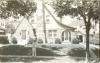
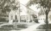
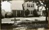
Folder contains photographs of residences in the Armour Hills neighborhood, from Dartmouth Road and 70th Street south to 70th Terrace, and Brookside Road east to Main Street. Folder also includes a plat map of the block.
Hover to Zoom

Missing images for parcels 5, 28, and 43.
Download Image File

Request a Building Photo
Any use of the images found in this collection should include the following credit: Missouri Valley Special Collections, Kansas City Public Library, Kansas City, Missouri. To inquire about permissions, please contact Missouri Valley Special Collections at (816) 701-3427 or lhistory@kclibrary.org
This project is supported by the Institute of Museum and Library Services under the provisions of the Library Services and Technology Act as administered by the Missouri State Library, a division of the Office of the Secretary of State.