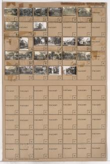
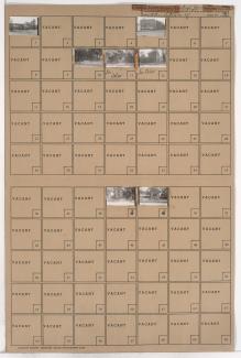
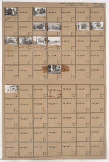
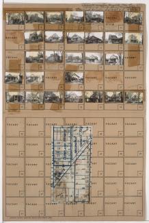
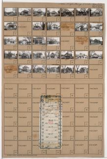
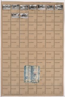
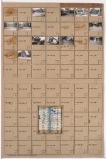
Tax Assessment Block Folder, Kansas City, MO, District 6, Block 242
Folder contains photographs of residences in the East Community Team neighborhood, from 19th Street south to 20th Street, and Cleveland Avenue east to Mersington Avenue.
Folder contains photographs of residences in the East Community Team neighborhood, from 19th Street south to 20th Street, and Mersington Avenue east to Myrtle Avenue.
Folder contains photographs of residences in the Lykins neighborhood, from 12th Street south to 12th Terrace, and Mersington Avenue east to Norton Avenue.
Folder contains photographs of residences and other buildings in the Lykins neighborhood, from 12th Street south to 12th Terrace, and Cleveland Avenue east to Mersington Avenue. Nick DePasco's 12th Street Beer Garden, at 3809 East 12th, is among the buildings pictured.
Folder contains photographs of residences and other buildings in the Lykins neighborhood, from 12th Terrace south to 13th Street, and Mersington Avenue east to Cleveland Avenue.
Folder contains photographs of residences in the Lykins neighborhood, from 12th Terrace south to 13th Street, and Norton Avenue east to Mersington Avenue.
Folder contains photographs of residences in the East Community Team neighborhood, from 16th Street south to 17th Street, and Mersington Avenue east to Myrtle Avenue.
Folder contains photographs of residences and other buildings in the East Community Team neighborhood, from 16th Street south to 17th Street, and Cleveland Avenue east to Mersington Avenue.
Folder contains photographs of residences in the East Community Team neighborhood, from 23rd Street south to 24th Street, and Mersington Avenue east to Myrtle Avenue, including a section of 23rd Terrace. Folder also includes a plat map of the block.
Folder contains photographs of residences, businesses, and other buildings in the East Community Team neighborhood, from 23rd Street south to 24th Street, and Cleveland Avenue east to Mersington Avenue, including a section of 23rd Terrace. Folder also includes a plat map of the block.
Folder contains photographs of residences in the East Community Team neighborhood, from 24th Street south to 25th Street, and Mersington Avenue east to Myrtle Avenue. Folder also includes a plat map of the block.
Folder contains photographs of residences in the East Community Team neighborhood, from 24th Street south to 25th Street, and Cleveland Avenue east to Mersington Avenue, including a section of 24th Terrace. Folder also includes a plat map of the block.
Folder contains phoographs of residences and businesses in the East Community Team neighborhood, from 25th Street south to 26th Street, and Mersington Avenue east to Myrtle Avenue. Floyd's Market, at 25th and Mersington, is among the buildings pictured. Folder also includes a plat map of the block.
Folder contains photographs of residences and other buildings in the East Community Team neighborhood, from 25th Street south to 26th Street, and Cleveland Avenue east to Mersington Avenue. The Mersington Heights Evangelical Association, at 25th and Mersington, is among the buildings pictured. Folder also includes a plat map of the block.
Folder contains photographs of residences and businesses in the East Community Team neighborhood, from 26th Street south to 27th Street, and Cleveland Avenue east to Mersington Avenue.
Folder contains photographs of residences in the East Community Team neighborhood, from 26th Street south to 27th Street, and Mersington Avenue east to Myrtle Avenue. Folder also includes a plat map of the block.
Folder contains photographs of residences and businesses in the Ingleside neighborhood, from 27th Street south to 28th Street, and Mersington Avenue east to Myrtle Avenue. Folder also includes a plat map of the block.
Folder contains photographs of residences and other buildings in the Ingleside neighborhood, from 27th Street south to 28th Street, and Cleveland Avenue east to Mersington Avenue. Folder also includes a plat map of the block.
Folder includes photographs of residences in the Ingleside neighborhood, from 28th Street south to 29th Street, and Cleveland Avenue east to Mersington Avenue. Folder also includes a plat map of the block.
Folder contains photographs of residences and other buildings in the Ingleside neighborhood, from 28th Street south to 29th Street, and Mersington Avenue east to Myrtle Avenue. St. John's Baptist Church, at 2804 Myrtle, and St. Matthew's A.M.E. Church, at 2801 Mersington, are among the buildings pictured. Folder also includes a plat map of the block.