Tax Assessment Block Folder, Kansas City, MO, District 3, Block 5

Folder contains photographs of businesses and apartment buildings adjacent to West Terrace (later, Case) Park, from 6th Street Trafficway south to 12th Street.
Folder contains photographs of businesses and apartment buildings adjacent to West Terrace (later, Case) Park, from 6th Street Trafficway south to 12th Street.
Folder contains photographs of residences and apartment buildings in the Quality Hill neighborhood, from 8th Street south to 9th Street, and Jefferson Street east to Pennsylvania Avenue.
Folder contains photographs of a filling station and garage in the Union Place addition, from 6th Street Trafficway south to Maiden Lane, and Pennsylvania Avenue east to Washington Street.

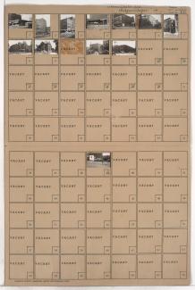
Folder contains photographs of residences and businesses in the Union Place addition, from Maiden Lane south to 7th Street, and Pennsylvania Avenue east to Washington Street. Folder also includes plat map of the block.

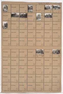
Folder contains photographs of residences, businesses, and apartment buildings in the Lucas Place addition, from 7th Street south to 9th Street, and Pennsylvania Avenue east to Washington Street.

Folder contains photographs of businesses and residences in the Quality Hill neighborhood, from 6th Street Trafficway south to 7th Street, and Washington Street east to Bank Street.
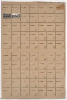
Folder contains photographs of businesses and other buildings in the Lucas Place addition, from 7th Street south to 8th Street, and Washington Street east to Bank Street. Midwest Envelope Company is among the buildings pictured.

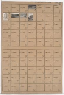
Folder contains photographs of businesses and other buildings in the Lucas Place addition, from 8th Street south to 9th Street, and Washington Street east to Bank Street.

Folder contains photographs of businesses and other buildings in the Quality Hill neighborhood, from 6th Street Trafficway south to 7th Street, and Bank Street east to Broadway Boulevard.

Folder contains photographs of businesses and other buildings in the Lucas Place addition, from 7th Street south to 8th Street, and Bank Street east to Broadway Boulevard.

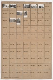
Folder contains photographs of buildings in the Lucas Place addition, from 8th Street south to 9th Street, and Bank Street east to Broadway Boulevard. The Harvey Dutton Building, at 8th and Broadway, and the Thayer Place building, at 816 Broadway, are among the buildings pictured. Folder also contains plat map of the block.
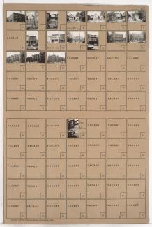
Folder contains photographs of residences, businesses, and apartment buildings in the Quality Hill neighborhood, from 9th Street south to 10th Street, and Pennsylvania Avenue east to Washington Street. Burlington Overall factory, at 9th and Washington, is among the buildings pictured.
Folder contains photographs of residences, businesses, and other buildings in the Quality Hill neighborhood, from 9th Street south to 10th Street, and Washington Street east to Broadway Boulevard. The Jewell Building, at 920 Broadway, with the Fried-Siegel Company as a tenant, is among the buildings pictured.
Folder contains photographs of residences and other buildings in the Quality Hill neighborhood, from 9th Street south to 10th Street, and Jefferson Street east to Pennsylvania Avenue. The Pennbrook Apartment Hotel, at 604 West 10th, and the Hotel Penn, at 906 Pennsylvania, are among the buildings pictured.

Folder contains photographs of residences, businesses, and apartment buildings in the Quality Hill neighborhood, from 10th Street south to 11th Street, and Summit Street east to Jefferson Street. Jefferson Market, at 1012 Jefferson, is among the buildings pictured. This block later became Case Park.

Folder contains photographs of residences and other buildings in the Quality Hill neighborhood, from 10th Street south to 11th Street, and Jefferson Street east to Pennsylvania Avenue. The Girls Club (formerly Blossom House) building, at 1032 Pennsylvania, and the Charlevoix Apartments, at 10th and Jefferson, are among the buildings pictured.

Folder contains photographs of residences and other buildings in the Quality Hill neighborhood, from 10th Street south to 11th Street, and Pennsylvania Avenue east to Washington Street. The Lahoma Hotel, at 510-512 West 11th, and the Major William Warner Residence, at 1021 Pennsylvania, are among the buildings pictured.

Folder contains photographs of residences, businesses, and other buildings in the Quality Hill neighborhood, from 10th Street south to 11th Street, and Washington Street east to Broadway Boulevard. The Musicians Club (earlier, Progress Club) building, at 1017 Washington, Eads Water Company, at 415-417 West 10th, and the Estill Hotel, at 1018 Broadway, are among the buildings pictured.

Folder contains photographs of residences, businesses, and other buildings in the Quality Hill neighborhood, from 11th Street south to 12th Street, and Washington Street east to Broadway Boulevard. The Cathedral of the Immaculate Conception, at 416 West 12th Street, and the Commercial Hotel, at 1104 Broadway, are among the buildings pictured.

Folder contains photographs of businesses, apartments, and other buildings in the Quality Hill neighborhood, from 11th Street south to 12th Street, and Pennsylvania Avenue east to Washington Street. The Chimes building, at 511 West 10th, is among the buildings pictured.