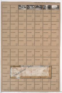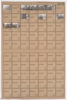
Folder contains photographs of residences in the Santa Fe Hills neighborhood south of the 1940 Kansas City city limits, from 86th Street south to 86th Terrace, and east of Holmes Road. Folder also includes a plat map of the block.
Street Names
Folder contains photographs of residences in the Santa Fe Hills neighborhood south of the 1940 Kansas City city limits, from 86th Street south to 86th Terrace, and east of Holmes Road. Folder also includes a plat map of the block.
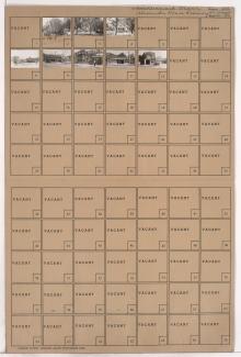
Folder contains photographs of residences in the Santa Fe Hills neighborhood south of the 1940 Kansas City city limits, from 86th Terrace south to 87th Street, and east of Holmes Road. Folder also includes a plat map of the block.
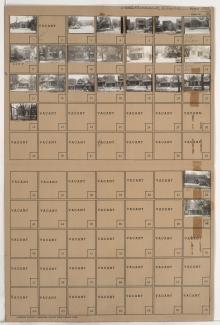
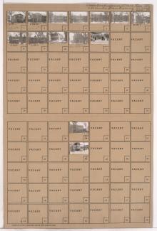
Folder contains photographs of residences, businesses, and other buildings in the Independence Plaza neighborhood, from 12th Street south to 13th Street, and Illinois Avenue east to Benton Boulevard.
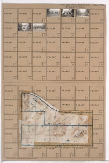
Folder contains photographs of residences and other businesses in the Independence Plaza neighborhood, from 12th Street south to 13th Street, and Bellefontaine Avenue east to Illinois Avenue.
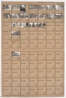
Folder contains photographs of residences and apartment buildings in the Independence Plaza neighborhood, from 13th Street south to 14th Street, and Illinois Avenue east to Benton Boulevard.
Folder contains photographs of residences and apartment buildings in the Downtown East neighborhood, from 13th Street south to 14th Street, and Bellefontaine Avenue east to Illinois Avenue.
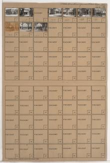
Folder contains photographs of residences and businesses in the 18th and Vine District, from 14th Street south to 15th Street (later Truman Road), and Illinois Avenue east to Benton Boulevard. McMillen's Lace Curtain Cleaners, at 3118-3120 East 15th, and Globe Auto Wrecking, at 3116 East 15th, are among the buildings pictured.
Folder contains photographs of apartment buildings and businesses in the 18th and Vine District, from 14th Street south to 15th Street (later Truman Road), and Bellefontaine Avenue east to Illinois Avenue.