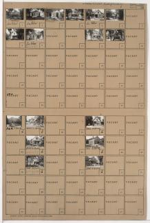
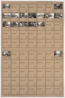
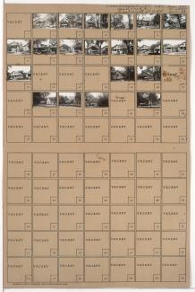
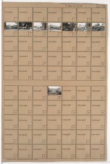
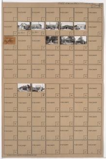
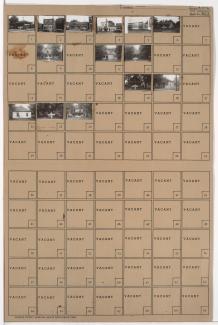
Tax Assessment Block Folder, Kansas City, MO, District 1, Block 166
Folder contains photographs of residences in the Ridgeview subdivision, from Winner Road on the southeast to Roberts Street on the South and Bennington Avenue on the east.
Folder contains photographs of residences and businesses in the Ridgeview subdivision, from Roberts Street south to Independence Avenue, and Winner Road east to Fuller Avenue.
Folder contains photographs of residences and businesses in the Ridgeview subdivision, from Roberts Street south to Independence Avenue, and Fuller Avenue east to Bennington Avenue. Fordview Drug Company, at the corner of Independence and Bennington, is among the buildings pictured.
Folder contains photographs of residences in the Sheffield neighborhood, from 8th Street south to 9th Street, and Fremont Avenue east to Fuller Avenue.
Folder contains photographs of residences in the Sheffield neighborhood, from 8th Street south to 9th Street, and Fuller Avenue east to Bennington Avenue.
Folder contains photographs of residences and apartment buildings in the Sheffield neighborhood, from 9th Street south to 10th Street, and Fuller Avenue east to Bennington Avenue.
Folder contains photographs of residences and apartment buildings in the Sheffield neighborhood, from 9th Street south to 10th Street, and Fremont Avenue east to Fuller Avenue.
Folder contains photographs of residences and other buildings in the Sheffield neighborhood, from Independence Avenue south to 7th Street, and Fuller Avenue east to Bennington Avenue. Northeast Hospital, at 620 Bennington, is among the buildings pictured.
Folder contains photographs of residences in the Sheffield neighborhood, from 7th Street south to 8th Street, and Fuller Avenue east to Bennington Avenue.
Folder contains photographs of residences in the Sheffield neighborhood, from Independence Avenue south to 7th Street, and Fremont Avenue east to Fuller Avenue.
Folder contains photographs of residences in the Sheffield neighborhood, from 7th Street south to 8th Street, and Fremont Avenue east to Fuller Avenue.
Folder contains photographs of residences in the Sheffield neighborhood, from 10th Street south to Peery Avenue, and Fremont Avenue east to Fuller Avenue.
Folder contains photographs of residences in the Sheffield neighborhood, from 10th Street south to Peery Avenue, and Fuller Avenue east to Bennington Avenue.
Folder contains photographs of residences and businesses in the Sheffield neighborhood, from Peery Avenue south to 12th Street, and Fuller Avenue east to Bennington Avenue.
Folder contains photographs of residences and businesses in the Sheffield neighborhood, from Peery Avenue south to 12th Street, and Fremont Avenue east to Fuller Avenue.
Folder contains photographs of residences and businesses in the Leeds neighborhood, from 36th Street south to 37th Street, and Fremont Avenue east to Fuller Avenue.
Folder contains photographs of residences, businesses, and other buildings in the Leeds neighborhood, from 37th Street south to 38th Street, and Fremont Avenue east to Fuller Avenue.
Folder contains photographs of residences in the East Blue Valley neighborhood, from 17th Street south to 18th Street, and Fuller Avenue east to Bennington Avenue. Folder also contains a plat map of the block.
Folder contains photographs of residences in the Leeds neighborhood, from 35th Street south to 35th Terrace, and Fuller Avenue east to Bennington Avenue. Folder also includes a plat map for the block.
Folder contains photographs of residences and other buildings in the Leeds neighborhood, from 35th Street south to 35th Terrace, and Fuller Avenue east to Fremont Avenue. Folder also includes a plat map of the block.