Tax Assessment Block Folder, Kansas City, MO, District 6, Block 194
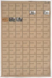
Folder contains photographs of residences in the Lykins neighborhood, from 12th Street south to 12th Terrace, and Norton Avenue east to Jackson Avenue.
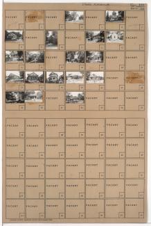
Street Names
Folder contains photographs of residences in the Lykins neighborhood, from 12th Street south to 12th Terrace, and Norton Avenue east to Jackson Avenue.
Folder contains photographs of residences in the Lykins neighborhood, from 12th Street south to 12th Terrace, and Mersington Avenue east to Norton Avenue.
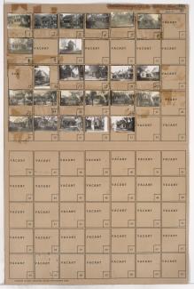
Folder contains photographs of residences and other buildings in the Lykins neighborhood, from 12th Street south to 12th Terrace, and Cleveland Avenue east to Mersington Avenue. Nick DePasco's 12th Street Beer Garden, at 3809 East 12th, is among the buildings pictured.

Folder contains photographs of residences and other buildings in the Lykins neighborhood, from 12th Terrace south to 13th Street, and Mersington Avenue east to Cleveland Avenue.

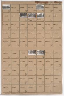
Folder contains photographs of residences in the Lykins neighborhood, from 12th Terrace south to 13th Street, and Norton Avenue east to Mersington Avenue.

Folder contains photographs of residences, businesses, and other buildings in the Lykins neighborhood, from 12th Terrace and 13th Street south to 14th Terrace, and Cleveland Avenue east to Jackson Avenue, including sections of Mersington Avenue, Norton Avenue, and 14th Street.

Folder contains photographs of residences and other buildings in the East Blue Valley neighborhood, from 12th Terrace south to 13th Street, and Fremont Avenue east to Bennington Avenue.

Folder contains photographs of residences and other buildings in the East Blue Valley neighborhood, from 12th Terrace south to 13th Street, and Bennington Avenue east to Ewing Avenue.

Folder contains photographs of residences and other buildings in the East Blue Valley neighborhood, from 12th Terrace south to 13th Street, and Ewing Avenue east to Winchester Avenue.

Folder contains photographs of residences in the Blue Valley Industrial District, from 12th Terrace south to 13th Street, and Winchester Avenue east to Bristol Avenue.

Folder contains photographs of residences and other buildings in the Blue Valley Industrial District, from 12th Street south to 12th Terrace, and Winchester Avenue east to Bristol Avenue.

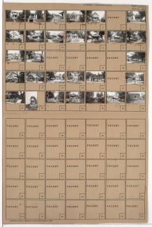
Folder contains photographs of residences and other buildings in the East Blue Valley neighborhood, from 12th Street south to 12th Terrace, and Ewing Avenue east to Winchester Avenue. Jackson Public School, at 12th and Ewing, is among the buildings pictured.
Folder contains photographs of residences in the East Blue Valley neighborhood, from 12th Terrace south to 13th Street, and Belmont Avenue east to Fremont Avenue.

Folder contains photographs of residences and other buildings in the East Blue Valley neighborhood, from 12th Street south to 12th Terrace, and Fremont Avenue east to Bennington Avenue.

Folder contains photographs of residences in the East Blue Valley neighborhood, from 12th Street south to 12th Terrace, and Bennington Avenue east to Ewing Avenue.
Folder contains photographs of residences in the East Blue Valley neighborhood, from 12th Street south to 12th Terrace, and Belmont Avenue east to Fremont Avenue.

Folder contains photographs of residences and other buildings in the West Blue Valley neighborhood, from 12th Street south to 12th Terrace, and White Avenue east to Belmont Avenue. Belmont Avenue Christian Church, at 12th and Belmont, is among the buildings pictured.

Folder contains photographs of residences in the West Blue Valley neighborhood, from 12th Terrace south to 13th Street, and White Avenue east to Belmont Avenue.