Tax Assessment Block Folder, Kansas City, MO, District 12, Block 158

Folder contains photographs of residences in the Sunset Hill neighborhood, from 53rd Street south to 53rd Terrace, and Belleview Avenue east to Summit Street.
Street Names
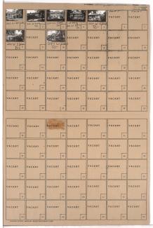
Folder contains photographs of residences in the Sunset Hill neighborhood, from 53rd Street south to 53rd Terrace, and Belleview Avenue east to Summit Street.

Folder contains photographs of residences in the Sunset Hill neighborhood, from 53rd Terrace south to 54th Street, and Belleview Avenue east to Summit Street.
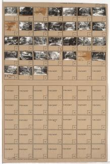
Folder contains photographs for residences in the Countryside neighborhood, from 53rd Street south to 53rd Terrace, and Broadway Boulevard east to Wyandotte Street.

Folder contains photographs of residences in the Countryside neighborhood, from 53rd Terrace south to 54th Street, and Wornall Road east to Wyandotte Street.

Folder contains photographs of residences in the Countryside neighborhood, from 53rd Street south to 53rd Terrace, and Wyandotte Street east to Main Street.

Folder contains photographs of residences in the Countryside neighborhood, from 53rd Terrace south to 54th Street, and Wyandotte Street east to Main Street.
Folder contains photographs of residences in the Countryside neighborhood, from 53rd Terrace south to 54th Street, and Main Street east to Brookside Boulevard.
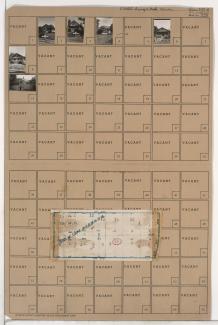
Folder contains photographs of residences in the Swope Parkway neighborhood, from 53rd Street south to 53rd Terrace, and Jackson Avenue east to Kensington Avenue. Folder also includes a plat map of the block.

Folder contains photographs of residences in the Swope Parkway neighborhood, from 53rd Terrace south to 54th Street, and Jackson Avenue east to Kensington Avenue.

Folder contains photographs of residences in the Swope Parkway neighborhood, from 53rd Street south to 53rd Terrace, and Cleveland Avenue east to Myrtle Avenue.

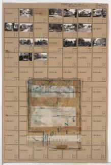
Folder contains photographs of residences in the Swope Parkway neighborhood, from 53rd Terrace south to 54th Street, and Kensington Avenue east to Elmwood Avenue. Folder also includes a plat map of the block.
Folder contains photographs of residences in the Swope Parkway neighborhood, from 53rd Terrace south to 55th Street, and Cleveland Avenue east to Myrtle Avenue. Folder also includes a plat map of the block.