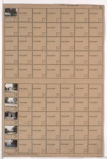
Tax Assessment Block Folder, Kansas City, MO, District 16, Block 46
Folder contains photographs of buildings in and around the Forest Hill and Calvary Cemeteries, in the Neighbors United for Action Neighborhood.
Street Names
Folder contains photographs of buildings in and around the Forest Hill and Calvary Cemeteries, in the Neighbors United for Action Neighborhood.
Folder contains photographs of a residence and a school in the Tri-Blenheim neighborhood, from 70th Terrace south to Gregory Boulevard, and Olive Street east to Prospect Avenue. Blenheim School, at Olive and Gregory, is among the buildings pictured.
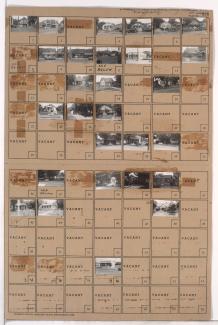
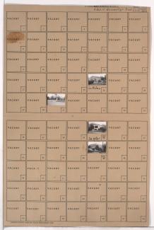
Folder contains photographs of residences, businesses, and other buildings in the Walnut Grove neighborhood, from Gregory Boulevard south to 72nd Street, and Olive Street east to Prospect Avenue. Sun Theater, at 7108 Prospect, is among the buildings pictured.

Folder contains photographs of residences in the Walnut Grove neighborhood, from 71st Street south to 72nd Street, and Brooklyn Avenue east to Olive Street.

Folder contains photographs of residences in the Battleflood Heights neighborhood, from Gregory Boulevard south to 72nd Street, and Woodland Avenue east to Paseo Boulevard.

Folder contains photographs of residences in the Battleflood Heights neighborhood, from Gregory Boulevard south to 72nd Street, and Lydia Avenue east to Wayne Avenue.
Folder contains photographs of residences and businesses in the Battleflood Heights neighborhood, from Gregory Boulevard south to 72nd Street, and Troost Avenue east to Tracy Avenue, including a section of Forest Avenue.
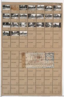
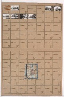
Folder contains photographs of residences and businesses in the Holmes Park neighborhood, from 70th Terrace south to Gregory Boulevard, and Oak Street east to Cherry Street. Folder also includes a plat map of the block.
Folder contains photographs of residences in the Holmes Park neighborhood, from 70th Terrace south to Gregory Boulevard, and Cherry Avenue east to Holmes Road. Folder also includes a plat map of the block.
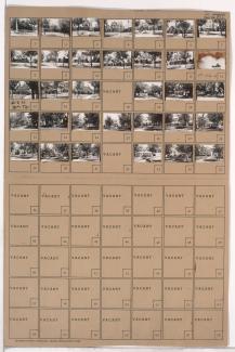
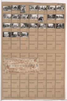
Folder contains photographs of residences and businesses in the Armour Hills neighborhood, from 70th Terrace south to Gregory Boulevard, and Grand Avenue east to Oak Street. Folder also includes a plat map of the block.

Folder contains photographs of residences in the Armour Hills neighborhood, from 70th Terrace south to Gregory Boulevard, and Brookside Road east to Main Street. Folder also includes a plat map of the block.

Folder contains photographs of residences and businesses in the Armour Fields neighborhood, from 70th Terrace south to Gregory Boulevard, and Jefferson Street (later Edgevale Road) east to Wornall Road.

Folder contains photographs of residences in the Armour Fields neighborhood, from 70th Terrace south to Gregory Boulevard, and Ward Parkway east to Valley Road.
Folder contains photographs of residences in the Armour Fields neighborhood, from 70th Terrace south to Gregory Boulevard, and Valley Road east to Jefferson Street (later Edgevale Road).

Folder contains photographs of residences in the Romanelli West neighborhood, from 67th Street south to Gregory Boulevard, and State Line Road east to Ward Parkway, including sections of Arno Road, 69th Terrace, Romany Road, 70th Street, and 70th Terrace.
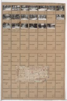
Folder contains photographs of residences, businesses, and other buildings in the Tower Homes neighborhood, from Gregory Boulevard south to 71st Terrace, and Harrison Street east to Troost Avenue. Folder also includes a plat map of the block.

Folder contains photographs of residences in the Tower Homes neighborhood, from Gregory Boulevard south to 71st Terrace, and Holmes Road east to Harrison Street. Folder also includes a plat map of the block.

Folder contains photographs of residences in the Tower Homes neighborhood, from Gregory Boulevard south to 72nd Street, and Main Street east to Walnut Street.
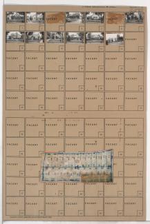
Folder contains photographs of residences in the Rockhill Gardens neighborhood, from Gregory Boulevard south to 71st Terrace, and Oak Street east to Cherry Street. Folder also includes a plat map of the block.

Folder contains photographs of residences in the Rockhill Gardens neighborhood, from Gregory Boulevard south to 71st Terrace, and Cherry Street east to Holmes Road. Folder also includes a plat map of the block.