Tax Assessment Block Folder, Kansas City, MO, District 17, Block 181

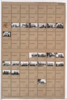
Folder contains photographs of residences in the Tower Homes neighborhood, from 72nd Terrace south to 73rd Street, and Grand Avenue east to Oak Street.
Street Names
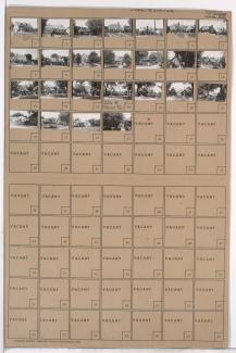
Folder contains photographs of residences in the Tower Homes neighborhood, from 72nd Terrace south to 73rd Street, and Grand Avenue east to Oak Street.
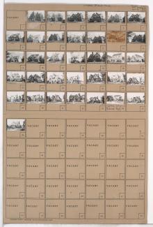
Folder contains photographs of residences in the Tower Homes neighborhood, from 72nd Street south to 72nd Terrace, and Grand Avenue east to Oak Street.
Folder contains photographs of residences in the Rockhill Gardens neighborhood, from 72nd Street south to 72nd Terrace, and Cherry Street east to Holmes Road. Folder also includes a plat map of the block.
Folder contains photographs of residences in the Tower Homes neighborhood, from 72nd Terrace south to 73rd Street, and Cherry Street east to Holmes Road. Folder also includes a plat map of the block.
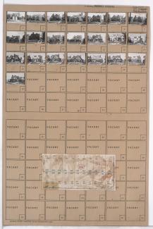
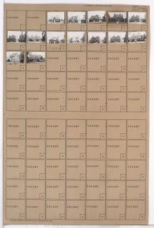
Folder contains photographs of residences in the Rockhill Gardens neighborhood, from 72nd Street south to 72nd Terrace, and Oak Street east to Cherry Street. Folder also includes a plat map of the block.
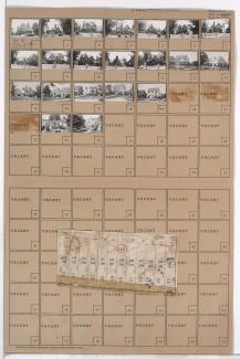
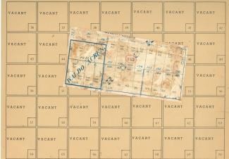
Folder contains photographs of residences in the Tower Homes neighborhood, from 72nd Street and Charlotte Street south to 72nd Terrace and 73rd Street, and Holmes Road east to Troost Avenue. Folder also includes a plat map of the block which can be viewed below.

Map of block in the Tower Homes neighborhood, from 72nd Street and Charlotte Street south to 72nd Terrace and 73rd Street, and Holmes Road east to Troost Avenue, containing information about tax assessment values of included properties, and illustrating lot numbers for the block. Photographs of properties on the block can be viewed below.

Folder contains photographs of residences in the Tower Homes neighborhood, from 72nd Terrace south to 73rd Street and east to Troost Avenue. Folder also includes a plat map of the block.
Folder contains photographs of residences in the Romanelli West neighborhood, from 72nd Street south to 72nd Terrace, and State Line Road east to Terrace Street.
Folder contains photographs of residences in the Romanelli West neighborhood, from 72nd Terrace south to 73rd Street, and State Line Road east to Terrace Street.
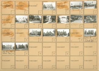
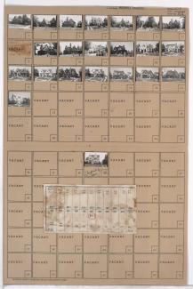
Folder contains photographs of residences in the Rockhill Gardens neighborhood, from 72nd Terrace south to 73rd Street, and Oak Street east to Cherry Street. Folder also includes a plat map of the block, which can be viewed below.
Map of block in the Rockhill Gardens neighborhood, from 72nd Terrace south to 73rd Street, and Oak Street east to Cherry Street, containing information about tax assessment values of included properties, and illustrating lot numbers for the block. Photographs of properties on the block can be viewed below.