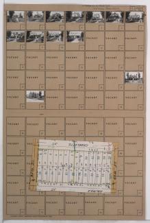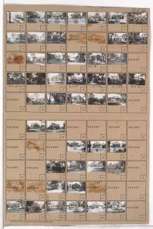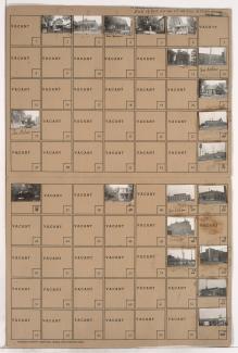
Folder contains photographs of residences in the Holmes Park neighborhood, from 65th Street south to 66th Street, and Charlotte Street east to Rockhill Road. Folder also includes a plat map of the block.
Street Names
Folder contains photographs of residences in the Holmes Park neighborhood, from 65th Street south to 66th Street, and Charlotte Street east to Rockhill Road. Folder also includes a plat map of the block.
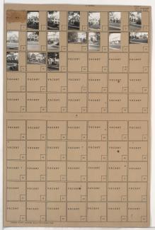
Folder contains photographs of residences in the Armour Hills neighborhood, from 65th Terrace south to 66th Street, and Linden Road east to Main Street. Folder also includes a plat map of the block.
Folder contains photographs of residences in the Holmes Park neighborhood, from 65th Street south to 66th Street, and Holmes Road south to Charlotte Street. Folder also includes a plat map of the block.
Folder contains photographs of residences in the Armour Hills neighborhood, from Edgevale Road south to 66th Street and east to Oak Street. Folder also includes a plat map of the block.
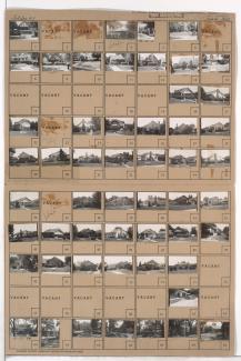
Folder contains photographs of residences in the Armour Hills neighborhood, from 65th Terrace south to 66th Street, and Main Street east to Edgevale Road. Folder also includes a plat map of the block.
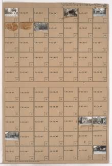
Folder contains photographs of residences in the Armour Hills neighborhood, from 66th Street south to 66th Terrace, and Main Street east to Edgevale Road.
Folder contains photographs of residences in the Armour Hills neighborhood, from 66th Street south to 66th Terrace, and Edgevale Road east to Oak Street.
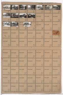
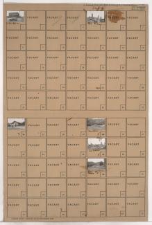
Folder contains photographs of residences in the Armour Hills neighborhood, from 66th Street south to 66th Terrace, and Brookside Road east to Linden Road.
Folder contains photographs of residences in the Armour Hills neighborhood, from Linden Road south to 66th Street and west to Brookside Road.
Folder contains photographs of residences in the Armour Hills neighborhood, from 66th Street south to 66th Terrace, and Linden Road east to Main Street.
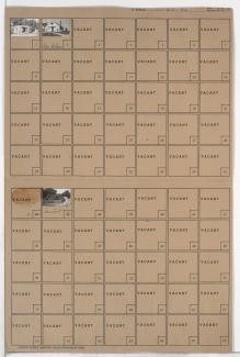
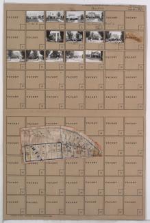
Folder contains photographs of residences and other buildings in the Strupwood neighborhood, east of the 1940 Kansas City city limits, from 63rd Street south to 66th Street, and east of Cambridge Avenue. Folder also includes a plat map of the block, which can be viewed below.
Map of block in the Strupwood neighborhood, east of the 1940 Kansas City city limits, from 63rd Street south to 66th Street, and east of Cambridge Avenue, containing information about tax assessment values of included properties, and illustrating lot numbers for the block.
Folder contains photographs of residences and other buildings in the Strupwood neighborhood east of the 1940 Kansas City city limits, from 63rd Street south to 66th Street and west of Cambridge Avenue.
Second of two folders containing photographs of residences in the Neighbors United for Action neighborhood, from 66th Street south to 66th Terrace, and Troost Avenue east to Broadmoor Road, including sections of Tracy, Virginia, and Lydia Avenues.
Folder contains photographs of residences in the Neighbors United for Action neighborhood, from 65th Street south to 66th Street, and Troost Avenue east to Paseo Boulevard.
One of two folders containing photographs of residences in the Neighbors United for Action neighborhood, from 66th Street south to 66th Terrace, and Troost Avenue east to Broadmoor Road, including sections of Tracy, Virginia, and Lydia Avenues.
Folder contains photographs of residences and businesses in the East Bottoms area, from Nicholson Avenue south to Rochester Avenue, and Montgall Avenue east to Chestnut Avenue.
Folder contains photographs of residences and industrial buildings in the Northeast Industrial District, from the Missouri River on the northwest and Olive Avenue on the northeast, to Nicholson Avenue on the southeast and a line contiguous with Troost Avenue on the west.
Folder contains photographs of businesses and industrial buildings in the Northeast Industrial District, from Nicholson Avenue south to June Avenue, and containing Cleveland Avenue, and an adjacent area from Cleveland Avenue west to a line contiguous with Monroe Avenue.
Folder contains photographs of residences, businesses, and industrial facilities in the Northeast Industrial District, on two adjacent blocks: one between the Missouri River and rail lines, and the second from Owen Avenue south to Nicholson Avenue, and Montgall Avenue east to Kansas Avenue. The Speas Vinegar plant, at 2400 Nicholson Avenue, is among the buildings pictured.