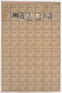
Tax Assessment Block Folder, Kansas City, MO, District 2, Block 97

Folder contains photographs of residences in the Scarritt Point neighborhood, from Smart Avenue south to Garner Avenue, and Myrtle Avenue east to Norton Avenue.
Street Names
Folder contains photographs of residences in the Scarritt Point neighborhood, from Smart Avenue south to Garner Avenue, and Myrtle Avenue east to Norton Avenue.

Folder contains photographs of residences in the Scarritt Point neighborhood, from Smart Avenue south to Garner Avenue, and Monroe Avenue east to Myrtle Avenue.

Folder contains photographs of residences and businesses in the Scarritt Point neighborhood, from Garner Avenue south to Thompson Avenue, and Monroe Avenue east to Myrtle Avenue.
Folder contains photographs of residences in the Scarritt Point neighborhood, from Garner Avenue south to Thompson Avenue, and Myrtle Avenue east to Norton Avenue.

Folder contains photographs of residences and businesses in the Scarritt Point neighborhood, from Smart Avenue south to Garner Avenue, and Benton Boulevard east to Indiana Avenue. Bruno Cut Rate Market, at Garner and Indiana, is among the buildings pictured.
Folder contains photographs of residences in the Chautauqua Place addition, from Smart Avenue south to Garner Avenue, and Indiana Avenue east to Bales Avenue.

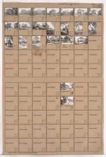
Folder contains photographs of residences in the Irving Park subdivision, from Smart Avenue south to Garner Avenue, and Askew Avenue east to Monroe Avenue.

Folder contains photographs of residences in the Irving Park subdivision, from Garner Avenue south to Thompson Avenue, and Askew Avenue east to Monroe Avenue. Folder also includes plat map of the block.

Folder contains photographs of residences and businesses in the Scarritt Point neighborhood, from Garner Avenue south to Thompson Avenue, and Indiana Avenue east to Bales Avenue.
Folder contains photographs of residences and apartment buildings in the Scarritt Point neighborhood, from Garner Avenue south to Thompson Avenue, and Benton Boulevard east to Indiana Avenue.

Folder contains photographs of residences in the Irving Park subdivision, from Garner Avenue south to Thompson Avenue, and Bales Avenue east to Askew Avenue.
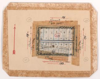
Map of block in the Scarritt Point neighborhood, from Smart Avenue south to Garner Avenue, and Bales Avenue east to Indiana Avenue, containing information about tax assessment values of included properties, and illustrating lot numbers for the block. Photographs of properties on the block can be viewed below.
Folder contains photographs of residences in the Irving Park subdivision, from Smart Avenue south to Garner Avenue, and Bales Avenue east to Askew Avenue. Folder also contains plat map of the block, which can be viewed below.