Tax Assessment Block Folder, Kansas City, MO, District 7, Block 34

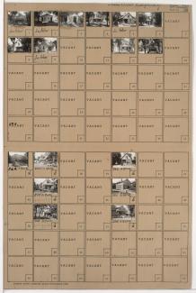
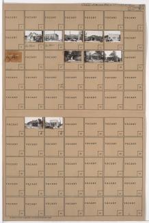
Folder contains photographs of residences in the Sheffield neighborhood, from 8th Street south to 9th Street, and Fremont Avenue east to Fuller Avenue.
Street Names
Folder contains photographs of residences in the Sheffield neighborhood, from 8th Street south to 9th Street, and Fremont Avenue east to Fuller Avenue.

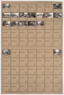
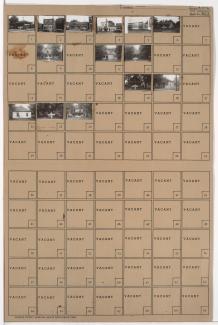
Folder contains photographs of residences and apartment buildings in the Sheffield neighborhood, from 9th Street south to 10th Street, and Fremont Avenue east to Fuller Avenue.

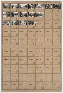
Folder contains photographs of residences and other buildings in the Sheffield neighborhood, from 9th Street south to 10th Street, and Belmont Avenue east to Fremont Avenue.

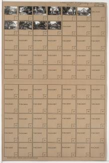
Folder contains photographs of residences in the Sheffield neighborhood, from 10th Street south to 11th Street, and Belmont Avenue east to Fremont Avenue.
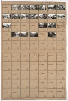
Folder contains photographs of residences in the Sheffield neighborhood, from Independence Avenue south to 7th Street, and Fremont Avenue east to Fuller Avenue.
Folder contains photographs of residences in the Sheffield neighborhood, from 7th Street south to 8th Street, and Fremont Avenue east to Fuller Avenue.
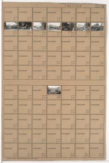
Folder contains photographs of residences in the Sheffield neighborhood, from Independence Avenue south to 7th Street, and Beacon Avenue east to Fremont Avenue.
Folder contains photographs of residences in the Sheffield neighborhood, from 7th Street south to 8th Street, and Beacon Avenue east to Fremont Avenue.

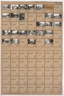
Folder contains photographs of residences in the Sheffield neighborhood, from 11th Street south to Peery Avenue, and Belmont Avenue east to Fremont Avenue.
Folder contains photographs of residences in the Sheffield neighborhood, from 10th Street south to Peery Avenue, and Fremont Avenue east to Fuller Avenue.
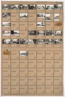
Folder contains photographs of residences and businesses in the Sheffield neighborhood, from Peery Avenue south to 12th Street, and Fremont Avenue east to Fuller Avenue.

Folder contains photographs of residences and other buildings in the Sheffield neighborhood, from Peery Avenue south to 12th Street, and Belmont Avenue east to Fremont Avenue. Gene's Food Store, at 12th and Belmont, is among the buildings pictured.

Folder contains a photograph of a building in the Leeds neighborhood, from 35th Terrace south to 36th Street, and Fremont Avenue east to Bennington Avenue. Folder also contains a plat map of the block.

Folder contains photographs of residences and other buildings in the East Blue Valley neighborhood, from 12th Terrace south to 13th Street, and Fremont Avenue east to Bennington Avenue.
Folder contains photographs of residences in the East Blue Valley neighborhood, from 13th Street south to 14th Street, and Fremont Avenue east to Bennington Avenue.

Folder contains photographs of residences and businesses in the East Blue Valley neighborhood, from 14th Street south to 15th Street (later Truman Road), and Fremont Avenue east to Bennington Avenue.

Folder contains photographs of residences in the East Blue Valley neighborhood, from 13th Street south to 14th Street, and Belmont Avenue east to Fremont Avenue.
Folder contains photographs of residences and businesses in the East Blue Valley neighborhood, from 14th Street south to 15th Street (later Truman Road), and Belmont Avenue east to Fremont Avenue.
Folder contains photographs of residences and businesses in the Leeds neighborhood, from 36th Street south to 37th Street, and Fremont Avenue east to Fuller Avenue.
Folder contains photographs of residences, businesses, and other buildings in the Leeds neighborhood, from 37th Street south to 38th Street, and Fremont Avenue east to Fuller Avenue.