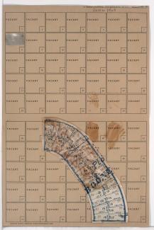
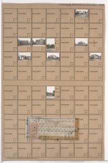
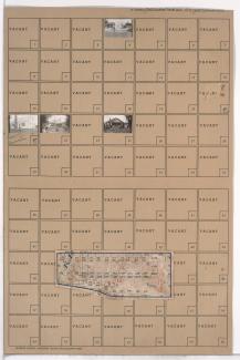
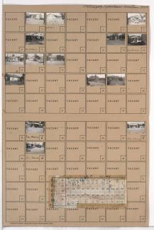
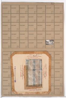
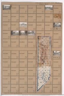
Folder contains photographs of residences, businesses, and other buildings in the Waldo Homes neighborhood south of the 1940 Kansas City city limits, from 83rd Terrace south to 84th Terrace, and Wornall Road east to Central Street. Folder also includes a plat map of the block.
Search
Folder contains a photograph of a residence in the Waldo Homes neighborhood south of the 1940 Kansas City city limits, from Douglas Street west to Central Street and south to 84th Terrace. Folder also includes a plat map of the block.
Folder contains a photograph of a residence in the Waldo Homes neighborhood south of the 1940 Kansas City city limits, from 83rd Terrace south to 84th Terrace, and Douglas and Central Streets east to Boone Boulevard. Folder also includes a plat map of the block.
Folder contains photographs of residences, businesses, and other buildings in the Marlborough Heights neighborhood, from 84th Street south to 84th Terrace, and Troost Avenue east to Tracy Avenue. Folder also includes a plat map of the block.
Folder contains photographs of residences in the Rolling Meadows neighborhood south of the 1940 Kansas City city limits, from 84th Street south to 84th Terrace, and Campbell Street east to Troost Avenue. Folder also includes a plat map of the block.
Folder contains photographs of residences and other buildings in the Rolling Meadows neighborhood south of the 1940 Kansas City city limits, from 84th Terrace south to 85th Street, and Campbell Street east to Troost Avenue. Folder also includes a plat map of the block.
Folder contains photographs of residences, businesses, and other buildings in the Marlborough Heights neighborhood south of the 1940 Kansas City city limits, from 84th Terrace south to 85th Street, and Troost Avenue east to Tracy Avenue. Folder also includes a plat map of the block.
Folder contains photographs of residences in the Marlborough Heights neighborhood south of the 1940 Kansas City city limits, from 84th Terrace south to 85th Street, and Tracy Avenue east to Lydia Avenue. Folder also includes a plat map of the block.
Folder contains photographs of residences in the Boone Hills neighborhood south of the 1940 Kansas City city limits, from 91st Street south to 92nd Street, and Walnut Street east to Grand Avenue. Folder also includes a plat map of the block.
Folder contains photographs of residences in the Boone Hills neighborhood south of the 1940 Kansas City city limits, from 91st Street south to 92nd Street, and McGee Street east to Oak Street. Folder also includes a plat map of the block.
Folder contains a photograph of a residence in the Boone Hills neighborhood south of the 1940 Kansas City city limits, from 91st Street south to 92nd Street, and Grand Avenue east to McGee Street. Folder also includes a plat map of the block.
Folder contains photographs of a residence in the Boone Hills neighborhood south of the 1940 Kansas City city limits, from 92nd Street south to 93rd Street, and Main Street east to Walnut Street. Folder also includes a plat map of the block.
Folder contains photographs of residences in the Boone Hills neighborhood south of the 1940 Kansas City city limits, from 92nd Street south to 93rd Street, and Grand Avenue east to McGee Street. Folder also includes a plat map of the block.