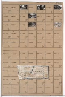
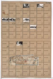
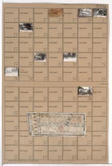
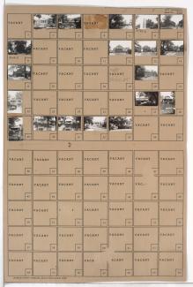
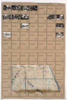
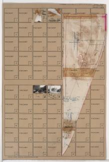
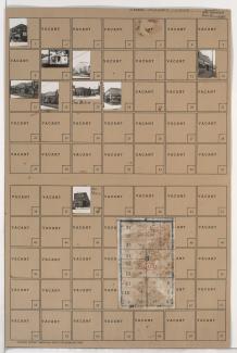
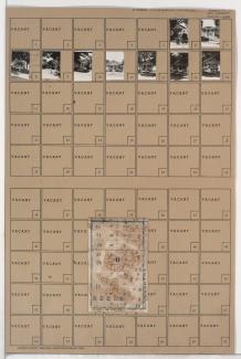
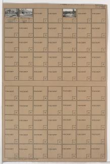
Tax Assessment Block Folder, Kansas City, MO, District 14, Block 12
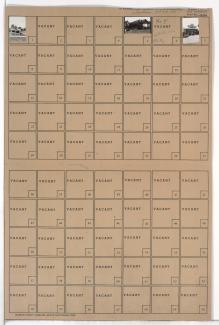
Folder contains photographs of businesses in the North Town Fork Creek neighborhood, from 47th Street south to Blue Ridge Boulevard, and Benton Boulevard east to Cleveland Avenue.
Folder contains photographs of residences in the North Town Fork Creek neighborhood, from 50th Street south to 50th Terrace, and Swope Parkway east to Cleveland Avenue. Folder also includes a plat map of the block.
Folder contains photographs of residences and businesses in the North Town Fork Creek neighborhood, from Blue Ridge Road south to 49th Terrace, and Swope Parkway east to Cleveland Avenue. Folder also includes a plat map of the block.
Folder contains photographs of residences in the North Town Fork Creek neighborhood, from 49th Terrace south to 50th Street, and Swope Parkway east to Cleveland Avenue. Folder also includes a plat map of the block.
Folder contains photographs of residences in the North Town Fork Creek neighborhood, from 50th Terrace south to 51st Street, and Swope Parkway east to Cleveland Avenue. Folder also includes a plat map of the block.
Folder contains photographs of residences and other buildings in the North Town Fork Creek neighborhood, from 51st Street south to 53rd Street, and Swope Parkway east to Cleveland Avenue. Folder also includes a plat map of the block, which can be viewed below.
Map of block in the North Town Fork Creek neighborhood, from 51st Street south to 53rd Street, and Swope Parkway east to Cleveland Avenue, containing information about tax assessment values of included properties, and illustrating lot numbers for the block. Photographs of properties on the block can be viewed below.
Second of two folders containing photographs of residences in the North Town Fork Creek neighborhood, from 55th Street south to 57th Street, and Bales Avenue east to Swope Parkway, including sections of Askew Avenue and 56th Street. Folder also contains a plat map of the block.
Folder contains photographs of residences in the North Town Fork Creek neighborhood, from 53rd Street south to 55th Street, and Swope Parkway east to Cleveland Avenue. Folder also includes a plat map of the block.
Folder contains photographs of buildings in the North Town Fork Creek neighborhood, from Swope Parkway south to 49th Street, and Agnes Avenue east to Indiana Avenue, including sections of Bellefontaine, Walrond, and College Avesnues. Folder also includes plat maps of the block.
Folder contains photographs of businesses and other buildings in the North Town Fork Creek neighborhood, from Swope Parkway south to 49th Street, and Prospect Avenue east to Montgall Avenue. Folder also includes a plat map of the block.
Folder contains photographs of residences in the North Town Fork Creek neighborhood, from Swope Parkway south to 49th Street, and Montgall Avenue east to Chestnut Avenue. Folder also includes a plat map of the block.
Folder contains a photograph of a building in the North Town Fork Creek neighborhood, from Swope Parkway south to 49th Street, and Chestnut Avenue east to South Benton Avenue.
Folder contains photographs of residences in the North Town Fork Creek neighborhood, from Swope Parkway south to 49th Street, and South Benton Boulevard east to Agnes Avenue. Folder also includes a plat map of the block.
Folder contains photographs of residences in the North Town Fork Creek neighborhood, from 50th Street south to 51st Street, and Chestnut Avenue east to South Benton Avenue. Folder also includes a plat map of the block.
Folder contains photographs of businesses and other buildings in the North Town Fork Creek neighborhood, from 49th Street south to 51st Street, and Indiana Avenue east to Swope Parkway. Goldman Stadium, at 51st and Indiana, is among the buildings pictured.
Folder contains photographs of residences in the North Town Fork Creek neighborhood, from 49th Street south to 50th Street, and College Avenue east to Indiana Avenue. Folder also includes a plat map of the block.
Folder contains photographs of residences in the North Town Fork Creek neighborhood, from 49th Street south to 50th Street, and Bellefontaine Avenue east to Walrond Avenue.
Folder contains photographs of residences and apartment buildings in the North Town Fork Creek neighborhood, from 49th Street south to 50th Street, and Agnes Avenue east to Bellefontaine Avenue.
Folder contains photographs of residences in the North Town Fork Creek neighborhood, from 49th Street south to 50th Street, and Walrond Avenue east to College Avenue.