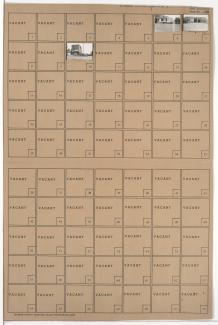
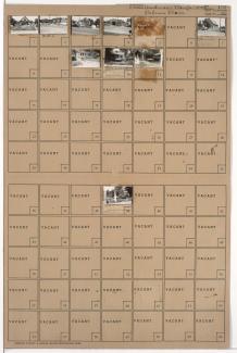
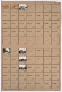
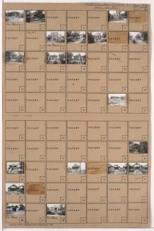
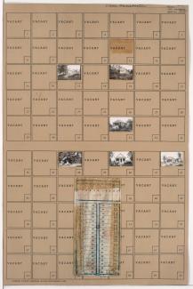
Tax Assessment Block Folder, Kansas City, MO, District 7, Block 38
Folder contains photographs of residences and other buildings in the Sheffield neighborhood, from 8th Street south to 9th Street, and Cambridge Avenue east to Winchester Avenue.
Folder contains photographs of residences, businesses, and other buildings in the Sheffield neighborhood, from 9th Street south to 10th Street, and Cambridge Avenue east to Winchester Avenue.
Folder contains photographs of residences in the Independence Avenue south to 7th Street, and Cambridge Avenue east to Winchester Avenue.
Folder contains photographs of residences in the Sheffield neighborhood, from 7th Street south to 8th Street, and Cambridge Avenue east to Winchester Avenue.
Folder contains photographs of businesses and other buildings in the Blue Valley Industrial District, from 12th Street south to 15th Street (later Truman Road), and Bristol and Winchester Avenues east to the railroad tracks, including sections of 13th and 15th Streets.
Folder contains photographs of residences and other buildings in the East Blue Valley neighborhood, from 12th Terrace south to 13th Street, and Ewing Avenue east to Winchester Avenue.
Folder contains photographs of residences in the Blue Valley Industrial District, from 12th Terrace south to 13th Street, and Winchester Avenue east to Bristol Avenue.
Folder contains photographs of buildings in the Blue Valley Industrial District, from 14th Street south to 15th Street (later Truman Road), and Winchester Avenue east to Bristol Avenue.
Folder contains photographs of residences, businesses, and other buildings in the East Blue Valley neighborhood, from 13th Street south to 14th Street, and Ewing Avenue east to Winchester Avenue.
Folder contains photographs of residences and businesses in the East Blue Valley neighborhood, from 14th Street south to 15th Street (later Truman Road), and Ewing Avenue east to Winchester Avenue. Centropolis Slavic Mission, at 6820 East 15th, and Western Ice Service, at 15th and Winchester, are among the buildings pictured.
Folder contains photographs of businesses and other buildings in the East Blue Valley neighborhood, from 15th Street (later Truman Road) south to 17th Street, and Ewing Avenue east to Winchester Avenue. Cash Bargain Lumber Company facilities, at 15th and Ewing, are among the buildings pictured. Folder also contains plat map of the block, which can be viewed below.
Folder contains photographs of residences and other buildings in the East Blue Valley neighborhood, from 15th Street (later Truman Road) south to 16th Terrace, and Winchester Avenue east to Bristol Avenue. Folder also contains plat map of the block, which can be viewed below.
Map of block in the East Blue Valley neighborhood, from 15th Street (later Truman Road) south to 16th Terrace, and Winchester Avenue east to Bristol Avenue, containing information about tax assessment values of included properties, and illustrating lot numbers for the block. Photographs of properties on the block can be viewed below.
Map of block in the East Blue Valley neighborhood, from 15th Street (later Truman Road) south to 17th Street, and Ewing Avenue east to Winchester Avenue, containing information about tax assessment values of included properties, and illustrating lot numbers for the block. Photographs of properties on the block can be viewed below.
Folder contains photographs of residences and other buildings in the Blue Valley Industrial District, from 12th Street south to 12th Terrace, and Winchester Avenue east to Bristol Avenue.
Folder contains photographs of residences and other buildings in the East Blue Valley neighborhood, from 12th Street south to 12th Terrace, and Ewing Avenue east to Winchester Avenue. Jackson Public School, at 12th and Ewing, is among the buildings pictured.
Folder contains photographs of residences and other buildings in the East Blue Valley neighborhood, from 16th Terrace south to 17th Street, and Winchester Avenue east to Bristol Avenue. Folder also contains a plat map of the block.
Folder contains photographs of residences in the East Blue Valley neighborhood, from 17th Street south to 18th Street, and Winchester Avenue east to Bristol Avenue. Folder also includes a plat map of the block.
Folder contains photographs of residences in the East Blue Valley neighborhood, from 17th Street south to 18th Street, and Cambridge Avenue east to Winchester Avenue. Folder also includes a plat map of the block.
Folder contains photographs of residences in the Central Blue Valley neighborhood, from 18th Street south to 19th Street, and Cambridge Avenue east to Winchester Avenue. Folder also contains a plat map of the block.