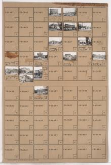
Folder contains photographs of businesses in the Sheffield addition, from Wilson Avenue south to Winner Road, and Ewing Avenue east to Cambridge Avenue. The Atlas Cafe, at 6817 Wilson Avenue, is among the buildings pictured.
Street Names
Folder contains photographs of businesses in the Sheffield addition, from Wilson Avenue south to Winner Road, and Ewing Avenue east to Cambridge Avenue. The Atlas Cafe, at 6817 Wilson Avenue, is among the buildings pictured.
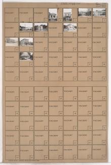
Folder contains photographs of businesses in the Sheffield neighborhood, from Wilson Avenue south to Independence Avenue, and from Cambridge Avenue east to the rail lines.
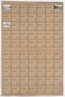
Folder contains photographs of residences and businesses in the Sheffield neighborhood, from Winner Road south to Roberts Street, and Ewing Avenue east to Cambridge Avenue.
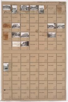
Folder contains photographs of residences and businesses in the Sheffield neighborhood, from Roberts Street south to Independence Avenue, and Ewing Avenue east to Cambridge Avenue.
Folder contains photographs of residences and other buildings in the Sheffield neighborhood, from 8th Street south to 9th Street, and Cambridge Avenue east to Winchester Avenue.
Folder contains photographs of residences, businesses, and other buildings in the Sheffield neighborhood, from 9th Street south to 10th Street, and Cambridge Avenue east to Winchester Avenue.
Folder contains photographs of residences in the Independence Avenue south to 7th Street, and Cambridge Avenue east to Winchester Avenue.
Folder contains photographs of residences in the Sheffield neighborhood, from 7th Street south to 8th Street, and Cambridge Avenue east to Winchester Avenue.
First of two folders contains photographs of residences and other buildings in the Sheffield neighborhood, from Independence Avenue south to 10th Street, and Ewing Avenue east to Cambridge Avenue.
Second of two folders contains photographs of residences and other buildings in the Sheffield neighborhood, from Independence Avenue south to 10th Street, and Ewing Avenue east to Cambridge Avenue.
Folder contains photographs of residences and other buildings in the East Blue Valley neighborhood, from 17th Street south to 18th Street, and Ewing Avenue east to Cambridge Avenue. Folder also includes a plat map of the block.
Folder contains photographs of residences in the East Blue Valley neighborhood, from 17th Street south to 18th Street, and Cambridge Avenue east to Winchester Avenue. Folder also includes a plat map of the block.
Folder contains photographs of residences in the Central Blue Valley neighborhood, from 18th Street south to 19th Street, and Cambridge Avenue east to Winchester Avenue. Folder also contains a plat map of the block.
Folder contains photographs of residences in the Central Blue Valley neighborhood, from 18th Street south to 19th Street, and Ewing Avenue east to Cambridge Avenue. Folder also includes a plat map of the block.
Folder contains photographs of residences in the Central Blue Valley neighborhood, from 19th Street south to 20th Street, and Ewing Avenue east to Cambridge Avenue. Folder also includes a plat map of the block.
Folder contains a photograph of a building in the Brown Estates neighborhood east of the 1940 Kansas City city limits, north of 63rd Street and west of Cambridge Avenue.
Folder contains photographs of residences in the Strupwood neighborhood, east of the 1940 Kansas City city limits, east of Cambridge Avenue and south of 63rd Street. Folder also includes a plat map of the block, which can be viewed below.
Map of block in the Strupwood neighborhood, east of the 1940 Kansas City city limits, east of Cambridge Avenue and south of 63rd Street, containing information about tax assessment values of included properties, and illustrating lot numbers for the block. Photographs of properties on the block can be viewed below.
Folder contains photographs of residences and other buildings in the Strupwood neighborhood, east of the 1940 Kansas City city limits, from 63rd Street south to 66th Street, and east of Cambridge Avenue. Folder also includes a plat map of the block, which can be viewed below.
Map of block in the Strupwood neighborhood, east of the 1940 Kansas City city limits, from 63rd Street south to 66th Street, and east of Cambridge Avenue, containing information about tax assessment values of included properties, and illustrating lot numbers for the block.