Tax Assessment Block Folder, Kansas City, MO, District 12, Block 122
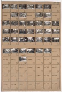
Folder contains photographs of residences in the Westwood neighborhood, from 48th Street south to Westwood Road, and Wyoming Street east to Fairmount Avenue.
Street Names
Folder contains photographs of residences in the Westwood neighborhood, from 48th Street south to Westwood Road, and Wyoming Street east to Fairmount Avenue.

Folder contains photographs of residences in the Westwood neighborhood, from 47th Street south to 49th Street, and State Line Road east to Wyoming Street, including a section of Bell Street. Folder also includes a plat map of the block.

Folder contains photographs of residences in the Westwood neighborhood, from Westwood Terrace west to Wyoming Street and south to 50th Street. Folder also includes a plat map of the block.

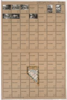
Folder contains photographs of residences in the Westwood neighborhood, from 49th Street south to Ward Parkway, and Holly Street east to Jarboe Street. Folder also includes a plat map of the block.

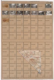
Folder contains photographs of residences in the Westwood neighborhood, from 49th Street south to 50th Street and Westwood Road, and Mercier Street east to Holly Street. Folder also includes a plat map of the block.
Folder contains photographs of residences in the Westwood neighborhood, from Westwood Road north to 49th Street and east to Mercier Street. Folder also includes a plat map of the block.
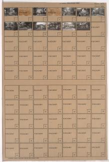
Folder contains photographs of residences in the Westwood neighborhood, from Westwood Road southwest to Westwood Terrace, and Wyoming Street southeast to 50th Street.

Folder contains photographs of residences in the Westwood neighborhood, from 49th Street south to 50th Street, and Bell Street east to Wyoming Street. Folder also includes a plat map of the block.

Folder contains photographs of residences in the Westwood neighborhood, from 49th Street south to 50th Street, and State Line Road east to Bell Street. Folder also includes a plat map of the block.

Folder contains photographs of residences in the Westwood neighborhood, in an area east of State Line Road and southwest of 51st Street. Folder also includes a plat map of the block.

Folder contains photographs of residences in the Westwood neighborhood, from 50th Terrace south to 51st Street, and Wyoming Street east to Westwood Terrace.

Folder contains photographs of residences in the Westwood neighborhood, from 50th Street south to 50th Terrace, and Westwood Terrace east to Ward Parkway.
Folder contains photographs of residences in the Westwood neighborhood, from 50th Terrace south to 51st Street, and Westwood Terrace east to Ward Parkway.

Folder contains photographs of residences and other buildings in the Westwood neighborhood, from 51st Street south to Sunford Circle, and State Line Road east to Ward Parkway, including a section of Brush Creek Parkway.