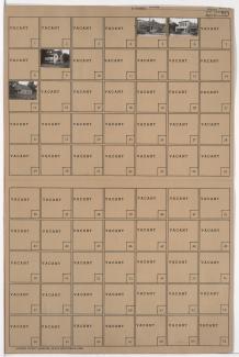
Tax Assessment Block Folder, Kansas City, MO, District 7, Block 248
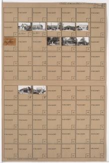
Folder contains photographs of residences and businesses in the Leeds neighborhood, from 36th Street south to 37th Street, and Fremont Avenue east to Fuller Avenue.
Street Names
Folder contains photographs of residences and businesses in the Leeds neighborhood, from 36th Street south to 37th Street, and Fremont Avenue east to Fuller Avenue.
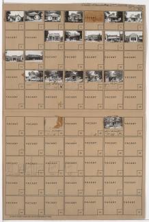
Folder contains photographs of residences, businesses, and other buildings in the Leeds neighborhood, from 37th Street south to 38th Street, and Fremont Avenue east to Fuller Avenue.
Folder contains photographs of residences, businesses, and other buildings in the Leeds neighborhood, from 35th Street south to 37th Street, and Bennington Avenue east to the Kansas City city limits.

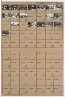
Folder contains photographs of businesses in the Leeds neighborhood, from 37th Street south to 39th Street, and Bennington Avenue east to Raytown Road.

Folder contains photographs of residences and businesses in the Vineyards Estates neighborhood, from Raytown Road south to 37th Street, and White Avenue east to Wheeling Avenue.
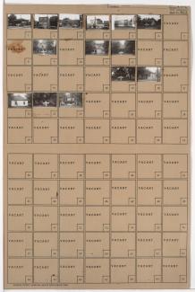
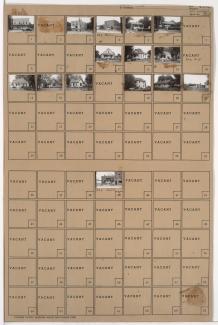
Folder contains photographs of residences and businesses in the Leeds neighborhood, from 36th Street south to 37th Street, and Beacon Avenue east to Fremont Avenue.
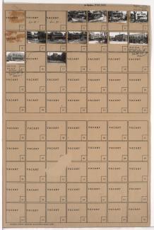
Folder contains photographs of residences and businesses in the Leeds neighborhood, from 37th Street south to 38th Street, and Beacon Avenue east to Fremont Avenue.
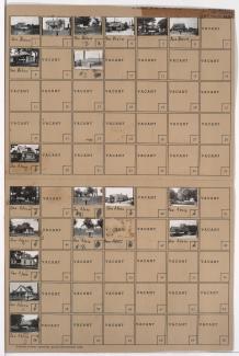
Folder contains photographs of residences and other buildings in the Leeds neighborhood, from 36th Street south to 37th Street, and Fuller Avenue east to Bennington Avenue. A United Auto Workers union hall, at 6508 East 37th, is among the buildings pictured.
Folder contains photographs of residences, businesses, and other buildings in the Leeds neighborhood, from 37th Street south to 38th Street, and Fuller Avenue east to Bennington Avenue.

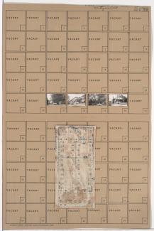
Folder contains a photograph of a residence in the Knoches Park neighborhood, from 37th Street south to 38th Street, and Spruce Avenue east to Kensington Avenue. Folder also contains a plat map of the block.
Folder contains photographs of residences and businesses in the Old Hyde Park neighborhood, from 36th Street south to 37th Street, and Main Street east to Walnut Street. The Warwick Cleaners, at 3625 Main, is among the buildings pictured.
Folder contains photographs of residences in the Palestine East neighborhood, from 36th Street south to 37th Street, and Mersington Avenue east to Myrtle Avenue. Folder also includes a plat map of the block.

Folder contains photographs of residences and other buildings in the Palestine West neighborhood, from 36th Street south to 37th Street, and Indiana Avenue east to Bales Avenue. Southeast Presbyterian Church and Sunday School, at 3601-3607 Indiana, are among the buildings pictured. Folder also includes a plat map of the block.

Folder contains photographs of residences in the Palestine West neighborhood, from 36th Street south to 37th Street, and Askew Avenue east to Monroe Avenue. Folder also includes a plat map of the block.

Folder contains photographs of residences in the Palestine West neighborhood, from 36th Street south to 37th Street, and Monroe Avenue east to Cleveland Avenue. Folder also includes a plat map of the block.

Folder contains photographs of residences in the Palestine East neighborhood, from 36th Street south to 37th Street, and Cleveland Avenue east to Mersington Avenue. Folder also includes a plat map of the block.

Folder contains photographs of residences in the Palestine East neighborhood, from 36th Street south to 37th Street, and Norton Avenue east to Jackson Avenue. Folder also includes a plat map of the block.

Folder contains photographs of residences and other buildings in the Palestine East neighborhood, from 37th Street south to 38th Street, and Myrtle Avenue east to Jackson Avenue. Folder also includes a plat map of the block.

Folder contains photographs of residences in the Palestine East neighborhood, from 37th Street south to 38th Street, and Cleveland Avenue east to Mersington Avenue. Folder also includes a plat map of the block.

Folder contains photographs of residences in the Palestine West neighborhood, from 37th Street south to 38th Street, and Monroe Avenue east to Cleveland Avenue. Folder also includes a plat map of the block.