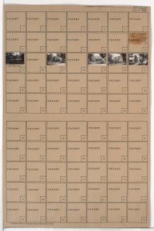
Folder contains photographs of residences in the East Meyer Cluster neighborhood, from 64th Street south to Hagerwood Road, and Chestnut Avenue east to South Benton Avenue.
Street Names
Folder contains photographs of residences in the East Meyer Cluster neighborhood, from 64th Street south to Hagerwood Road, and Chestnut Avenue east to South Benton Avenue.
Folder contains photographs of residences in the East Meyer Cluster neighborhood, from Hagerwood Road south to Meyer Boulevard, and Chestnut Avenue east to South Benton Avenue.
Folder contains photographs of residences in the East Meyer Cluster neighborhood, from 63rd Street south to 64th Street, and Hagerwood Road east to Chestnut Avenue.
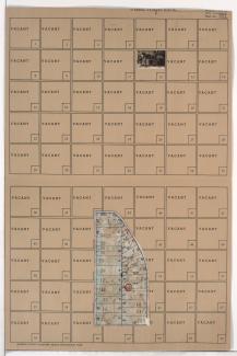
Folder contains a photograph of a residence in the East Meyer Cluster neighborhood, from 63rd Street south to 64th Street, and Prospect Avenue east to Montgall Avenue and Hagerwood Road. Folder also includes a plat map of the block.
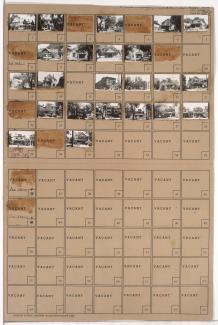
Folder contains photographs of residences, businesses, and other buildings in the Valentine neighborhood, from 35th Street south to Knickerbocker Place, and Pennsylvania Avenue east to Broadway Boulevard. The Kansas City Life building, at 3520 Broadway, and the Woodlea Hotel, at 3544 Broadway, are among the buildings pictured.
Folder contains photographs of residences and apartment buildings in the Valentine neighborhood, from 35th Street south to Valentine Road, and Jefferson Street east to Pennsylvania Avenue.
Folder contains photographs of residences and apartment buildings in the Valentine neighborhood, from Valentine Road south to 38th Street, and Pennsylvania Avenue east to Washington Street.
Folder contains photographs of residences in the Valentine neighborhood, from Valentine Road south to 37th Street, and Jefferson Street east to Pennsylvania Avenue.
Folder contains photographs of residences in the Valentine neighborhood, from 37th Street south to 38th Street, and Jefferson Street east to Pennsylvania Avenue.
Folder contains photographs of residences and other buildings in the Valentine neighborhood, from 38th Street south to 39th Street, and Pennsylvania Avenue east to Washington Street.
Folder contains photographs of residences, businesses, and apartment buildings in the Valentine neighborhood, from 38th Street south to 39th Street, and Summit Street (later Southwest Trafficway) east to Pennsylvania Avenue. Ritz Ice Cream, at 630 West 39th, is among the buildings pictured.
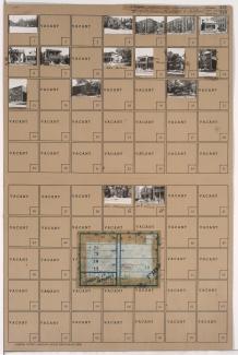
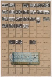
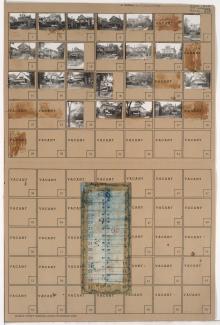
Folder contains photographs of residences, businesses, and other buildings in the Westport neighborhood, from 40th Street south to Westport Road, and Mill Street east to Pennsylvania Avenue. Manor Baking Company, at 4026-4050 Pennsylvania, Sawyer Material & Coal Company, at 530 Westport Road, and Kelly's Westport Inn, at Westport and Pennsylvania, are among the buildings pictured. Folder also includes a plat map of the block.
Folder contains photographs of residences, businesses, and apartment buildings in the Westport neighborhood, from 39th Street south to 39th Terrace, and Pennsylvania Avenue east to Washington Street. Advertising Pencil Company, at 525 West 39th, and the Bristol Apartments, at 516-526 39th Terrace, are among the buildings pictured. Folder also includes a plat map of the block.
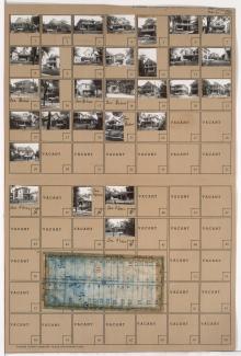
Folder contains photographs of residences and other buildings in the Westport neighborhood, from 39th Terrace south to 40th Street, and Pennsylvania Avenue east to Washington Street. Westport Methodist Church, at 40th and Washington Streets, and Our Lady of Good Counsel Catholic Church, at 39th Terrace and Washington, and the Our Lady of Good Counsel Catholic School, at 39th Terrace and Pennsylvania, are among the buildings pictured. Folder also includes a plat map of the block.
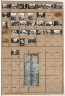
Folder contains photographs of residences and other buildings in the Westport neighborhood, from 39th Street south to 39th Terrace, and Waddell Avenue (later Summit Street, later Southwest Trafficway) east to Pennsylvania Avenue. Adolph Hapke Jewelry Store, at 721 East 39th, and Janoe's Bakery, at 727 West 39th, are among the buildings pictured. Folder also includes a plat map of the block.
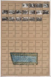
Folder contains photographs of residences in the Westport neighborhood, from 39th Terrace south to 40th Street, and Waddell Avenue (later Summit Street, later Southwest Trafficway) east to Pennsylvania Avenue. Folder also includes a plat map of the block.
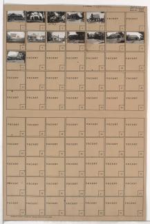
Folder contains photographs of residences and apartment buildings in the Valentine neighborhood, from 31st Street south to 32nd Street, and Pennsylvania Avenue east to Washington Street. Folder also includes a plat map of the block.
Folder contains photographs of residences and apartment buildings in the Valentine neighborhood, from 31st Street south to 32nd Street, and Jefferson Street east to Pennsylvania Avenue. Folder also includes a plat map of the block.
Folder contains photographs of residences and apartment buildings in the Valentine neighborhood, from 32nd Street south to 33rd Street, and Jefferson Street east to Pennsylvania Avenue. Folder also includes a plat map of the block.
Folder contains photographs of residences in the Valentine neighborhood, from 32nd Street south to 33rd Street, and Pennsylvania Avenue east to Washington Street. Folder also includes a plat map of the block.