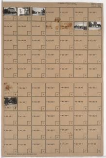
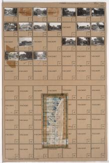
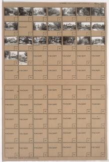
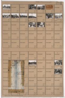
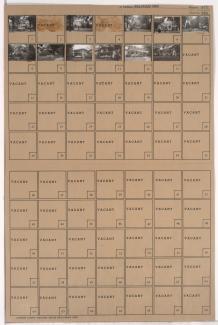
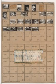
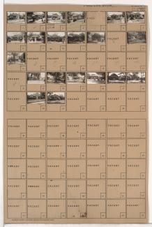
Tax Assessment Block Folder, Kansas City, MO, District 12, Block 106
Folder contains photographs of the Walnuts Apartments in the South Plaza neighborhood, from 50th Street south to 51st Street, and Wornall Road east to Wyandotte Street.
Folder contains photographs of residences in the South Plaza neighborhood, from Brookside Boulevard west to Grand Avenue and south to 51st Street.
Folder contains photographs of businesses and other buildings in the South Plaza neighborhood, from Brush Creek and 48th Street (later Volker Boulevard) south to 51st Street, and Brookside Boulevard east to Oak Street, including a section of 51st Street.
Folder contains photographs of residences, businesses, and other buildings in the South Plaza neighborhood, from 50th Street south to 51st Street, and Main Street east to Walnut Street. The Beacon Restaurant, at 5039 Main, and Country Club Cleaners, at 5029-5031 Main, are among the buildings pictured. Folder also includes a plat map of the block.
Folder contains photographs of residences in the South Plaza neighborhood, from 50th Street south to 51st Street, and Walnut Street east to Grand Avenue.
Folder contains photographs of residences and businesses in the South Plaza neighborhood from 50th Street south to 51st Street, and Baltimore Avenue east to Main Street. Crown Drug, at 51st and Main, and Country Club Laundry, at 5028 Main, are among the buildings pictured. Folder also contains a plat map of the block.
Folder contains photographs of residences, apartments, and other buildings in the South Plaza neighborhood, from 50th Street south to 51st Street, and Wyandotte Street east to Baltimore Avenue.
Folder contains photographs of residences in the Sunset Hill neighborhood, from Rockwell Lane and 51st Street south to 52nd Street and east to Sunset Drive.
Folder contains photographs of residences in the Westwood neighborhood, in an area east of State Line Road and southwest of 51st Street. Folder also includes a plat map of the block.
Folder contains photographs of residences in the Westwood neighborhood, from 50th Terrace south to 51st Street, and Wyoming Street east to Westwood Terrace.
Folder contains photographs of residences in the Westwood neighborhood, from 50th Terrace south to 51st Street, and Westwood Terrace east to Ward Parkway.
Folder contains photographs of residences and other buildings in the Sunset Hill neighborhood, from 50th Street south to 51st Street, and Summit Street east to Wornall Road. Various buildings on the Sunset Hill School campus (later Pembroke Hill School) are among the buildings pictured.
Folder contains photographs of buildings in Loose Park in the Sunset Hill neighborhood, from 51st and 52nd Streets south to 55th Street, and Summit Street east to Wornall Road.
Folder contains photographs of residences and other buildings in the Westwood neighborhood, from 51st Street south to Sunford Circle, and State Line Road east to Ward Parkway, including a section of Brush Creek Parkway.
Folder contains photographs of residences and other buildings in the Blue Hills neighborhood, from 50th Street south to 51st Street, and Euclid Avenue east to Garfield Avenue. Garfield Baptist Church, at 50th and Garfield, is among the buildings pictured. Folder also includes a plat map of the block.
Folder contains photographs of residences in the Blue Hills neighborhood, from 50th Street south to 51st Street, and Wabash Avenue east to Prospect Avenue. Folder also includes a plat map of the block.
Folder contains photographs of residences in the Blue Hills neighborhood, from 50th Street south to 51st Street, and Olive Street east to Wabash Avenue. Folder also includes a plat map of the block.
Folder contains photographs of residences in the Cole Grove neighborhood, from 50th Street south to 51st Street, and Park Avenue east to Olive Street.
Folder contains photographs of residences in the Blue Hills neighborhood, from 50th Street south to 51st Street, and Brooklyn Avenue east to Park Avenue.
Folder contains photographs of residences and other buildings in the Blue Hills neighborhood, from 50th Street south to 51st Street, and Garfield Avenue east to Brooklyn Avenue. Frances Willard School, at 50th and Garfield, is among the buildings pictured. Folder also includes a plat map of the block.