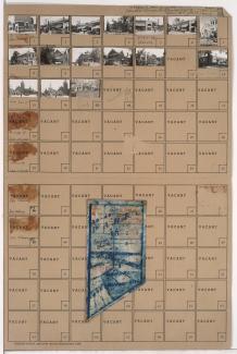
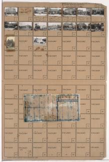
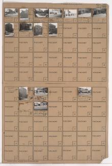
Tax Assessment Block Folder, Kansas City, MO, District 14, Block 17
Folder contains photographs of residences and businesses in the Mount Cleveland neighborhood, from 49th Street south to Blue Ridge Road, and Lawn Avenue east to Lister Avenue.
Folder contains photographs of residences, businesses, and other buildings in the Westport neighborhood, from 39th Street south to Westport Road, and Baltimore Avenue east to Main Street. Foster's Shoes, at Westport and Main, Christmas Barbershop, at 2 Westport Road, and Hyde Park Christian Church, at 39th and Baltimore, are among the buildings pictured. Folder also includes a plat map of the block.
Folder contains photographs of residences, businesses, and other buildings in the North Hyde Park neighborhood, from 31st Street south to Linwood Boulevard, and Harrison Street east to Troost Avenue. The Wirthman Building, including the Isis Theater and Crown Drugs, at 3100 Troost, Gehr's Cafe, at 3128 Troost, and a Woolworth's store, at 3118-3120 Troost, are among the buildings pictured. Folder also includes a plat map of the block.
Folder contains photographs of businesses and apartment buildings in the Longfellow neighborhood, from 30th Street south to 31st Street, and Harrison Street east to Troost Avenue. A Safeway grocery store, at 3004-3006 Troost, and the Barcelona Apartments, at 3035 Harrison, are among the buildings pictured.