Tax Assessment Block Folder, Kansas City, MO, District 16, Block 70

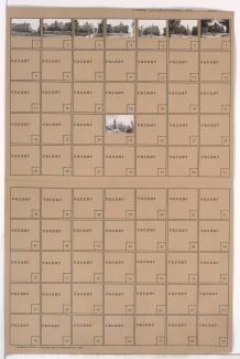
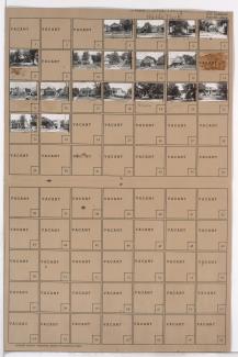
Folder contains photographs of residences in the Battleflood Heights neighborhood, from 72nd Street south to 73rd Street, and Lydia Avenue east to Flora Avenue.
Street Names
Folder contains photographs of residences in the Battleflood Heights neighborhood, from 72nd Street south to 73rd Street, and Lydia Avenue east to Flora Avenue.

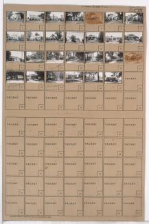
Folder contains photographs of residences in the Battleflood Heights neighborhood, from 72nd Street south to 73rd Street, and Virginia Avenue east to Lydia Avenue. Folder also includes a plat map of the block.
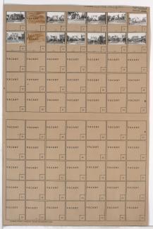
Folder contains photographs of residences in the Battleflood Heights neighborhood, from 72nd Street south to 73rd Street, and Wayne Avenue east to Highland Avenue.

Folder contains photographs of residences in the Walnut Grove neighborhood, from 72nd Street south to 73rd Street, and Brooklyn Avenue east to Park Avenue.

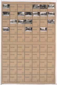
Folder contains photographs of residences in the Battleflood Heights neighborhood, from 73rd Street south to 74th Street, and Highland Avenue east to Woodland Avenue.
Folder contains photographs of residences in the Walnut Grove neighborhood, from 72nd Street south to 73rd Street, and Park Avenue east to Olive Street.

Folder contains photographs of residences in the Walnut Grove neighborhood, from 72nd Street south to 73rd Street, and Olive Street east to Wabash Avenue.

Folder contains photographs of residences in the Walnut Grove neighborhood, from 73rd Street south to 74th Street, and Wabash Avenue east to Prospect Avenue.

Folder contains photographs of residences in the Walnut Grove neighborhood, from 73rd Street south to 74th Street, and Olive Street east to Wabash Avenue.
Folder contains photographs of residences and other buildings in the Walnut Grove neighborhood, from 73rd Street south to 74th Street, and Park Avenue east to Olive Street.

Folder contains photographs of residences in the Walnut Grove neighborhood, from 73rd Street south to 74th Street, and Arleta Boulevard east to Euclid Avenue.
Folder contains photographs of residences in the Walnut Grove neighborhood, from 73rd Street south to 74th Street, and Brooklyn Avenue east to Park Avenue.

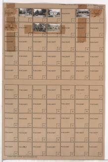
Folder contains photographs of residences in the Battleflood Heights neighborhood, from 73rd Street south to 74th Street, and Tracy Avenue east to Virginia Avenue.

Folder contains photographs of residences and other buildings in the Battleflood Heights neighborhood, from 73rd Street south to 74th Street, and Forest Avenue east to Tracy Avenue.

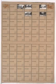
Folder contains photographs of residences in the Battleflood Heights neighborhood, from 73rd Street south to 74th Street, and Flora Avenue east to Wayne Avenue.

Folder contains photographs of residences in the Tower Homes neighborhood, from 72nd Terrace south to 73rd Street, and Grand Avenue east to Oak Street.
Folder contains a photograph of a building in the Waldo neighborhood, from 72nd Street south to 73rd Street, and Wornall Road east to Central Street.
Folder contains photographs of residences in the Tower Homes neighborhood, from 72nd Street south to 73rd Street, and Baltimore Avenue east to Main Street.
Folder contains photographs of residences in the Tower Homes neighborhood, from 72nd Street south to 73rd Street, and Main Street east to Walnut Street.
Folder contains photographs of residences in the Tower Homes neighborhood, from 72nd Street south to 73rd Street, and Wyandotte Street east to Baltimore Avenue.