Tax Assessment Block Folder, Kansas City, MO, District 12, Block 177
Folder contains photographs of residences in the Western 49-63 neighborhood, from 56th Street south to 57th Street, and Oak Street east to Locust Street.
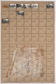
Street Names
Folder contains photographs of residences in the Western 49-63 neighborhood, from 56th Street south to 57th Street, and Oak Street east to Locust Street.
Folder contains photographs of residences and businesses in the Western 49-63 neighborhood, from 55th Street south to 56th Street, and Harrison Street east to Troost Avenue. A Kroger grocery store, at 5500 Troost, is among the buildings pictured. Folder also includes a plat map of the block.

Folder contains photographs of residences in the Western 49-63 neighborhood, from 55th Street south to 56th Street, and Rockhill Road east to Harrison Street.

Folder contains photographs of residences in the Western 49-63 neighborhood, from 55th Street south to 56th Street, and Charlotte Street east to Rockhill Road.

Folder contains photographs of residences in the Western 49-63 neighborhood, from 55th Street south to 56th Street, and Holmes Street east to Charlotte Street.

Folder contains photographs of residences in the Crestwood neighborhood, from 55th Street south to Crestwood Drive and 56th Street, and from Crestwood Drive east to Holmes Street.
Folder contains photographs of residences in the Crestwood neighborhood, from Crestwood Drive south to 56th Street and west to Locust Street.

Folder contains photographs of residences in the Crestwood neighborhood, from Crestwood Drive south to 56th Street, and Oak Street east to Locust Street.

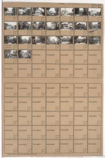
Folder contains photographs of residences in the Western 49-63 neighborhood, from 56th Street south to 57th Street, and Locust Street east to Cherry Street.

Folder contains photographs of residences in the Western 49-63 neighborhood, from 56th Street south to 57th Street, and Cherry Street east to Kenwood Avenue.

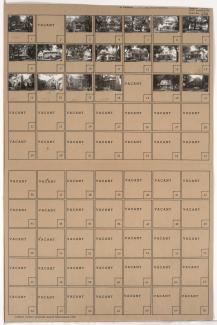
Folder contains photographs of residences in the Western 49-63 neighborhood, from 56th Street south to 57th Street, and Holmes Street east to Charlotte Street.

Folder contains photographs of residences in the Western 49-63 neighborhood, from 56th Street south to 57th Street, and Kenwood Avenue east to Holmes Street.

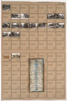
Folder contains photographs of residences in the Western 49-63 neighborhood, from 56th Street south to 57th Street, and Charlotte Street east to Rockhill Road.
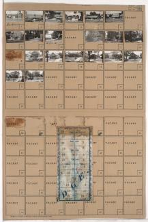
Folder contains photographs of residences and businesses in the Western 49-63 neighborhood, from 56th Street south to 57th Street, and Harrison Street east to Troost Avenue. A Safeway grocery store, at 5640 Troost, is among the buildings pictured. Folder also includes a plat map of the block.

Folder contains photographs of residences in the Western 49-63 neighborhood, from 56th Street south to 57th Street, and Rockhill Road east to Harrison Street.

Folder contains photographs of residences in the Countryside neighborhood, from 55th Terrace south to 56th Street, and Main Street east to Brookside Boulevard.

Folder contains photographs of residences in the Countryside neighborhood, from 56th Street south to 56th Terrace, and Main Street east to Brookside Boulevard.

Folder contains photographs of residences in the Countryside neighborhood, from 55th Terrace south to 56th Street, and Brookside Boulevard east to Oak Street.
Folder contains photographs of residences in the Brookside Plaza neighborhood, from 56th Street south to 57th Street, and Brookside Boulevard east to Oak Street. Folder also includes a plat map of the block.

Folder contains photographs of residences in the Ward Estates neighborhood, from 55th Street south to 56th Street, and Pennsylvania Avenue east to Wornall Road.