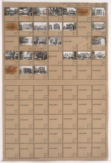
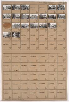
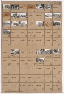
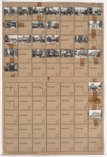
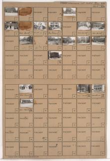
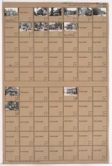
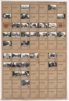
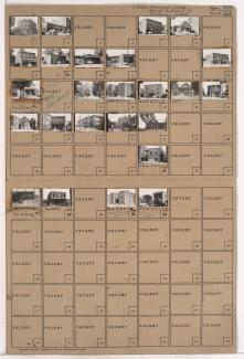
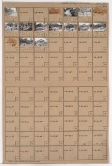
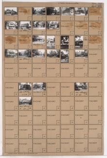
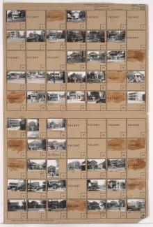
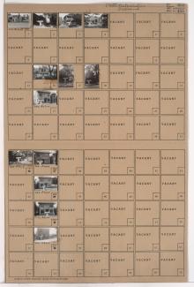
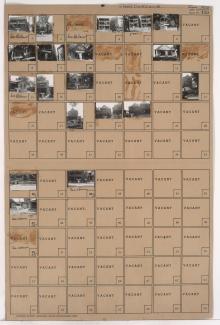
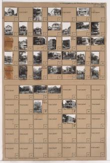
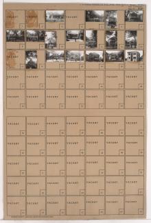
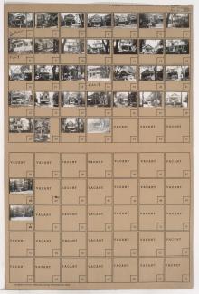
Tax Assessment Block Folder, Kansas City, MO, District 5, Block 107
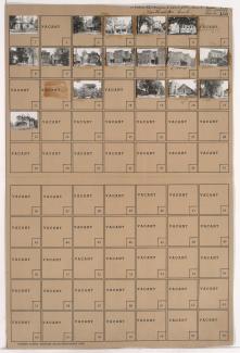
Folder contains photographs of residences and other buildings in the Forgotten Homes neighborhood, from 12th Street south to 13th Street, and Michigan Avenue east to Euclid Avenue.
Folder contains photographs of residences, apartments, and other buildings in the Forgotten Homes neighborhood, from 13th Street south to 14th Street, and Michigan Avenue east to Euclid Avenue.
Folder contains photographs of residences and apartment buildings in the Forgotten Homes neighborhood, from 13th Street south to 14th Street, and Euclid Avenue east to Garfield Avenue. Euclid Apartments, at 1313-1315 Euclid, is among the buildings pictured.
Folder contains photographs of residences, businesses, and other buildings in the 18th and Vine District, from 14th Street south to 15th Street (later Truman Road), and Michigan Avenue east to Euclid Avenue. R. L. Hamilton Used Trucks and Cars, at 1900 East 15th,
Folder contains photographs of residences, businesses, and other buildings in the 18th and Vine District, from 14th Street south to 15th Street (later Truman Road), and Euclid Avenue east to Garfield Avenue. Auto Resale Company, at 2010 East 15th, is among the buildings pictured.
Folder contains photographs of residences, businesses, and other buildings in the 18th and Vine District, from 15th Street (later Truman Road) south to 16th Street, and Euclid Avenue east to Garfield Avenue.
Folder contains photographs of residences, apartments, and other buildings in the 18th and Vine District, from 17th Street south to 18th Street, and Euclid Avenue east to Garfield Avenue. The former Jefferson School building (apartments, at the time of the photograph), at 1710 Garfield, and Seidlitz Paint and Varnish Company, at 18th and Garfield, are among the buildings pictured.
Folder contains photographs of residences and businesses in the Wendell Phillips neighborhood, from 18th Street south to 19th Street, and Euclid Avenue east to Brooklyn Avenue. Bauer Manufacturing Company, at 2009 East 18th, is among the buildings pictured.
Folder contains photographs of residences, businesses, and other buildings in the Wendell Phillips neighborhood, from 18th Street south to 19th Street, and Woodland Avenue east to Euclid Avenue. Attucks School, on 19th Street, and Charles Bryant Barbecue, 1921 E. 18th Street, are among the buildings pictured.
Folder contains photographs of residences and other buildings in the Wendell Phillips neighborhood, from 21st Street south to 22nd Street, and Woodland Avenue east to Euclid Avenue. Lincoln School, at 21st and Woodland, is among the buildings pictured.
Folder contains a photograph of Ruppert Stadium (later Municipal Stadium) in the Wendell Phillips neighborhood, from 21st Street south to 22nd Street, and Euclid Avenue east to Brooklyn Avenue.
Folder contains photographs of residences and apartment buildings adjacent to Spring Valley Park, from 27th Street south to 29th Street, and Woodland Avenue east to Garfield and Brooklyn Avenues, including sections of 28th Street and Michigan and Euclid Avenues.
Folder contains photographs of residences, apartments, and other buildings in the Wendell Phillips neighborhood, from 24th Street south to 24th Terrace, and Michigan Avenue east to Brooklyn Avenue, including sections of Garfield and Euclid Avenues.
Folder contains photographs of residences, businesses, and other buildings in the Wendell Phillips neighborhood, from 24th Terrace south to 25th Street, and Euclid Avenue east to Garfield Avenue.
Folder contains photographs of residences and apartment buildings in the Wendell Phillips neighborhood, from 24th Terrace south to 25th Street, and Michigan Avenue east to Euclid Avenue.
Folder contains photographs of residences and apartment buildings in the Wendell Phillips neighborhood, from 25th Street south to 26th Street, and Michigan Avenue east to Euclid Avenue.
Folder contains photographs of residences in the Wendell Phillips neighborhood, from 26th Street south to 27th Street, and Euclid Avenue east to Garfield Avenue.
Folder contains photographs of residences and apartment buildings in the Wendell Phillips neighborhood, from 26th Street south to 27th Street, and Woodland Avenue east to Euclid Avenue.
Folder contains photographs of residences and apartment buildings in the Key Coalition neighborhood, from 29th Street south to 30th Street, and Euclid Avenue east to Garfield Avenue.
Folder contains photographs of residences and other buildings in the Key Coalition neighborhood, from 29th Street south to 30th Street, and Michigan Avenue east to Euclid Avenue.