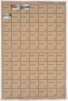
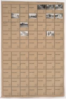
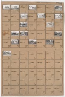
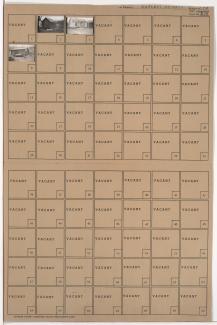
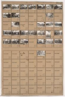
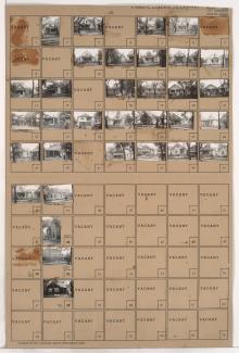
Tax Assessment Block Folder, Kansas City, MO, District 6, Block 126
Folder contains photographs of residences and businesses in the West Blue Valley neighborhood, from 12th Street south to 14th Street, and Lawndale Avenue east to Topping Avenue.
Folder contains photographs of buildings in the West Blue Valley neighborhood, from 14th Street south to 15th Street (later Truman Road), and Lawndale Avenue east to Topping Avenue.
Folder contains photographs of residences and other buildings in the West Blue Valley neighborhood, from 12th Street south to 14th Street, and Oakley Avenue east to Lawndale Avenue.
Folder contains photographs of residences and other buildings in the West Blue Valley neighborhood, from 14th Street south to 15th Street (later Truman Road), and Oakley Avenue east to Lawndale Avenue.
Folder contains photographs of residences in the Blue Valley neighborhood, from 22nd Street south to 23rd Street, and Oakley Avenue east to Lawndale Avenue.
Folder contains photographs of residences in the Clifton Heights addition, from Norledge Place south to Scarritt Avenue, and Lawndale Avenue east to Topping Avenue.
Folder contains photographs of residences in the Clifton Heights addition, from Norledge Place south to Scarritt Avenue, and Oakley Avenue east to Lawndale Avenue.
Folder contains photographs of residences in the South Blue Valley neighborhood, from 23rd Street south to 24th Street, and Oakley Avenue east to Lawndale Avenue.
Folder contains photographs of residences in the South Blue Valley neighborhood, from 23rd Street south to 24th Street, and Lawndale Avenue east to Topping Avenue.
Folder contains photographs of residences in the South Blue Valley neighborhood, from 24th Street south to 25th Street, and Oakley Avenue east to Lawndale Avenue.
Folder contains photographs of residences in the South Blue Valley neighborhood, from 24th Street south to 25th Street, and Lawndale Avenue east to Topping Avenue.
Folder contains a photograph of a residence in the South Blue Valley neighborhood, from 25th Street south to 26th Street, and Lawndale Avenue east to Topping Avenue.
Folder contains photographs of residences in the South Blue Valley neighborhood, from 26th Street south to 27th Street, and Oakley Avenue east to Lawndale Avenue.
Folder contains photographs of the Askew Public School, at at 2630 Askew, on a block from 26th Street south to 27th Street, and Lawndale Avenue east to Topping Avenue.
Folder contains photographs of residences and businesses in the Clifton Heights addition, from Scarritt Avenue south to St. John Avenue, and Oakley Avenue east to Lawndale Avenue. Chief Tire & Battery Shop, at 5612 St. John Avenue, is among the buildings pictured.
Folder contains photographs of residences, businesses, and a church in the Clifton Heights addition, from Scarritt Avenue south to St. John Avenue, and Lawndale Avenue east to Topping Avenue. Bethany Baptist Church and the school to its rear, at 141 Lawndale, are among the buildings pictured.
Folder contains photographs of residences in the Clifton Heights addition, from Gladstone Boulevard south to Saida Avenue, and Lawndale Avenue east to Topping Avenue.
Folder contains photographs of residences and businesses in the Oakley Park subdivision, from St. John Avenue south to Anderson Avenue, and Oakley Avenue east to Lawndale Avenue. A Kroger grocery store, at Oakley and St. John, and the Belmont Theatre, at 5607 St. John, are among the buildings pictured.
Folder contains photographs of residences, apartment buildings, and businesses in the Winram Place, Oakley, and Oakley Park subdivisions, from St. John Avenue south to Anderson Avenue, and Lawndale Avenue east to Topping Avenue.
Folder contains photographs of residences in the Clifton Heights addition, from Gladstone Boulevard south to Saida Avenue, and Oakley Avenue east to Lawndale Avenue.