Tax Assessment Block Folder, Kansas City, MO, District 11, Block 148

Folder contains a photograph of a residence in the Coleman Highlands neighborhood, from 31st Street south to 32nd Street, and Mercier Street east to Holly Street.
Street Names
Folder contains a photograph of a residence in the Coleman Highlands neighborhood, from 31st Street south to 32nd Street, and Mercier Street east to Holly Street.
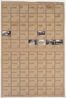
Folder contains photographs of residences and other buildings in the Coleman Highlands neighborhood, from 31st Street south to 32nd Street, and Terrace Street east to Mercier Street.

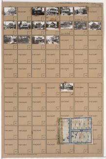
Folder contains photographs of residences and apartment buildings in the Volker neighborhood, from Valentine Road south to 39th Street, and Terrace Street east to Mercier Street. Folder also inlcudes a plat map of the block.

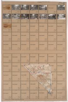
Folder contains photographs of residences in the Volker neighborhood, from Valentine Road south to 38th Street, and Mercier Street east to Roanoke Road. Folder also includes a plat map of the block.
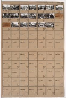
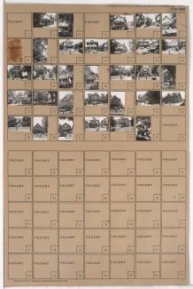
Folder contains photographs of residences and businesses in the Volker neighborhood, from 38th Street south to 39th Street, and Mercier Street east to Roanoke Road. Roanoke Plumbing and Heating, at 1222 West 39th, is among the buildings pictured. Folder also includes a plat map of the block.

Folder contains photographs of residences and businesses in the West Plaza neighborhood, from 47th Street south to 48th Street, and Mercier Street east to Holly Street. Folder also includes a plat map of the block.

Folder contains photographs of residences in the West Plaza neighborhood, from 47th Street south to 48th Street, and Terrace Street east to Mercier Street.

Folder contains photographs of residences in the West Plaza neighborhood, from 48th Street south to 49th Street, and Terrace Street east to Mercier Street. Folder also includes a plat map of the block.

Folder contains photographs of residences in the West Plaza neighborhood, from 48th Street south to 49th Street, and Mercier Street east to Holly Street. Folder also includes a plat map of the block.

Folder contains photographs of residences in the Westwood neighborhood, from 49th Street south to 50th Street and Westwood Road, and Mercier Street east to Holly Street. Folder also includes a plat map of the block.
Folder contains photographs of residences in the Westwood neighborhood, from Westwood Road north to 49th Street and east to Mercier Street. Folder also includes a plat map of the block.

Folder contains photographs of residences in the Sunset Hill neighborhood, from Sunset Drive north to Rockwell Lane and east to Mercier Street and Ward Parkway, including Brentwood Circle.

Folder contains photographs of residences in the Sunset Hill neighborhood, from Sunset Drive and Mercier Street northwest and southwest to Ward Parkway.
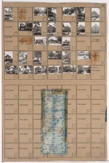
Folder contains photographs of residences and other buildings in the Volker neighborhood, from 39th Street south to 40th Street, and Mercier Street east to Roanoke Road. The Loretto Academy, at 1111 West 39th, is among the buildings pictured, though it is largely obscured by trees.

Folder contains photographs of residences and apartment buildings in the Volker neighborhood, from 39th Street south to 40th Street, and Terrace Street east to Mercier Street.

Folder contains photographs of residences in the Volker neighborhood, from 40th Street south to 41st Street, and Terrace Street east to Mercier Street.

Folder contains photographs of residences in the Volker neighborhood, from 40th Street south to 41st Street, and Mercier Street east to Holly Street.

Folder contains photographs of residences and apartment buildings in the Volker neighborhood, from 41st Street south to 42nd Street, and Mercier Street east to Holly Street.
Folder contains photographs of residences in the Volker neighborhood, from 41st Street south to 42nd Street, and Terrace Street east to Mercier Street.
Folder contains photographs of residences and other buildings in the Volker neighborhood, from 42nd Street south to 43rd Street/Westport Road, and Terrace Street east to Mercier Street. Guardian Angel Roman Catholic Church, at Westport and Mercier, is among the buildings pictured. Folder also includes a plat map of the block.