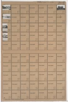
Folder contains photographs of businesses and other buildings in the Country Club Plaza neighborhood, from Ward Parkway and 48th Terrace (later 48th Street) south to 49th Street, and Wornall Road east to Main Street. The Villa Serena Apartment Hotel, at 325 Ward Parkway, is among the buildings pictured.
Search

Folder contains photographs of residences in the South Plaza neighborhood, from 49th Street south to 50th Street, and Wyandotte Street east to Baltimore Avenue.
Street Names

Folder contains a photograph of the E. C. White School in the South Plaza neighborhood, from Brookside Boulevard (later, Brookside and Ward Parkway) south to 49th Street and west to Main Street. The school is located at 11 Brookside Boulevard.
Street Names

Folder contains photographs of residences in the South Plaza neighborhood, from 49th Street south to 50th Street, and Walnut Street east to Grand Avenue.
Street Names
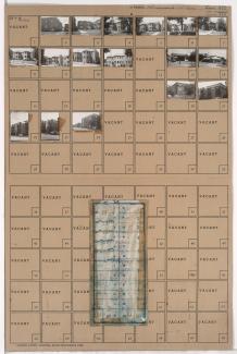
Folder contains photographs of apartment buildings and businesses in the South Plaza neighborhood, from 49th Street south to 50th Street, and Main Street east to Walnut Street. Folder also includes a plat map of the block. The Regency Court Apartments, at 49th and Walnut, is among the buildings pictured.
Street Names
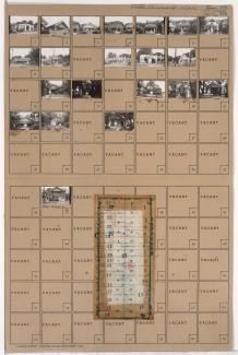
Folder contains photographs of residences and businesses in the South Plaza neighborhood, from 49th Street south to 50th Street, and Baltimore Avenue east to Main Street. Folder also includes a plat map of the block.
Street Names

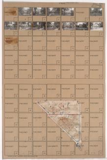
Folder contains photographs of residences in the South Plaza neighborhood, from 49th Street south to 50th Street, and Wornall Road east to Central Street. Folder also includes a plat map of the block.
Street Names

Folder contains photographs of residences in the South Plaza neighborhood, from 49th Street south to 50th Street, and Central Street east to Wyandotte Street.
Street Names

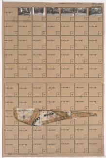
Folder contains photographs of residences in the Westwood neighborhood, from 47th Street south to 49th Street, and State Line Road east to Wyoming Street, including a section of Bell Street. Folder also includes a plat map of the block.
Street Names

Folder contains photographs of residences in the Sunset Hill neighborhood, from Ward Parkway south to 49th Street, and Sunset Drive east to Wornall Road. Folder also includes a plat map of the block.
Street Names

Folder contains photographs of residences in the West Plaza neighborhood, from 48th Street south to 49th Street and Westwood Road, and Fairmount Avenue east to Liberty Street. Folder also includes a plat map of the block.
Street Names

Folder contains photographs of residences in the West Plaza neighborhood, from 48th Street south to 49th Street, and Terrace Street east to Mercier Street. Folder also includes a plat map of the block.
Street Names

Folder contains photographs of residences in the West Plaza neighborhood, from 48th Street south to 49th Street, and Liberty Street east to Terrace Street. Folder also includes a plat map of the block.
Street Names

Folder contains photographs of residences in the West Plaza neighborhood, from 48th Street south to 49th Street, and Mercier Street east to Holly Street. Folder also includes a plat map of the block.
Street Names

Folder contains photographs of residences in the West Plaza neighborhood, from 48th Street south to 49th Street, and Holly Street east to Jarboe Street. Folder also includes a plat map of the block.
Street Names

Folder contains photographs of residences in the Sunset Hill neighborhood, from 49th Street south to 49th Terrace, and Sunset Drive east to Wornall Road. Folder also includes a plat map of the block.
Street Names
Folder contains photographs of residences in the Sunset Hill neighborhood, from Ward Parkway southeast to Sunset Drive, and Summit Street northeast to 49th Street.
Street Names

Folder contains photographs of residences in the Westwood neighborhood, from 49th Street south to Ward Parkway, and Holly Street east to Jarboe Street. Folder also includes a plat map of the block.
Street Names

Folder contains photographs of residences in the Westwood neighborhood, from 49th Street south to 50th Street and Westwood Road, and Mercier Street east to Holly Street. Folder also includes a plat map of the block.
Street Names
Folder contains photographs of residences in the Westwood neighborhood, from Westwood Road north to 49th Street and east to Mercier Street. Folder also includes a plat map of the block.
Street Names