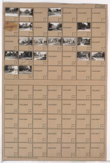
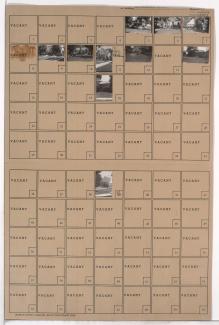
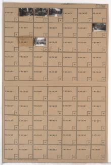
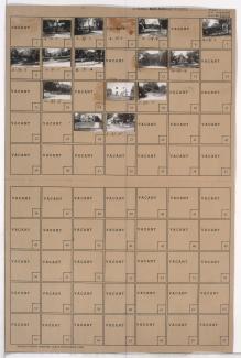
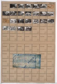
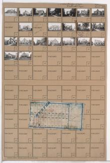
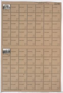
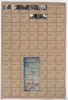
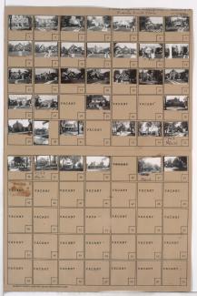
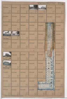
Tax Assessment Block Folder, Kansas City, MO, District 16, Block 127
Folder contains photographs of residences in the Battleflood Heights neighborhood, from 76th Terrace south to 77th Street, and Lydia Avenue east to Paseo Boulevard.
Folder contains photographs of residences in the Battleflood Heights neighborhood, from 76th Terrace south to 77th Street, and Troost Avenue east to Lydia Avenue.
Folder contains photographs of residences in the Battleflood Heights neighborhood, from 77th Street south to 77th Terrace, and Troost Avenue east to Lydia Avenue.
Folder contains photographs of residences in the Battleflood Heights neighborhood, from 77th Street south to 77th Terrace, and Lydia Avenue east to Paseo Boulevard.
Folder contains photographs of residences in the Walnut Grove neighborhood, from 76th Terrace south to 77th Street, and Paseo Boulevard east to Brooklyn Avenue.
Folder contains photographs of residences in the Walnut Grove neighborhood, from 77th Street south to 77th Terrace, and Brooklyn Avenue east to Prospect Avenue.
Folder contains photographs of residences in the Walnut Grove neighborhood, from 77th Street south to 77th Terrace, and U.S. Highway 71 (later Hickman Mills Drive) east to Brooklyn Avenue.
Folder contains photographs of residences in the Battleflood Heights neighborhood, from 77th Street south to 78th Street, and Troost Avenue east to Lydia Avenue
Map of block in the Tower Homes neighborhood, from from 75th Street south to 77th Street, and Main Street east to Walnut Street, containing information about tax assessment values of included properties, and illustrating lot numbers for the block. Photographs of properties on the block can be viewed below.
Folder contains photographs of residences in the Rockhill Manor neighborhood, from 76th Terrace south to 77th Street, and Campbell Street east to Troost Avenue. Folder also includes a plat map of the block.
Folder contains photographs of residences in the Tower Homes neighborhood, from 76th Street south to 77th Street, and Charlotte Street east to Campbell Street.
Folder contains photographs of residences in the Tower Homes neighborhood, from 76th Street south to 77th Street, and Holmes Road east to Charlotte Street. Folder also includes a plat map of the block.
Folder contains photographs of residences in the Tower Homes neighborhood, from 75th Street south to 77th Street, and Grand Avenue east to Oak Street, including a section of McGee Street. Folder also includes a plat map of the block, which can be viewed below.
Folder contains photographs of residences and other buildings in the Tower Homes neighborhood, from 75th Street south to 77th Street, and Oak Street east to Holmes Road, including a section of Locust Street.
Map of block in the Tower Homes neighborhood, from 75th Street south to 77th Street, and Grand Avenue east to Oak Street, including a section of McGee Street, containing information about tax assessment values of included properties, and illustrating lot numbers for the block. Photographs of properties on the block can be viewed below.
Folder contains photographs of residences in the Tower Homes neighborhood, from 75th Street south to 77th Street, and Walnut Street east to Grand Avenue. Folder also includes a plat map of the block, which can be viewed below.
Map of block in the Tower Homes neighborhood, from from 75th Street south to 77th Street, and Walnut Street east to Grand Avenue, containing information about tax assessment values of included properties, and illustrating lot numbers for the block.Photographs of properties on the block can be viewed below.
Folder contains photographs of residences in the Tower Homes neighborhood, from 75th Street south to 77th Street, and Main Street east to Walnut Street. Folder also includes a plat map of the block, which can be viewed below.
Folder contains photographs of residences and businesses in the Tower Homes neighborhood, from 77th Street south to 77th Terrace and the 1940 Kansas City city limits, and Holmes Road east to Troost Avenue, including a section of Campbell Street. Folder also includes a plat map of the block.