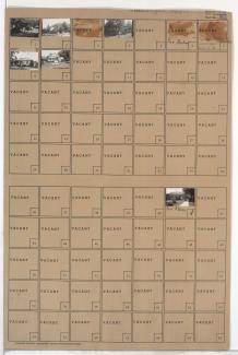
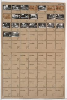
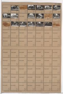
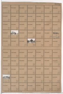
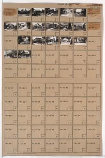
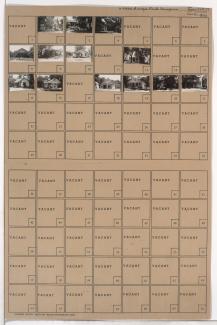
Tax Assessment Block Folder, Kansas City, MO, District 16, Block 26
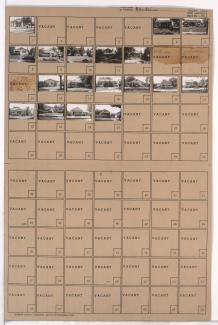
Folder contains photographs of residences and businesses in the Tri-Blenheim neighborhood, from 67th Terrace south to 68th Street, and Olive Avenue east to Prospect Avenue.
Folder contains photographs of residences in the Neighbors United for Action neighborhood, from 67th Street south to 68th Street, and Woodland Avenue east to Paseo Boulevard.
Folder contains photographs of residences in the Tri-Blenheim neighborhood, from 68th Street south to 68th Terrace, and Olive Street east to Prospect Avenue.
Map of block in the Holmes Park neighborhood, from 67th Street south to 68th Street, and Holmes Road east to Troost Avenue, containing information about tax assessment values of included properties, and illustrating lot numbers for the block. Photographs of properties on the block can be viewed below.
Folder contains photographs of residences in the Armour Hills neighborhood, from 67th Street south to 68th Street, and Main Street east to Grand Avenue. Folder also includes a plat map of the block.
Folder contains photographs of residences in the Armour Hills neighborhood, from 67th Street south to 68th Street, and Grand Avenue east to Oak Street.
Folder contains a photograph of a building in the Holmes Park neighborhood, from 67th Street south to 68th Street, and Holmes Road east to Troost Avenue. A plat map of the block is affixed to the outside of the folder, and can be viewed below.
Folder contains photographs of residences in the Holmes Park neighborhood, from 68th Street south to 69th Street, and Campbell Street east to Troost Avenue.
Folder contains photographs of residences in the Oak Meyer Gardens neighborhood, from 68th Street south to Rockhill Road, and Oak Street east to Locust Street. Folder also includes a plat map of the block.
Folder contains photographs of residences in the Armour Hills neighborhood, from 68th Street south to 68th Terrace, and Grand Avenue east to Oak Street.
Folder contains photographs of residences in the Armour Hills neighborhood, from 68th Street south to 68th Terrace, and Main Street east to Grand Avenue.
Folder contains photographs of residences in the Armour Hills neighborhood, from 67th Terrace south to 68th Street, and Brookside Road east to Edgevale Road.
Folder contains photographs of residences in the Armour Hills neighborhood, from 68th Street south to 68th Terrace, and Brookside Road east to Edgevale Road.
Folder contains photographs of residences in the Armour Fields neighborhood, from 67th Terrace south to 68th Street, and Valley Road east to Pennsylvania Avenue.
Folder contains photographs of residences in the Armour Fields neighborhood, from 67th Terrace south to 68th Street, and Pennsylvania Avenue east to Wornall Road.
Folder contains photographs of residences in the Armour Fields neighborhood, from 68th Street south to 68th Terrace, and Pennsylvania Avenue east to Wornall Road.
Folder contains photographs of residences in the Armour Fields neighborhood, from 68th Street south to 69th Street, and Valley Road east to Pennsylvania Avenue.
Folder contains photographs of residences in the East Meyer Cluster neighborhood, from 67th Street south to 68th Street, and Prospect Avenue east to Montgall Avenue.
Folder contains photographs of residences in the Foxtown West neighborhood, from 67th Street south to 68th Street, and Prospect Avenue east to Montgall Avenue.
Folder contains photographs of residences in the Foxtown West neighborhood, from 67th Street south to 68th Street, and Askew Avenue east to Monroe Avenue.