Tax Assessment Block Folder, Kansas City, MO, District 11, Block 284
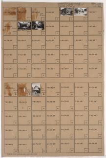
Folder contains photographs of buildings in the Westport neighborhood, from Westport Road south to 40th Street and east to Baltimore Avenue.
Street Names
Folder contains photographs of buildings in the Westport neighborhood, from Westport Road south to 40th Street and east to Baltimore Avenue.
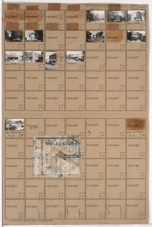
Folder contains photographs of residences, businesses, and other buildings in the Westport neighborhood, from 39th Street south to Westport Road, and Baltimore Avenue east to Main Street. Foster's Shoes, at Westport and Main, Christmas Barbershop, at 2 Westport Road, and Hyde Park Christian Church, at 39th and Baltimore, are among the buildings pictured. Folder also includes a plat map of the block.
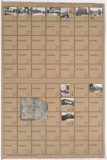
Folder contains photographs of buildings in the Westport neighborhood, from Westport Road south to 40th Street, and Baltimore Avenue east to Main Street. Katz Drugstore, at Westport and Main, is among the buildings pictured. Folder also includes a plat map of the block.

Folder contains photographs of residences, businesses, and other buildings in the Westport neighborhood, from 40th Street south to Westport Road, and Mill Street east to Pennsylvania Avenue. Manor Baking Company, at 4026-4050 Pennsylvania, Sawyer Material & Coal Company, at 530 Westport Road, and Kelly's Westport Inn, at Westport and Pennsylvania, are among the buildings pictured. Folder also includes a plat map of the block.
Folder contains photographs of residences, businesses, and other buildings in the Westport neighborhood, from 39th Terrace south to Westport Road, and Broadway Boulevard and Washington Street east to Central Street, including a section of 40th Street. Westport Laundry Company, at 3954 Central, Wayne's Body & Fender Works, at 4045 Broadway, are among the buildings pictured. Folder also includes a plat map of the block.
Folder contains photographs of residences and businesses in the Westport neighborhood, from 39th Street south to 39th Terrace, and Washington Street east to Broadway Boulevard. Folder also includes a plat map of the block.
Folder contains photographs of residences and apartment buildings in the Westport neighborhood, from 39th Street south to 39th Terrace, and Broadway Boulevard south to Central Street. Folder also includes a plat map of the block.
Folder contains photographs of residences and other buildings in the Westport neighborhood, from 39th Terrace south to 40th Street, and Washington Street east to Broadway Boulevard. Broadway Baptist Church, at 39th and Washington, is among the buildings pictured.
Folder contains photographs of residences, businesses, and apartment buildings in the Westport neighborhood, from 39th Street south to 39th Terrace, and Pennsylvania Avenue east to Washington Street. Advertising Pencil Company, at 525 West 39th, and the Bristol Apartments, at 516-526 39th Terrace, are among the buildings pictured. Folder also includes a plat map of the block.

Folder contains photographs of residences and other buildings in the Westport neighborhood, from 39th Terrace south to 40th Street, and Pennsylvania Avenue east to Washington Street. Westport Methodist Church, at 40th and Washington Streets, and Our Lady of Good Counsel Catholic Church, at 39th Terrace and Washington, and the Our Lady of Good Counsel Catholic School, at 39th Terrace and Pennsylvania, are among the buildings pictured. Folder also includes a plat map of the block.
Folder contains photographs of residences and other buildings in the Westport neighborhood, from 39th Street south to 39th Terrace, and Waddell Avenue south to Pennsylvania Avenue. Adolph Hapke Jewelry Store, at 721 East 39th, and Janoe's Bakery, at 727 West 39th, are among the buildings pictured. Folder also includes a plat map of the block.
Folder contains photographs of residences in the Westport neighborhood, from 39th Terrace south to 40th Street, and Waddell Avenue east to Pennsylvania Avenue. Folder also includes a plat map of the block.
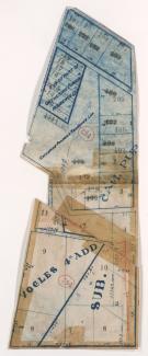
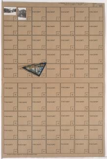
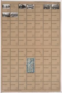
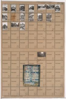
Map of block in the Westport neighborhood, from 40th Street south to Westport Road, and Waddell Avenue east to Mill Street, containing information about tax assessment values of included properties, and illustrating lot numbers for the block. Photographs of properties on the block can be viewed below.
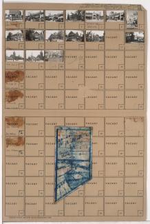
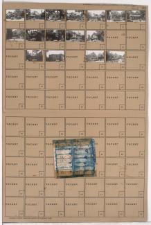
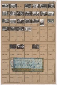
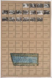
Folder contains photographs of residences and other buildings in the Westport neighborhood, from 40th Street south to Westport Road, and Waddell Avenue east to Mill Street. Kansas City Public Service Company building, at 40th and Waddell, and South Side Wood and Coal Company, at 536 Westport Road, are among the buildings pictured. Folder also includes a plat map of the block, which can be viewed below.
Folder contains photographs of residences and other buildings in the Westport neighborhood, from Lawrence Avenue south to Filmore Street (later 41st Street), and Mill Creek Parkway (later Broadway) east to Central Street. Kallaian Rose Rug Company, at 4163 Mill Creek, is among the buildings pictured.

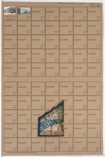
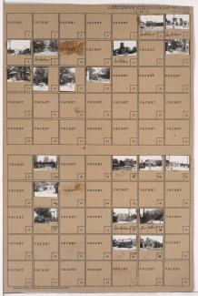
Folder contains photographs of businesses and other buildings in the Westport neighborhood, from Westport Road south to Archibald Avenue, and Mill Street east to Pennsylvania Avenue. Doerschuk's Drug Store, at 501 Westport, is among the buildings pictured. Folder also includes a plat map of the block.
Folder contains photographs of businesses and other buildings in the Westport neighborhood, from 40th Terrace south to Westport Road, and Pennsylvania Avenue east to Washington Street. The Bel-Art Cafe, at 4038 Broadway, Stegner and Stubbs Restaurant, at 406 Westport Road, and K.C. Curtain & Linen Company, at 400 Westport Road, are among the buildings pictured. Folder also includes a plat map of the block.
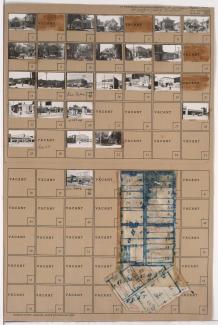
Folder contains photographs of residences, businesses, and other buildings in the Westport neighborhood, from Westport Road south to Archibald Avenue, and Mill Creek Parkway (later Broadway) east to Central Street. Westport Avenue Bank, at Westport and Mill Creek Parkway, and Broadway Hardware Company, at 311 Westport, are among the buildings pictured. Folder also includes a plat map of the block.
Folder contains photographs of residences, businesses, and other buildings in the Westport neighborhood, from 40th Street south to 40th Terrace, and Pennsylvania Avenue east to Washington Street. Fire Station No. 19, at 4012 Washington, is among the buildings pictured. Folder also includes a plat map of the block.
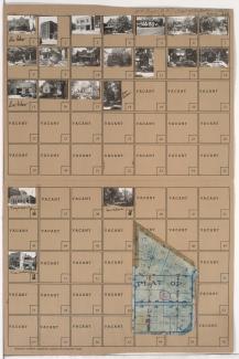
Folder contains photographs of residences and businesses in the Westport neighborhood, from 40th Street south to 40th Way, and Baltimore Avenue east to Main Street. Dods Cleaners & Dyers, at 40th and Main, and Fred's Cabinet Shop, at 4012 Main, are among the buildings pictured. Folder also includes a plat map of the block.