Tax Assessment Block Folder, Kansas City, MO, District 16, Block 137
Folder contains photographs of residences in the Battleflood Heights neighborhood, from 78th Street south to 79th Street, and Lydia Avenue east to Paseo Boulevard.
Street Names
Folder contains photographs of residences in the Battleflood Heights neighborhood, from 78th Street south to 79th Street, and Lydia Avenue east to Paseo Boulevard.
Folder contains photographs of residences in the 77th Terrace south to U.S. Highway 71 (later Hickman Mills Road) and 79th Street, and Brooklyn Avenue east to Prospect Avenue.
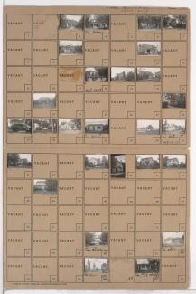
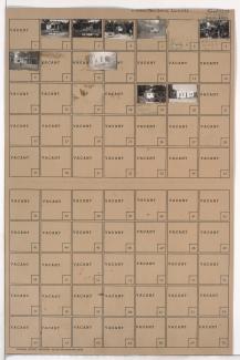
Folder contains photographs of residences and other buildings in the Walnut Grove neighborhood, from 78th Street south to 79th Street, and Paseo Boulevard east to U.S. Highway 71 (later Hickman Mills Road) and Brooklyn Avenue.

Folder contains photographs of residences in the Walnut Grove neighborhood, from 79th Street south to the 1940 Kansas City city limits, and Garfield Avenue east to Brooklyn Avenue. Folder also includes a plat map of the block.

Folder contains photographs of residences in the Walnut Grove neighborhood, from 79th Street south to the 1940 Kansas City city limits, and Michigan Avenue east to Euclid Avenue.
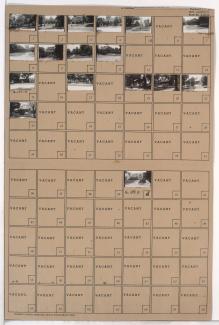
Folder contains photographs of residences in the Battleflood Heights neighborhood, from 78th Street south to 79th Street, and Troost Avenue east to Lydia Avenue.
Folder contains a photograph of a residence in the Battleflood Heights neighborhood, from 79th Street south to the 1940 Kansas City city limits, and Troost Avenue east to Forest Avenue.

Folder contains a photograph of a residence in the Battleflood Heights neighborhood, from 79th Street south to the 1940 Kansas City city limits, and Tracy Avenue east to Virginia Avenue.

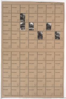
Folder contains photographs of residences in the Battleflood Heights neighborhood, from 79th Street south to the 1940 Kansas City city limits, and Virginia Avenue east to Lydia Avenue.

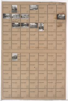
Folder contains photographs of residences in the Battleflood Heights neighborhood, from 79th Street south to the 1940 Kansas City city limits, and Lydia Avenue east to Paseo Boulevard.
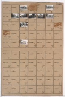
Folder contains a photograph of a residence in the Walnut Grove neighborhood, from 79th Street south to the 1940 Kansas City city limits, and Paseo Boulevard east to Michigan Avenue.

Folder contains photographs of residences in the Oldham Farms neighborhood east of the 1940 Kansas City city limits, from Oldham Road and 79th Street south to 83rd Street, and Bennington Avenue east to Bristol Avenue.

Folder contains a photograph of a residence in the Swope Park neighborhood, north of Oldham Road and 79th Street, and from the 1940 Kansas City city limits east to Bristol Avenue.

Folder contains photographs of residences in the Ward Parkway neighborhood south of the 1940 Kansas City city limits, from 77th Terrace south to 79th Street, and Ward Parkway east to Jarboe Street. Folder also includes a plat map of the block.
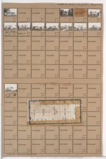
Folder contains photographs of residences in the West Waldo neighborhood south of the 1940 Kansas City city limits, from 79th Street south to 80th Street, and Holly Street east to Jarboe Street. Folder also includes a plat map of the block.

Folder contains photographs of residences in the West Waldo neighborhood south of the 1940 Kansas City city limits, from 79th Street south to 80th Street, and Belleview Avenue east to Madison Avenue. Folder also includes a plat map of the block.
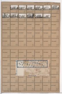
Folder contains photographs of residences in the West Waldo neighborhood south of the 1940 Kansas City city limits, from 79th Street south to 80th Street, and Madison Avenue east to Summit Street. Folder also includes a plat map of the block.
Folder contains photographs of residences, businesses, and other buildings in the Rockhill Manor neighborhood south of the 1940 Kansas City city limits, from 79th Street south to 81st Street, and Holmes Street east to Troost Avenue, including sections of 80th Street and 80th Terrace.
Folder contains photographs of residences, businesses, and other buildings in the Marlborough East neighborhood, from 77th Street south to the 1940 Kansas City city limits, and Prospect Avenue east to the city limits, including sections of 77th Terrace, 78th Street, 78th Terrace, and 79th Street. Swope Park Baptist Mission, at 7703 Prospect, is among the buildings pictured.