Tax Assessment Block Folder, Kansas City, MO, District 11, Block 202

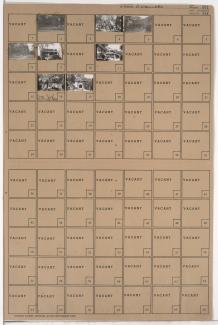
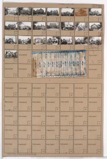
Folder contains photographs of residences in the Roanoke neighborhood, from 37th Street south to 38th Street, and Valentine Road east to Jarboe Street.
Street Names
Folder contains photographs of residences in the Roanoke neighborhood, from 37th Street south to 38th Street, and Valentine Road east to Jarboe Street.
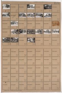
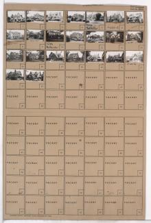
Folder contains photographs of residences in the Roanoke neighborhood, from 37th Street south to 38th Street, and Jarboe Street east to Belleview Avenue.

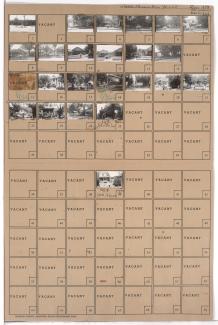
Folder contains photographs of residences and businesses in the West Plaza neighborhood, from 47th Street south to 48th Street, and Jarboe Street east to Belleview Street. Folder also includes a plat map of the block.

Folder contains photographs of residences and businesses in the West Plaza neighborhood, from 47th Street south to 48th Street, and Holly Street east to Jarboe Street. Folder also includes a plat map of the block.

Folder contains photographs of residences and businesses in the West Plaza neighborhood, from 48th Street south to Ward Parkway, and Jarboe Street east to Belleview Avenue. Folder also includes a plat map of the block.

Folder contains photographs of residences in the West Plaza neighborhood, from 48th Street south to 49th Street, and Holly Street east to Jarboe Street. Folder also includes a plat map of the block.

Folder contains photographs of residences in the Westwood neighborhood, from 49th Street south to Ward Parkway, and Holly Street east to Jarboe Street. Folder also includes a plat map of the block.
Folder contains photographs of residences, businesses, and apartment buildings in the West Plaza neighborhood, from 43rd Street/Westport Road south to 44th Street, and Jarboe Street east to Clark Avenue (later Belleview Avenue).

Folder contains photographs of residences in the West Plaza neighborhood, from 43rd Street/Westport Road south to 44th Street, and Holly Street east to Jarboe Street.

Folder contains photographs of residences and apartment buildings in the West Plaza neighborhood, from 44th Street south to 45th Street, and Holly Street east to Jarboe Street. Jarboe Place Apartments, at 4400 Jarboe, is among the buildings pictured. Folder also includes a plat map of the block.
Folder contains photographs of residences, businesses, and other buildings in the West Plaza neighborhood, from 45th Street south to 46th Street, and Jarboe Street east to Clark Avenue (later Belleview Avenue), including a section of Roanoke Parkway.
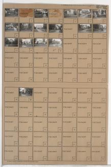
Folder includes photographs of buildings in the West Plaza neighborhood, from 46th Street south to 47th Street, and Holly Street east to Jarboe Street. E. F. Swinney School, at 1106 West 47th, is among the buildings pictured.

Folder contains photographs of residences in the West Plaza neighborhood, from 46th Street south to 47th Street, an Jarboe Street east to Clark Avenue (later Belleview Avenue), including a section of Roanoke Parkway.
Folder contains photographs of residences in the Ward Parkway neighborhood, from 72nd Street south to 73rd Street, and Ward Parkway east to Jarboe Street. Folder also includes a plat map of the block.
Folder contains photographs of residences in the Ward Parkway neighborhood, from 72nd Street south to 73rd Street, and Jarboe Street east to Belleview Avenue.

Folder contains photographs of residences in the Ward Parkway neighborhood, from 73rd Street south to 74th Street, and Ward Parkway east to Jarboe Street.

Folder contains photographs of residences in the Ward Parkway neighborhood, from 73rd Street south to 74th Street, and Jarboe Street east to Belleview Avenue.
Folder contains photographs of residences in the Westmoreland Heights neighborhood, from 74th Street south to 75th Street, and Ward Parkway east to Jarboe Street.

Folder contains photographs of residences in the Ward Parkway neighborhood, from 74th Street south to 75th Street, and Jarboe Street east to Belleview Avenue.
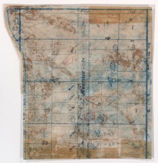
Map of block in the Ward Parkway neighborhood, from 75th Street south to 77th Street, and Jarboe Street east to Madison Avenue, containing information about tax assessment values of included properties, and illustrating lot numbers for the block. Photographs of properties on the block can be viewed below.