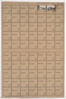
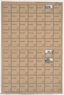
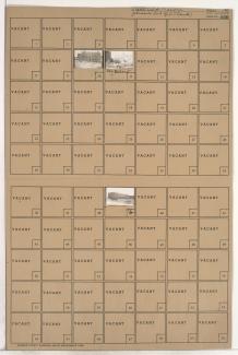
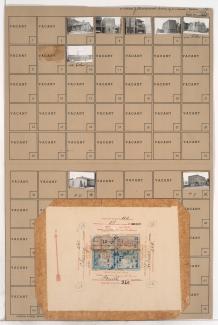
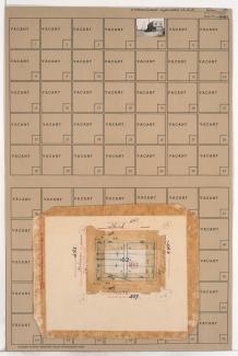
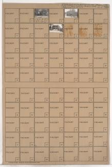
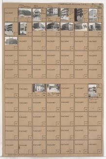
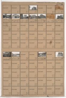
Tax Assessment Block Folder, Kansas City, MO, District 2, Block 246
Folder contains photographs of residences and buildings in the East Kansas addition, from 4th Street south to 5th Street, and Charlotte Street east to Campbell Street.
Folder contains photographs of businesses and other buildings in the Columbus Park neighborhood, from Missouri Avenue south to Independence Avenue, and Holmes Street east to Charlotte Street. Karnes School, at 550 Charlotte, and Nick's Tin Shop, at 704 Independence, are among the buildings pictured.
Folder contains photographs of residences in the East Kansas addition, from 2nd Street south to 3rd Street, and Charlotte Street east to Campbell Street.
Folder contains photographs of residences and other buildings in the East Kansas addition, from 2nd Street south to 3rd Street, and Campbell Street east to Harrison Street.
Folder contains a photograph of a building in the East Kansas addition, from 2nd Street south to 3rd Street, and Holmes Street east to Charlotte Street. A Kansas City Power and Light Company transformer station, at 205-209 Holmes, is pictured.
Folder contains photographs of industrial buildings in the Old Town addition, from 2nd Street south to 3rd Street, and Cherry Street east to Holmes Street.
Folder contains photographs of houses and other buildings in Northeast Kansas City, from 3rd Street south to 4th Street, and Cherry Street east to Holmes Street. Monark Egg Corporation, at 601-611 East 3rd, and Tutsalino Market, at 306 Holmes, are among the buildings pictured. Folder also includes plat map of the block.
Folder contains a photograph of a building in the East Kansas addition, from 3rd Street south to 4th Street, and Holmes Street east to Charlotte Avenue. Folder also contains plat map of the block.
Folder contains photographs of residences and businesses in Northeast Kansas City, from 4th Street south to 5th Street, and Troost Avenue east to Forest Avenue.
Folder contains photographs of residences and businesses in Northeast Kansas City, from 5th Street south to Pacific Street, and Forest Avenue east to Tracy Avenue. An Italian Evangelical Church, at 505-507 Forest, and Mission, at 1207 5th Street, are among the buildings pictured.
Folder contains photographs of residences and businesses in the Guinotte's Bluff addition, from 5th Street south to Missouri Avenue, and Troost Avenue east to Forest Avenue.
Folder contains photographs of residences and businesses in an area of Kansas City, from Belvidere Avenue south to Independence Avenue, and Tracy Avenue east to Lydia Avenue. Cain Memorial A.M.E. Church, at 595 Tracy, is among the buildings pictured.
Folder contains photographs of residences, businesses, and apartment buildings in an area of Northeast Kansas City, from Pacific Street south to Independence Avenue, and Forest Avenue east to Tracy Avenue. Pete's Barber Shop, at 1204 Independence, is among the buildings pictured.
Folder contains photographs of residences and businesses in the Guinotte's Bluff addition, from Belvidere Avenue south to Independence Avenue, and Troost Avenue east to Forest Avenue. Numerous businesses along Independence Avenue are pictured.
Folder contains photographs of residences and businesses in the Guinotte's Bluff addition, from Pacific Street south to Belvidere Avenue, and Troost Avenue east to Forest Avenue. The Fidelity National Bank building can be seen in the background of an image.
Folder contains photographs of residences and businesses in the East Kansas addition, from 5th Street south to Missouri Avenue, and Harrison Street east to Gillis Street.
Folder contains photographs of residences, apartment buildings, and businesses in the East Kansas addition, from 5th Street south to Missouri Avenue, and Campbell Street east to Harrison Street. Caldarello Market, at 521 Campbell, is among the buildings pictured.
Folder contains photographs of residences and businesses in the Columbus Park neighborhood, from 5th Street south to Missouri Avenue, and Gillis Street east to Troost Avenue. LaFranca's Market, at 1040 East Missouri, is among the buildings pictured.
Folder contains photographs of residences and buildings in the East Kansas addition, from 5th Street south to Missouri Avenue, and Charlotte Street east to Campbell Street. Nigro Drugstore, at 522 Campbell, and Kansas City Boiler Works, at 504-506 Campbell, are among the buildings pictured.
Folder contains photographs of residences and businesses in the East Kansas addition, from 4th Street south to 5th Street, and Holmes Street east to Charlotte Street.