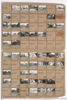
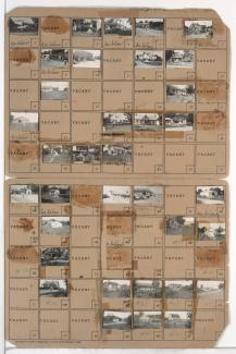
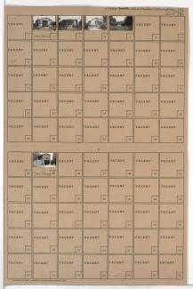
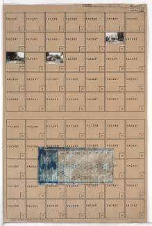
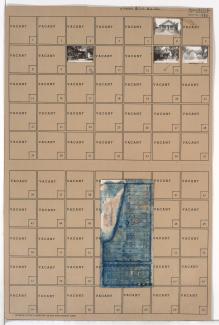
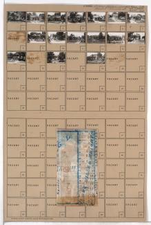
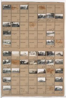
Folder contains photographs of residences, businesses, and other buildings in the Crossgates neighborhood, south of Hickman Mills Road and east of Hillcrest Road, in an area that later would fall in within the Kansas City and Grandview city limits.
Search
Folder contains photographs of residences and businesses in the Crossgates and Grandview area south of the 1940 Kansas City city limits, west of Hillcrest Road and adjacent to Martha Truman Road.
Folder contains photographs of residences, businesses, and other buildings in the Royal Oaks neighborhood, from 107th Street south to Hickman Mills Road, and Grandview Road east to Hillcrest Road.
Folder contains photographs of residences in the Mount Cleveland neighborhood, from Brush Creek south to 49th Street, and Elmwood Avenue east to Brighton and Chelsea Avenues, including sections of Lawn and Lister Avenues. Folder also includes a plat map of the block, which can be viewed below.
Map of block in the Mount Cleveland neighborhood, from Brush Creek south to 49th Street, and Elmwood Avenue east to Brighton and Chelsea Avenues, including sections of Lawn and Lister Avenues, containing information about tax assessment values of included properties, and illustrating lot numbers for the block. Photographs of properties on the block can be viewed below.
Folder contains photographs of residences and other buildings in the Mount Cleveland neighborhood, from 48th Terrace south to 49th Street, and Chelsea Avenue east to Brighton Avenue.
Folder contains photographs of residences in the Mount Cleveland neighborhood, from 49th Terrace south to Blue Ridge Road, and Jackson Avenue east to Kensington Avenue. Folder also includes a plat map of the block.
Folder contains photographs of residences and other buildings in the Mount Cleveland neighborhood, from 47th Street south to Blue Ridge Road and 49th Street, and Cleveland Avenue east to Jackson and Elmwood Avenues.
Folder contains photographs of residences in the Mount Cleveland neighborhood, from 49th Street south to 49th Terrace, and Jackson Avenue east to Kensington Avenue. Folder also includes a plat map of the block.
Folder contains photographs of residences in the Mount Cleveland neighborhood, from 49th Street south to 50th Street, and Elmwood Avenue east to Lawn Avenue. Folder also includes a plat map of the block.
Folder contains photographs of residences and businesses in the Mount Cleveland neighborhood, from 49th Street south to Blue Ridge Road, and Lawn Avenue east to Lister Avenue.
Folder contains photographs of residences, businesses, and other buildings in the Mount Cleveland neighborhood, from 49th Street south to Blue Ridge Road, and Lister Avenue east to Chelsea Avenue.
Folder contains photographs of buildings in the Mount Cleveland neighborhood, from 49th Street south to Blue Ridge Road, and Chelsea Avenue east to Brighton Avenue.
Folder contains photographs of residences and other buildings in the Mount Cleveland neighborhood, from Blue Ridge Road south to 50th Terrace, and Kensington Avenue east to Elmwood Avenue. Folder also includes a plat map of the block.
Folder contains photographs of residences and other buildings in the Mount Cleveland neighborhood, from 50th Terrace south to 51st Street, and Kensington Avenue east to Elmwood Avenue. Folder also includes a plat map of the block.
Folder contains photographs of residences in the Mount Cleveland neighborhood, from 50th Street south to 51st Street, and Elmwood Avenue east to Lawn Avenue.
Folder contains photographs of residences in the Mount Cleveland neighborhood, from Blue Ridge Road south to 50th Terrace, and Jackson Avenue east to Kensington Avenue. Folder also includes a plat map of the block.
Folder contains photographs of residences in the Mount Cleveland neighborhood, from 50th Terrace south to 51st Street, and Kensington Avenue east to Jackson Avenue. Folder also includes a plat map of the block.
Folder contains photographs of businesses in the Mount Cleveland neighborhood, from Blue Ridge Road south to 51st Street, and Cleveland Avenue east to Jackson Avenue.
Folder contains photographs of residences in the Mount Cleveland neighborhood, from 52nd Street south to 53rd Street, and Myrtle Avenue east to Norton Avenue. Folder also includes a plat map of the block.