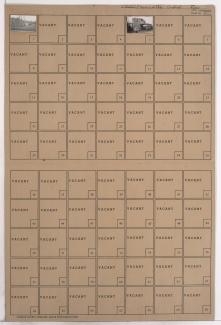
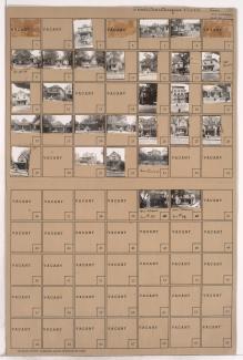
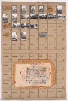
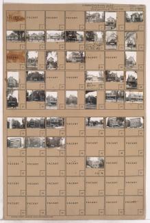
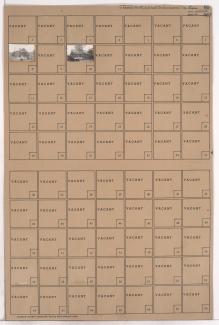
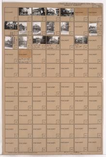
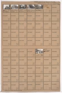
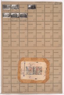
Tax Assessment Block Folder, Kansas City, MO, District 2, Block 76
Folder contains a photograph of an industrial building in the Northeast Industrial District, from Guinotte Avenue south to the rail lines, and Lexington Avenue east to Vine Street.
Folder contains photographs of an industrial building and a business in the Northeast Industrial District, from Guinotte Avenue south to the rail lines, and Lydia Avenue east to Lexington Avenue.
Folder contains photographs of residences, businesses, and a church in the Walrond Place subdivision, from Anderson Avenue south to Lexington Avenue, and Benton Boulevard east to Indiana Avenue. Assumption Roman Catholic Church, at the corner of Benton Boulevard and Lexington Avenue, is among the buildings pictured.
Folder contains photographs of residences and buildings in the Chautauqua Place addition, from Anderson Avenue south to Lexington Avenue, and Indiana Avenue east to Bales Avenue.
Folder contains photographs of Scarritt Public School, on a block that runs from Anderson Avenue south to Lexington Avenue, and Bales Avenue east to Askew Avenue.
Folder contains photographs of residences in the Chautauqua Place addition, from Anderson Avenue south to Lexington Avenue, and Askew Avenue east to Monroe Avenue.
Folder contains photographs of residences and other buildings in the Chautauqua Place addition, from Lexington Avenue south to Smart Avenue, and Askew Avenue east to Monroe Avenue. Folder also includes a plat map of the block.
Folder contains photographs of residences in the Chautauqua Place addition, from Lexington Avenue south to Smart Avenue, and Bales Avenue east to Askew Avenue. Folder also includes plat map of the block.
Folder contains photographs of residences in the Chautauqua Place addition, from Lexington Avenue south to Smart Avenue, and Indiana Avenue east to Bales Avenue.
Folder contains photographs of residences in the Walrond Place subdivision, from Lexington Avenue south to Smart Avenue, and Benton Boulevard east to Indiana Avenue.
Folder contains photographs of residences and businesses in an area of Northeast Kansas City, from Lexington Avenue south to Independence Avenue, and Chestnut Parkway east to Bellefontaine Avenue.
Folder contains photographs of residences in an area adjacent to Kessler Park, bound by Dora Avenue on the northwest, Lexington Avenue on the southwest, and the park on the east. A grain elevator can be seen in the background of one image.
Folder contains photographs of residences in the Pendleton Heights neighborhood, from Lydia Avenue northeast to Lexington Avenue, and Dora Avenue south to 2nd Street.
Folder contains photographs of residences and apartment buildings in an area of Northeast Kansas City, from 2nd Street and Lexington Avenue south to 3rd Street, and Lydia Avenue east to Highland Avenue.
Folder contains photographs of residences in the Scarritt Point neighborhood, from Lexington Avenue south to Elma Street, and Wabash Avenue east to Prospect Boulevard, including a segment of Smart Avenue.
Folder contains photographs of residences in the Pendleton Heights neighborhood, from Lexington Avenue south to Elma Street, and Olive Street and east to Wabash Avenue.
Folder contains photographs of residences and businesses in the Pendleton Heights neighborhood, from Lexington Avenue south to Minnie Street, and Park Avenue east to Olive Street.
Folder contains photographs of buildings in the Pendleton Heights neighborhood, from Lexington Avenue south to Minnie Street, and Brooklyn Avenue east to Ord Street. The Lexington Place Apartments, at Lexington and Ord, are among the buildings pictured.
Folder contains photographs of residences and businesses in the Pendleton Heights neighborhood, from Lexington Avenue south to Minnie Street, and Garfield Avenue east to Brooklyn Avenue. Among the buildings pictured are the LeGrand A. Copley residence, at 2122 Minnie, the Judge Jackson L. Smith Mansion, at 309 Garfield, and "The Chateau," also a LeGrand A. Copley residence, at 2118 Minnie. Folder also contains plat map of the block.
Folder contains photographs of residences and apartment buildings in the Pendleton Heights neighborhood, from Lexington Avenue south to Missouri Avenue, and Maple Boulevard east to Garfield Avenue. Pictured houses include the Winifred Sexton residence, at 344 Garfield. The Pearl Schultz apartment buildings, at 1915-1921 Lexington, and Mrs. Andrew J. Bonham's storefront, at 1918 Missouri Avenue, are among the other buildings pictured.