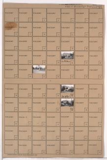
Tax Assessment Block Folder, Kansas City, MO, District 16, Block 70

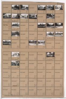
Folder contains photographs of residences in the Battleflood Heights neighborhood, from 72nd Street south to 73rd Street, and Lydia Avenue east to Flora Avenue.
Street Names
Folder contains photographs of residences in the Battleflood Heights neighborhood, from 72nd Street south to 73rd Street, and Lydia Avenue east to Flora Avenue.

Folder contains photographs of residences in the Battleflood Heights neighborhood, from Gregory Boulevard south to 72nd Street, and Woodland Avenue east to Paseo Boulevard.

Folder contains photographs of residences in the Battleflood Heights neighborhood, from Gregory Boulevard south to 72nd Street, and Lydia Avenue east to Wayne Avenue.
Folder contains photographs of residences and businesses in the Battleflood Heights neighborhood, from Gregory Boulevard south to 72nd Street, and Troost Avenue east to Tracy Avenue, including a section of Forest Avenue.

Folder contains photographs of residences in the Battleflood Heights neighborhood, from 72nd Street south to 73rd Street, and Virginia Avenue east to Lydia Avenue. Folder also includes a plat map of the block.
Folder contains photographs of residences in the Battleflood Heights neighborhood, from 72nd Street south to 73rd Street, and Wayne Avenue east to Highland Avenue.

Folder contains photographs of residences in the Battleflood Heights neighborhood, from 73rd Street south to 74th Street, and Highland Avenue east to Woodland Avenue.

Folder contains photographs of residences in the Battleflood Heights neighborhood, from 73rd Street south to 74th Street, and Tracy Avenue east to Virginia Avenue.

Folder contains photographs of residences and other buildings in the Battleflood Heights neighborhood, from 73rd Street south to 74th Street, and Forest Avenue east to Tracy Avenue.

Folder contains photographs of residences in the Battleflood Heights neighborhood, from 73rd Street south to 74th Street, and Flora Avenue east to Wayne Avenue.

Folder contains photographs of residences in the Battleflood Heights neighborhood, from 74th Street south to 75th Street, and Forest Avenue east to Tracy Avenue.
Folder contains photographs of residences and businesses in the Battleflood Heights neighborhood, from 74th Street south to 75th Street, and Troost Avenue east to Forest Avenue.
Folder contains a photograph of Marlborough School in the Battleflood Heights neighborhood, from 74th Street south to 75th Street, and Tracy Avenue east to Virginia Avenue. Marlborough School is located at 7417 Tracy.

Folder contains photographs of residences in the Battleflood Heights neighborhood, from 75th Street south to 75th Terrace, and Lydia Avenue east to Paseo Boulevard.

Folder contains photographs of residences in the Battleflood Heights neighborhood, from 76th Terrace south to 77th Street, and Lydia Avenue east to Paseo Boulevard.

Folder contains photographs of residences in the Battleflood Heights neighborhood, from 75th Terrace south to 76th Street, and Lydia Avenue east to Paseo Boulevard.

Folder contains photographs of residences in the Battleflood Heights neighborhood, from 75th Street south to 75th Terrace, and Troost Avenue east to Lydia Avenue.

Folder contains photographs of residences in the Battleflood Heights neighborhood, from 76th Street south to 76th Terrace, and Lydia Avenue east to Paseo Boulevard.

Folder contains photographs of residences in the Battleflood Heights neighborhood, from 75th Terrace south to 76th Street, and Troost Avenue east to Lydia Avenue.
Folder contains photographs of residences and businesses in the Battleflood Heights neighborhood, from 76th Street south to 76th Terrace, and Troost Avenue east to Lydia Avenue.