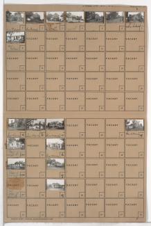
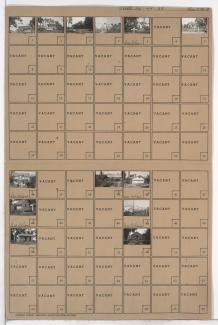
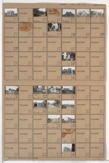
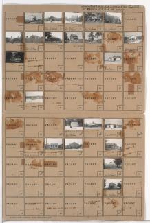
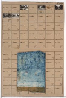
Tax Assessment Block Folder, Kansas City, MO, District 20, Block 9
Folder contains a photograph of a building in the Brown Estates neighborhood east of the 1940 Kansas City city limits, north of 63rd Street and west of Cambridge Avenue.
Folder contains photographs of residences and other buildings in the Brown Estates neighborhood, east of the 1940 Kansas City city limits, adjacent to Coal Mine Road and south of 51st Street.
Folder contains photographs of residences and other buildings in the Brown Estates neighborhood, east of the 1940 Kansas City city limits, from 51st Street south to 56th Street, and adjacent to Kling Road.
Folder contains photographs of residences and businesses in the Brown Estates neighborhood, east of the 1940 Kansas City city limits, from 52nd Street south to 56th Street, and west of Bennington Avenue.
Folder contains photographs of residences and other buildings in the Brown Estates neighborhood east of the 1940 Kansas City city limits, from 56th Street south to Byram Ford Road and west of Bennington Avenue.
Folder contains photographs of residences and other buildings in the Brown Estates neighborhood, east of the 1940 Kansas City city limits and north of 63rd Street.
Folder contains photographs of residences and other buildings in the Brown Estates neighborhood, from 56th Street south to Byram Ford Road, east of the 1940 Kansas City city limits.
Folder contains photographs of residences, businesses, and other buildings in the Brown Estates neighborhood south of the 1940 Kansas City city limits, south of 55th Street and adjacent to U.S. Highway 50 and Byram Ford Road.
Folder contains a photograph of a residence in the Brown Estates neighborhood south of the 1940 Kansas City city limits, south of 55th Street and east to Bennington Avenue. Folder also includes a plat map of the block.
Folder contains photographs of residences and businesses in the Brown Estates neighborhood, from Blue Ridge Road south to 51st Street, and Oakley Avenue east to Topping Avenue. Folder also includes a plat map of the block.
Folder contains photographs of residences in the Brown Estates neighborhood, from Blue Ridge Road south to 51st Street, and Hardesty Avenue east to Oakley Avenue.
Folder contains photographs of residences in the Brown Estates neighborhood, from Blue Ridge Road south to 51st Street, and Denver Avenue east to Hardesty Avenue. Folder also includes a plat map of the block.
Folder contains photographs of residences in the Brown Estates neighborhood, from Blue Ridge Road south to 51st Street, and Brighton Avenue east to Denver Avenue.
Folder contains a photograph of a residence in the Swope Parkway neighborhood, from 52nd Street south to 53rd Street, and Denver Avenue east to the Blue River.
Folder contains photographs of residences in the Brown Estates neighborhood, from 51st Street south to 53rd Street, and the Blue River east to Hardesty Avenue.
Folder contains photographs of residences in the Brown Estates neighborhood, from 51st Street south to 53rd Street, and Hardesty Avenue east to Oakley Avenue.
Folder contains a photograph of a residence in the Brown Estates neighborhood, from 51st Street south to 53rd Street, and Oakley Avenue east to Topping Avenue. Folder also includes a plat map of the block.
Folder contains photographs of residences in the Brown Estates neighborhood, from 53rd Street south to 55th Street, and Oakley Avenue east to Topping Avenue.
Folder contains photographs of residences in the Brown Estates neighborhood, from 53rd Street south to 55th Street, and Hardesty Avenue east to Oakley Avenue. Folder also includes a plat map of the block.
Folder contains photographs of residences in the Brown Estates neighborhood, from the Blue River east to Hardesty Avenue, and 53rd Street south to 55th Street, including a section of 54th Street.