Tax Assessment Block Folder, Kansas City, MO, District 4, Block 359
Folder contains photographs of businesses in the Union Hill neighborhood, from 27th Street south to 27th Terrace, and McGee Trafficway east to Oak Street.
Street Names
Folder contains photographs of businesses in the Union Hill neighborhood, from 27th Street south to 27th Terrace, and McGee Trafficway east to Oak Street.

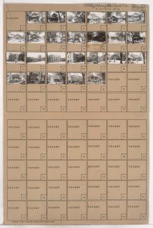
Second of two folders containing photographs of residences, businesses, and other buildings in the Union Hill neighborhood, adjacent to the Union Cemetery.

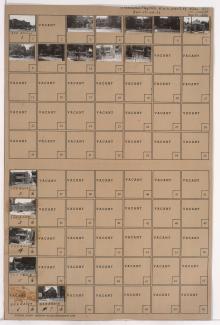
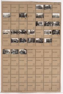
First of two folders containing photographs of residences, businesses, and other buildings in the Union Hill neighborhood, adjacent to the Union Hill Cemetery. Richardson Trailer Company is among the buildings pictured.

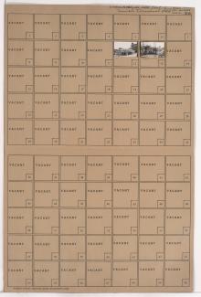
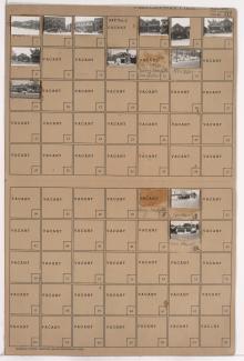
Folder contains photographs of businesses in the Union Hill neighborhood, from 27th Street south to Warwick Trafficway, and Grand Avenue east to Warwick Trafficway. Paranite Wire and Cable Corporation, at 121 East 27th, and Monark Motor Freight System, at 2716 Warwick, are among the buildings pictured.

Folder contains photographs of businesses in the Union Hill neighborhood, from 27th Street south to 28th Street, and Main Street east to Walnut Street and Warwick Trafficway.

Folder contains photographs of businesses in the Union Hill neighborhood, from 28th Street south to 29th Street, and Main Street east to Warwick Trafficway.

Folder contains photographs of residences in the Independence Plaza neighborhood, from 13th Street south to 14th Street, and Brooklyn Avenue east to Park Avenue.

Folder contains photographs of residences in the South Indian Mound neighborhood, from St. John Avenue south to Anderson Avenue, and Lawn Avenue east to Van Brunt Boulevard.
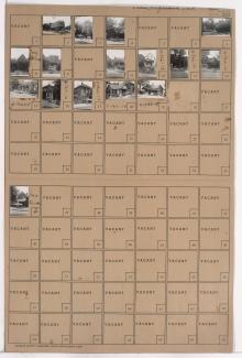
Folder contains photographs of residences, businesses, and apartment buildings in the Union Hill neighborhood, from an area of Penn Valley Park south to 28th and 29th Streets, and Wyandotte Street and Baltimore Avenue east to Main Street. St. Mary's Hospital, at 2812 Main, is among the buildings pictured.

Folder contains photographs of residences and other buildings in the Union Hill neighborhood, from 28th Street south to 29th Street, and Wyandotte Street east to Baltimore Avenue. The St. Mary's Hospital Nurses Home, at 2840 Baltimore, and the Bruce Dodson Insurance Company, at 2800 Wyandotte, are among the buildings pictured. Folder also contains plat map of the block.
Folder contains photographs of residences and other buildings adjacent to Penn Valley Park, from Penn Valley Place south to 30th Street, and Summit Street east to Penn Valley Place.
Folder contains photographs of residences and apartment buildings adjacent to Penn Valley Park, from 29th Street south to 30th Street, and Wyandotte Avenue east to Baltimore Avenue.
Folder contains photographs of residences, businesses, and apartment buildings adjacent to Penn Valley Park, from 29th Street south to 30th Street, and Baltimore Avenue east to Main Street.

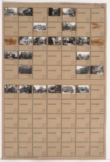
Folder contains photographs of residences, businesses, and apartment buildings in the Union Hill neighborhood, from 29th Street south to 30th Street, and Main Street east to Walnut Street. The Willows Maternity Hospital, at 2929 Main, is among the buildings pictured.

Folder contains photographs of residences in the Union Hill neighborhood, from 29th Street south to 30th Street, and Walnut Street east to Grand Avenue.

Folder contains photographs of residences in the Union Hill neighborhood, from 30th Street south to 31st Street, and McGee Street east to DeGroff Way.

Folder contains photographs of residences and apartment buildings in the Union Hill neighborhood, from 30th Street south to 31st Street, and Grand Avenue east to McGee Street.
Folder contains photographs of residences, businesses, and other buildings in the Longfellow neighborhood, from 29th Street south to McGee Street Trafficway, and Gillham Road east to Cherry Street. Greenlease Used Cars is among the buildings pictured.
Folder contains photographs of residences, businesses, and a church in the South Indian Mound neighborhood, from St. John Avenue south to Budd Park Esplanade, and Chelsea Avenue east to Brighton Avenue. The Budd Park Christian Church, at 4925 St. John Avenue, is among the buildings pictured.

Folder contains photographs of residences and other buildings in the Union Hill neighborhood, from 30th Street south to 31st Street, and Walnut Street east to Grand Avenue. The Third Prebysterian Church, at 3027 Walnut, is among the buildings pictured.