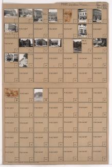
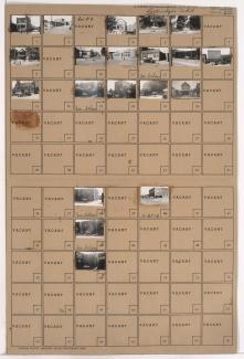
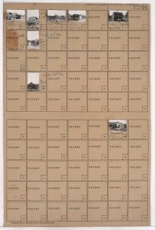
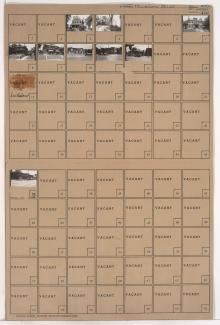
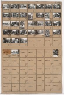
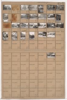
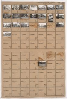
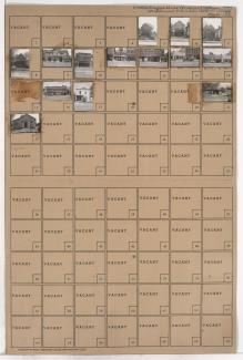
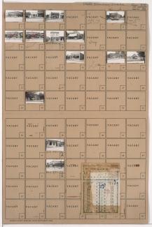
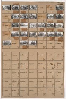
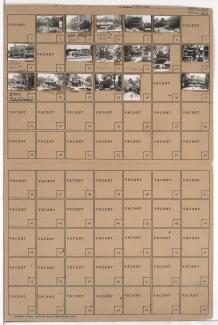
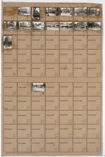
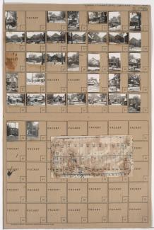
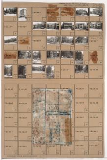
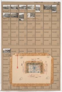
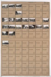
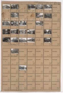
Folder contains photographs of residences, businesses, and other buildings in the Parkview neighborhood, from 12th Street south to 13th Street, and Vine Street east to Highland Avenue. Church of God in Christ, at 1212 Highland, and Cosner Market, at 1601 East 12th, are among the buildings pictured.
Search
Folder contains photographs of residences, businesses, and other buildings in the Dundee Place addition, from 12th Street south to 13th Street, and Harrison Street east to Troost Avenue. Franklin Ice Cream Company, at 1207 Locust, is among the buildings pictured.
Folder contains photographs of residences, businesses, and other images in the Downtown East neighborhood, from 17th Street south to 18th Street, and Forest Avenue east to Tracy Avenue. Southwest Ornamental Iron Company, at 1722 Tracy, and Amber Produce, at 1208 East 18th, are among the buildings
Folder contains photographs of residences and businesses in the Wendell Phillips neighborhood, from 22nd Terrace south to 23rd Street, and Flora Avenue east to Vine Street.
Folder contains photographs of residences, businesses, and other buildings in the Beacon Hill neighborhood, from 26th Street south to 27th Street, and Troost Avenue east to Forest Avenue.
Folder contains photographs of residences, businesses, and other buildings in the 30th Street south to 31st Street, and Garfield Avenue east to Brooklyn Avenue.
Folder contains photographs of residences and businesses in the 18th and Vine District, from 17th Street south to 18th Street, and Prospect Avenue east to Montgall Avenue.
Folder contains photographs of residences, businesses, and other buildings in the 18th and Vine District, from 14th Street south to 15th Street (later Truman Road), and Prospect Avenue east to Montgall Avenue. State Theater, at 1431 Prospect, is among the buildings pictured.
Folder contains photographs of residences, businesses, and other buildings in the East Community Team neighborhoods, from 14th Street south to 15th Street (Truman Road), and Jackson Avenue east to Spruce Avenue.
Folder contains photographs of businesses and other buildings in the East Blue Valley neighborhood, from 15th Street (later Truman Road) south to 16th Street, and Corrington Avenue east to Crystal Avenue. Milgram Grocery Store, at 7217 East 15th, and W. A. Turley Sheet Metal Works, at 1524 Crystal, are among the buildings pictured.
Folder contains photographs of residences and businesses in the East Community Team neighborhood, from 26th Street south to 27th Street, and Lawn Avenue east to Lister Avenue. Tipton's Pharmacy, at 4727 East 27th,
Folder contains photographs of residences and businesses in the East Community Team neighborhood, from 23rd Street south to 24th Street, and Lister Avenue east to Chelsea Avenue. The 24th Street Tavern, at 4820 East 24th, and Snappy Tire and Battery Shop, at 4810 East 24th, are among the buildings pictured. Folder also includes a plat map of the block.
Folder contains photographs of residences, businesses, and apartment buildings in the Old Hyde Park neighborhood, from 37th Street south to 38th Street, and Baltimore Avenue east to Main Street. The Goodenow Textile Company, at 3710 Main, and Kitty Clover Potato Chips, at 3716 Main, are among the buildings pictured.
Folder contains photographs of residences, businesses, and other buildings in the Squier Park neighborhood, from Armour Boulevard south to 36th Street, and Troost Avenue east to Forest Avenue. Cavalier Apartment Hotel, at 1105-1113 Armour, Lee Yuen Laundry, at 3535 Troost, are among the buildings pictured.
Folder contains photographs of residences and businesses in the Manheim Park neighborhood, from 41st Street south to 42nd Street, and Troost Avenue east to Forest Avenue. The Man Who Dyes for a Living, at 4109 Troost, is among the buildings pictured. Troost Recreation, at 4103 Troost, and Reynold's Cafe, at 4107 1/2 Troost, are among the buildings pictured. Folder also includes a plat map of the block.
Folder contains photographs of residences, businesses, and apartment buildings in the North Hyde Park neighborhood, from Linwood Boulevard south to 33rd Street, and Harrison Street east to Troost Avenue, including sections of 32rd Terrace and Cherry Lane. The Carlton Hotel, at 1007-1009 East Linwood, and the Blue Bird Cafeteria, at 3210 Troost, are among the buildings pictured. Folder also includes a plat map of the block.
Folder contains photographs of businesses and other buildings in the Old Town addition, from 3rd Street south to 4th Street, and Walnut Street east to Grand Avenue. DeMaria-Janssen, Inc., bottling company, at 306-310 Grand, and Harmony Lunch, at 124 East 4th, are among the buildings pictured. Folder also contains plat map of the block.
Folder contains photographs of residences in the Foxtown East neighborhood, from 67th Street south to 67th Terrace, and Cleveland Avenue east to Myrtle Avenue.
Folder contains photographs of businesses in the River Market neighborhood, from 5th Street south to Missouri Avenue, and Walnut Street east to Grand Avenue. Planters Seed Company, at 513 Walnut, the Harden Seed Company, at 507 Walnut, and Hickman Brothers Distributors, at 525-527 Walnut, are among the businesses pictured.
Folder contains photographs of businesses and other buildings in the McDaniels addition, from Independence Avenue south to 6th Street Trafficway, and Walnut Street east to Grand Avenue. The Sterling Hotel and Capitol Hotel, on Walnut Street, are among the buildings pictured.