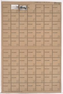
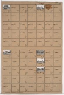
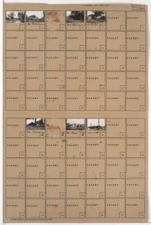
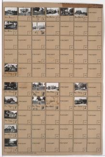
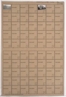
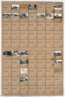
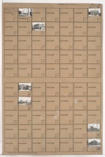
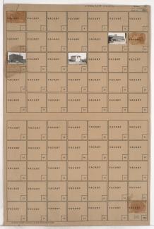
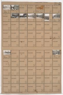
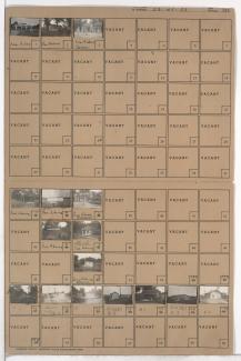
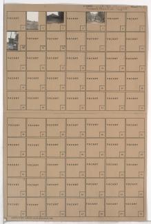
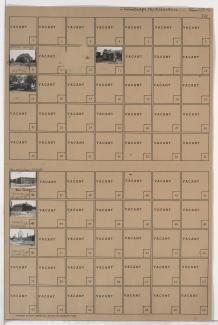
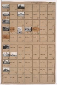
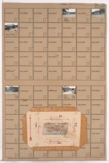
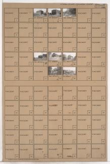
Tax Assessment Block Folder, Kansas City, MO, District 5, Block 176
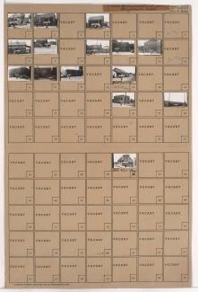
Folder contains photographs of businesses and other buildings in the Wendell Phillips neighborhood, from 18th Street south to 20th Street, and Olive Street east to Prospect Avenue.
Folder contains photographs of buildings in the Lykins neighborhood, from 14th Street south to 15th Street (later Truman Road), and Askew Avenue east to Cleveland Avenue.
Folder contains photographs of buildings in the Lykins neighborhood, from 9th Street south to 12th Street, and Van Brunt Boulevard east to Brighton Avenue.
Folder contains photographs of businesses and industrial buildings in the Northeast Industrial District, from Nicholson Avenue south to June Avenue, and containing Cleveland Avenue, and an adjacent area from Cleveland Avenue west to a line contiguous with Monroe Avenue.
Folder contains photographs of residences and other buildings in the Leeds neighborhood, from 31st Street south to 35th Street, and from the Blue River and Bennington Avenue east to the Kansas City city limits.
Folder contains photographs of residences, businesses, and other buildings in the Leeds neighborhood, from 35th Street south to 37th Street, and Bennington Avenue east to the Kansas City city limits.
Folder contains photographs of an industrial building and a business in the Northeast Industrial District, from Guinotte Avenue south to the rail lines, and Lydia Avenue east to Lexington Avenue.
Folder contains photographs of residences and businesses in the East Kansas City addition, bounded on the north by Front Street, Topping Avenue on the west, and containing the Missouri Pacific and Kansas City Southern rail lines. A Kansas City Southern Railway grain elevator is among the buildings pictured.
Folder contains photographs of businesses and industrial buildings in the Old Town addition, from Front Street south to 2nd Street, and Walnut Street east to Grand Avenue, including a section of Pine Avenue. Spencer Produce Company, at 128-132 Grand, Stewart Sand and Materials Company, at 100-120 East 2nd Street, and Michael-Swanson-Brady Produce Company, at 113-115 Walnut, are among the buildings pictured.
Folder contains photographs of businesses and other buildings in the Old Town addition, from Front Street south to 2nd Street, and Main Street east to Walnut Street. The Kansas City Southern Railroad office, at 2nd and Main, is among the buildings pictured. The A.S.B. Bridge can seen in the background of an image.
Folder contains photographs of businesses and other buildings in the River Market neighborhood, from Elm Street south to 3rd Street, and Wyandotte Avenue east to Delaware Avenue. M. Lyon and Company, at 102 West 3rd, and the Standard Seed Company, at 120 East 3rd, are among the buildings pictured. Folder also includes plat map of the block.
Folder contains photographs of businesses and other buildings in the Old Town addition, from 2nd Street south to 3rd Street, and Main Street east to Walnut Street. Townley Metal and Hardware Company, at 200 Walnut Street, Maguire Urban Commission Company, at 2 East 3rd, and Mallin Produce Company, at 100 East 3rd, are among the buildings pictured.
Folder contains photographs of businesses and other buildings in the Old Town addition, from 2nd Street south to 3rd Street, and Oak Street east to Cherry Street, bisected by Locust Street. The United States Cold Storage building, at 500 East 3rd Street, General Machine Works, at 209 Oak, and the Royal Crown Cola Company, at 3rd and Cherry, are among the buildings pictured.
Folder contains photographs of residences, businesses, and other buildings in the Dodson neighborhood, from the 1940 Kansas City city limits south to 85th Street, and west of Indiana Avenue.
Folder contains photographs of residences and other buildings in the Mount Cleveland neighborhood, from 48th Terrace south to 49th Street, and Chelsea Avenue east to Brighton Avenue.
Folder contains photographs of residences and other buildings in the Marlborough East neighborhood, from the 1940 Kansas City city limits south to 83rd Street and west of the Blue River.
Folder contains photographs of residences and other buildings in the Swope Parkway neighborhood, from 57th Street and the Blue River south to 58th and 59th Streets, and Elmwood and Lister Avenues east to Brighton Avenue and the Blue River.
Folder contains photographs of industrial buildings in an area of Northeast Kansas City between the Missouri River and the rail lines, 1st Street, and Front Street, and spanning from the Hannibal Bridge to the A.S.B. Bridge, which can be seen in the background of one of the images.
Folder contains photographs of businesses in an area of Northeast Kansas City, from Front Street south to Guinotte Avenue, and Tracy Avenue east to Lydia Avenue. The A.S.B. Bridge can be seen in the background of one of the images. Folder also includes plat map of the block.
Folder contains photographs of residences and other buildings in the East Kansas addition, from 1st Street south to 2nd Street, and Holmes Street east to Charlotte Street.