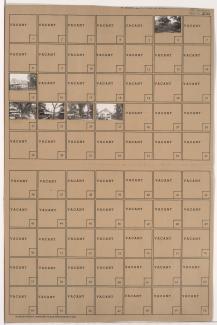
Tax Assessment Block Folder, Kansas City, MO, District 8, Block 132
Folder contains photographs of residences in the Knoches Park neighborhood, from 30th Street south to 31st Street and Linwood Boulevard, and Brighton Avenue east to Quincy Avenue.
Folder contains a photograph of a residence in the Knoches Park neighborhood, from 30th Street south to Linwood Boulevard, and Quincy Avenue east to Denver Avenue. Folder also includes a plat map of the block.
Folder contains photographs of residences in the Knoches Park neighborhood, from 30th Street south to Linwood Boulevard, and Denver Avenue east to Colorado Avenue. Folder also includes a plat map of the block.
Folder contains photographs of residences and businesses in the Knoches Park neighborhood, from 29th Street south to Linwood Boulevard, and Colorado Avenue east to Van Brunt Boulevard. Folder also includes a plat map of the block.
Folder contains photographs of residences in the Knoches Park neighborhood, from Linwood Boulevard south to 33rd Street, and Cypress Avenue east to Elmwood Avenue. Folder also includes a plat map of the block.
Folder contains photographs of residences in the Boulevard Village neighborhood, from Linwood Boulevard south to 33rd Street, and Lister Avenue east to Chelsea Avenue. Folder also includes a plat map of the block.
Folder contains photographs of residences in the Boulevard Village neighborhood, from Linwood Boulevard south to 33rd Street, and Poplar Avenue east to Brighton Avenue.
Folder contains photographs of residences in the Knoches Park neighborhood, from Linwood Boulevard south to 33rd Street, and Elmwood Avenue east to Lister Avenue. Folder also includes a plat map of the block.
Folder contains photographs of residences in the Knoches Park neighborhood, from Linwood Boulevard south to 33rd Street, and Kensington Avenue east to Cypress Avenue.
Folder contains photographs of residences in the Knoches Park neighborhood, from 31st Street south to Linwood Boulevard, and Lister Avenue east to Chelsea Avenue. Folder also includes a plat map of the block.
Folder contains a photograph of a residence in the Knoches Park neighborhood, from Linwood Boulevard north to 31st Street and west to Poplar Avenue. Folder also includes a plat map of the block.
Folder contains photographs of residences in the Knoches Park neighborhood, from 31st Street south to Linwood Boulevard, and Elmwood Avenue east to Lister Avenue. Folder also includes a plat map of the block.
Folder contains photographs of residences and other buildings in the Knoches Park neighborhood, from 31st Street south to Linwood Boulevard, and Kensington Avenue east to Cypress Avenue. Folder also includes a plat map of the block.
Folder contains photographs of residences in the Knoches Park neighborhood, from 31st Street south to Linwood Boulevard, and Spruce Avenue east to Kensington Avenue. Folder also includes a plat map of the block.
Folder contains a photograph of the Milton Moore School in the Knoches Park neighborhood, from 31st Street south to Linwood Boulevard, and Cypress Avenue east to Elmwood Avenue. Folder also includes a plat map of the block.
Folder contains photographs of residences, businesses, and other buildings in the Knoches Park neighborhood, from 31st Street south to Linwood Boulevard, and Jackson Avenue east to Spruce Avenue. Jay Bird Tavern, at 31st and Jackson, is among the buildings pictured. Folder also includes a plat map of the park.
Folder contains photographs of residences and apartment buildings in the Knoches Park neighborhood, from Linwood Boulevard south to 33rd Street, and Jackson Avenue east to Spruce Avenue. Folder also includes a plat map of the block.
Folder contains photographs of residences in the Knoches Park neighborhood, from Linwood Boulevard south to 33rd Street, and Spruce Avenue east to Kensington Avenue. Folder also includes a plat map of the block.
Folder contains photographs of residences in the Palestine East neighborhood, from Linwood Boulevard south to 33rd Street, and Cleveland Avenue east to Mersington Avenue. Folder also includes a plat map of the block.
Folder contains photographs of residences in the Ingleside neighborhood, from 31st Street south to Linwood Boulevard, and Norton Avenue east to Jackson Avenue. Folder also includes a plat map of the block.