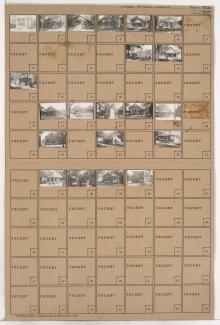
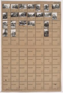
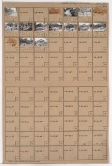
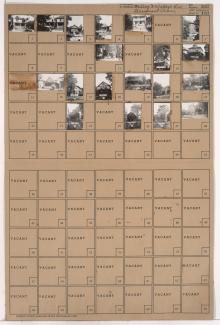
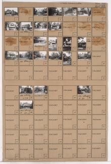
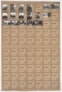
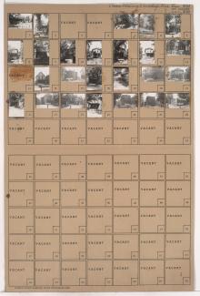
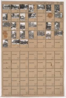
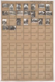
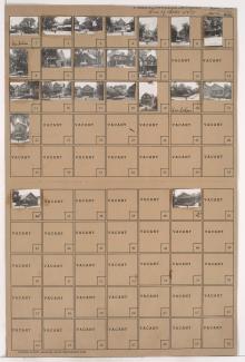
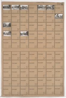
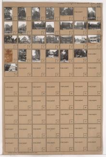
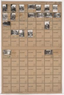
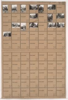
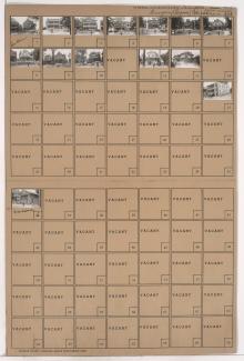
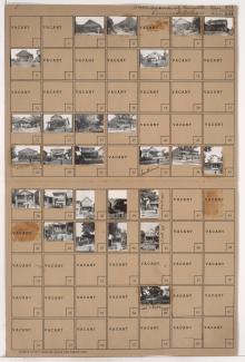
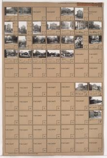
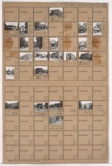
Tax Assessment Block Folder, Kansas City, MO, District 1, Block 128
Folder contains photographs of residences in the Cliff Drive Park subdivision, from Sunrise Drive south to Norledge Place, and Kensington Avenue east to Elmwood Avenue.
Folder contains photographs of residences and apartment buildings in the North Indian Mound neighborhood, from Norledge Place south to Scarritt Avenue, and Wheeling Avenue east to Belmont Boulevard.
Folder contains photographs of residences in the Wendell Phillips neighborhood, from 21st Street south to 22nd Street, and Highland Avenue east to Woodland Avenue.
Folder contains photographs of residences and other buildings in the Wendell Phillips neighborhood, from 21st Street south to 22nd Street, and Woodland Avenue east to Euclid Avenue. Lincoln School, at 21st and Woodland, is among the buildings pictured.
Folder contains a photograph of Ruppert Stadium (later Municipal Stadium) in the Wendell Phillips neighborhood, from 21st Street south to 22nd Street, and Euclid Avenue east to Brooklyn Avenue.
Folder contains photographs of residences and apartment buildings in the Wendell Phillips neighborhood, from 20th Street south to 21st Street, and Brooklyn Avenue east to Park Avenue.
Folder contains photographs of residences and apartment buildings adjacent to Spring Valley Park, from 27th Street south to 29th Street, and Woodland Avenue east to Garfield and Brooklyn Avenues, including sections of 28th Street and Michigan and Euclid Avenues.
Folder contains photographs of residences and apartment buildings in the Wendell Phillips neighborhood, from 21st Street south to 22nd Street, and Brooklyn Avenue east to Park Avenue.
Folder contains photographs of residences and apartment buildings in the Wendell Phillips neighborhood, from 20th Street south to 21st Street, and Park Avenue east to Olive Street.
Folder contains photographs of residences and other buildings in the Wendell Phillips neighborhood, from 20th Street south to 21st Street, and Olive Street east to Wabash Avenue.
Folder contains photographs of residences and apartment buildings in the Wendell Phillips neighborhood, from 21st Street south to 22nd Street, and Olive Street east to Wabash Avenue.
Folder contains photographs of residences and businesses in the Wendell Phillips neighborhood, from 21st Street south to 22nd Street, and Wabash Avenue east to Prospect Avenue. Ward's Chapel of A.M.E. Church, at 22nd and Prospect, is among the buildings pictured.
Folder contains photographs of residences in the Cliff Drive Park subdivision, from Sunrise Drive south to Norledge Place, and Jackson Avenue east to Kensington Avenue, and including a section of Cliff Drive Place.
Folder contains photographs of residences and apartment buildings in the Wendell Phillips neighborhood, from 22nd Street south to 23rd Street, and Olive Street east to Wabash Avenue.
Foulder contains photographs of residences and other buildings in the Wendell Phillips neighborhood, from 22nd Street south to 23rd Street, and Park Avenue east to Olive Street. Carson Barbecue, at 2308 East 23rd, is among the buildings pictured.
Folder contains photographs of residences and other buildings in the Wendell Phillips neighborhood, from 22nd Street south to 23rd Street, and Brooklyn Avenue east to Park Avenue.
Folder contains photographs of residences and apartment buildings in the Wendell Phillips neighborhood, from 22nd Street south to 23rd Street, and Garfield Avenue east to Brooklyn Avenue.
Folder contains photographs of residences and apartment buildings in the Wendell Phillips neighborhood, from 22nd Street south to 23rd Street, and Michigan Avenue east to Garfield Avenue.
Folder contains photographs of residences and apartment buildings in the Wendell Phillips neighborhood, from 22nd Street south to 23rd Street, and Woodland Avenue east to Michigan Avenue.
Folder contains photographs of residences, businesses, and other buildings in the Wendell Phillips neighborhood, from 22nd Street south to 22nd Terrace, and Vine Street east to Woodland Avenue.