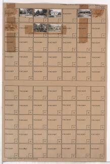
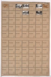
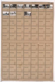
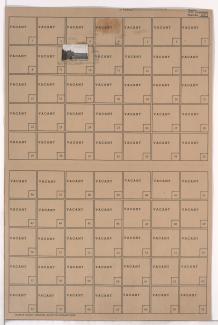
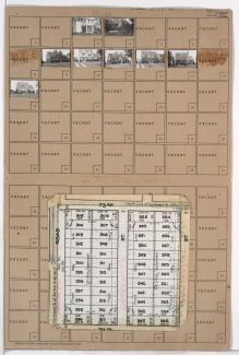
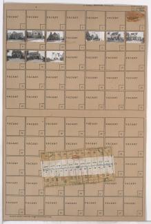
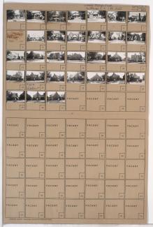
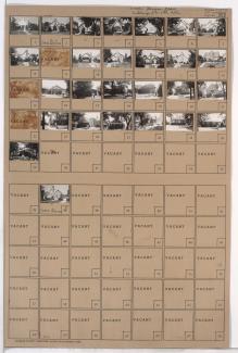
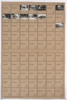
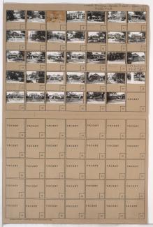
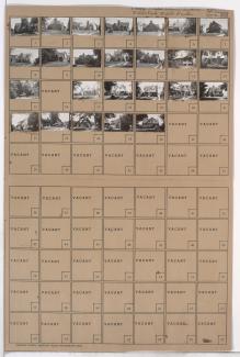
Tax Assessment Block Folder, Kansas City, MO, District 16, Block 88
Folder contains photographs of residences in the Battleflood Heights neighborhood, from 73rd Street south to 74th Street, and Highland Avenue east to Woodland Avenue.
Folder contains photographs of residences in the Walnut Grove neighborhood, from 73rd Street south to 74th Street, and Wabash Avenue east to Prospect Avenue.
Folder contains photographs of residences in the Walnut Grove neighborhood, from 73rd Street south to 74th Street, and Olive Street east to Wabash Avenue.
Folder contains photographs of residences and other buildings in the Walnut Grove neighborhood, from 73rd Street south to 74th Street, and Park Avenue east to Olive Street.
Folder contains photographs of residences in the Walnut Grove neighborhood, from 73rd Street south to 74th Street, and Arleta Boulevard east to Euclid Avenue.
Folder contains photographs of residences in the Walnut Grove neighborhood, from 73rd Street south to 74th Street, and Brooklyn Avenue east to Park Avenue.
Folder contains photographs of residences in the Battleflood Heights neighborhood, from 73rd Street south to 74th Street, and Tracy Avenue east to Virginia Avenue.
Folder contains photographs of residences and other buildings in the Battleflood Heights neighborhood, from 73rd Street south to 74th Street, and Forest Avenue east to Tracy Avenue.
Folder contains photographs of residences in the Battleflood Heights neighborhood, from 73rd Street south to 74th Street, and Flora Avenue east to Wayne Avenue.
Folder contains photographs of residences in the Battleflood Heights neighborhood, from 74th Street south to 75th Street, and Forest Avenue east to Tracy Avenue.
Folder contains photographs of residences and businesses in the Battleflood Heights neighborhood, from 74th Street south to 75th Street, and Troost Avenue east to Forest Avenue.
Folder contains a photograph of Marlborough School in the Battleflood Heights neighborhood, from 74th Street south to 75th Street, and Tracy Avenue east to Virginia Avenue. Marlborough School is located at 7417 Tracy.
Folder contains photographs of residences in the Walnut Grove neighborhood, from Euclid Avenue north to 74th Street and east to Brooklyn Avenue.
Folder contains photographs of residences in the Tower Homes neighborhood, from 73rd Street south to 75th Street, and Holmes Road east to Troost Avenue, including sections of 73rd Terrace, 74th Street, Campbell Street, and Harrison Street. Folder also includes a plat map of the block.
Folder contains photographs of residences in the Rockhill Gardens neighborhood, from 74th Street south to 74th Terrace, and Cherry Street east to Holmes Road. Folder also includes a plat map of the block.
Folder contains photographs of residences in the Tower Homes neighborhood, from 73rd Street south to 74th Street, and Walnut Street east to Grand Avenue.
Folder contains photographs of residences in the Tower Homes neighborhood, from 73rd Street south to 74th Street, and Main Street east to Walnut Street.
Folder contains photographs of residences and businesses in the Tower Homes neighborhood, from 73rd Terrace south to 74th Street, and Wornall Road east to Wyandotte Street. Anchor Awning Manufacturing Company, at 230 West 74th, is among the buildings pictured.
Folder contains photographs of residences in the Tower Homes neighborhood, from 73rd Terrace south to 74th Street, and Wyandotte Street east to Main Street.
Folder contains photographs of residences in the Tower Homes neighborhood, from 73rd Terrace south to 74th Street, and Grand Avenue east to Oak Street.