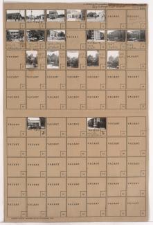
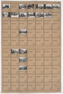
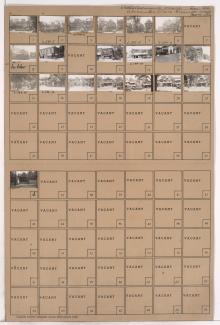
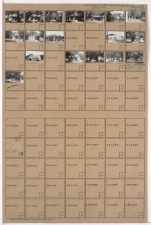
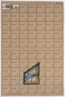
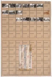
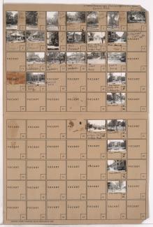
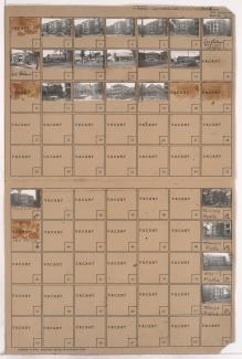
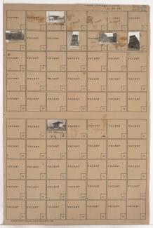
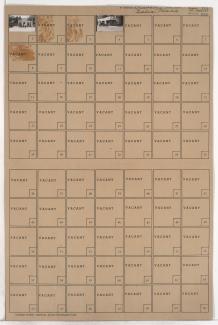
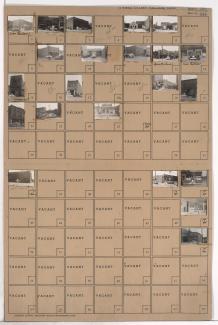
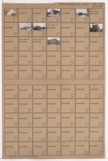
Tax Assessment Block Folder, Kansas City, MO, District 4, Block 136
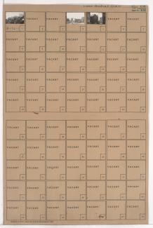
Folder contains photographs of residences and businesses in the Central Place subdivision, from 14th Street south to 14th Terrace, and Oak Street east to Locust Street.
Folder contains photographs of residences, businesses, and other buildings in the Downtown East neighborhood, from 15th Street (later Truman Road) south to 16th Street, and Lydia Avenue east to Paseo Boulevard. The Fountain View Apartments, at 1512-1514 Paseo, Doehler Funeral Home, at 1415 East 15th, and the De LaSalle Academy school, at 16th and Paseo, are among the buildings pictured.
Folder contains photographs of residences, businesses, and other buildings in the Beacon Hill neighborhood, from 27th Street south to 28th Street, and Troost Avenue east to Forest Avenue. The Carrol Theater, at 2711 Troost, and the Spanish Court Apartments, also on Troost, are among the buildings pictured.
Folder contains photographs of residences and businesses in the Lykins neighborhood, from 14th Street south to 15th Street (later Truman Road), and Benton Boulevard east to College Avenue. DeTar Motor Company, at 3206-3208 East 15th, is among the buildings pictured.
Folder contains photographs of residences and businesses in the Independence Plaza neighborhood, from Independence Avenue south to 6th Street, and Chestnut Avenue east to Gladstone Boulevard. Independence Avenue Bicycle Shop, advertising bike rental, at 2813 Independence Avenue, is among the buildings pictured.
Folder contains photographs of residences and other buildings in the West Blue Valley neighborhood, from 12th Street south to 15th Street (later Truman Road), and Van Brunt Boulevard east to Denver Avenue.
Folder contains photographs of residences, businesses, and other buildings in the East Community Team neighborhood, from 15th Street (later Truman Road) south to 16th Street, and Cypress Avenue east to Elmwood Avenue. Missouri Monument Company, at 4509 East 15th, and Sheridan Cabinet Company, at 1513 Cypress, are among the buildings pictured.
Folder contains a photograph of a of a Standard Oil service station in the Lykins neighborhood, from Winner Road north to Independence Avenue and west to White Avenue.
Folder contains photographs of residences and businesses in the Leeds neighborhood, from 36th Street south to 37th Street, and Beacon Avenue east to Fremont Avenue.
Folder contains photographs of buildings in the Westport neighborhood, from Westport Road south to 40th Street, and Baltimore Avenue east to Main Street. Katz Drugstore, at Westport and Main, is among the buildings pictured. Folder also includes a plat map of the block.
Folder contains photographs of residences, businesses, and apartment buildings in the Country Club Plaza neighborhood, from 46th Street south to 47th Street, and Madison Avenue east to Summit Street.
Folder contains photographs of residences and businesses in the Old Town addition, from 4th Street south to 5th Street, and Locust Street east to Cherry Street. Johnnie's Place, at 510 E. 5th, and a L. L. Coryell & Sons gas station, at 502 E. 5th, are among the buildings pictured. A billboard for Folger's Coffee can be seen in one of the images.
Folder contains photographs of residences and businesses in the Pendleton Heights neighborhood, from Amie Street south to Independence Avenue, and Wabash Avenue east to Prospect Boulevard. The Dora Beals residence, at 538 Prospect, a Parkview Drugstore, at Independence and Prospect, and the Stonewall Court Apartments, at Wabash and Independence, are among the buildings pictured.
Folder contains photographs of residences, apartment buildings, and businesses in the Pendleton Heights neighborhood, from Brownell Avenue south to Independence Avenue, and Woodland Avenue east to Maple Boulevard. The Colonial Court Apartments are among the buildings pictured. Folder also contains plat map of the block, which can be viewed below.
Folder contains photographs of businesses and other buildings in the Cottage Place addition, from 5th Street south to 6th Street Trafficway, and Bluff Street (later Beardsley Road) east to Pennsylvania Avenue.
Folder contains photographs of businesses in the Quality Hill neighborhood, from 13th Street south to 14th Street Trafficway, and Washington Street east to Broadway Boulevard.
Folder contains photographs of businesses and other buildings in the West Bottoms district, from 9th Street south to St. Louis Avenue, and Hickory Street east to Mulberry Street. Gifford's Cafe, at 1314 St. Louis, is among the buildings pictured. The building that was once home to Jim Pendergast's Climax Saloon, at 1320 St. Louis, is among the buildings pictured.
Folder contains photographs of businesses in the West Bottoms district, from 12th Street south to 13th Street, and Liberty Street east to Hickory Street.
Folder contains photographs of residences and businesses in the West Side neighborhood, from 30th Street south to 31st Street, and Belleview Street east to Summit Street.
Folder contains photographs of businesses and other buildings in the McDaniels addition, from Independence Avenue south to 6th Street Trafficway, and Grand Avenue east to McGee Street. Commercial Candy Company is among the buildings pictured.