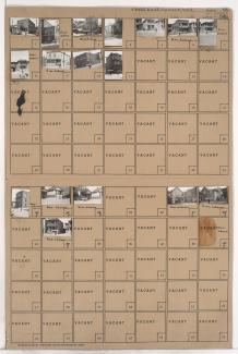
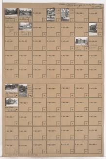
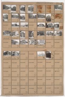
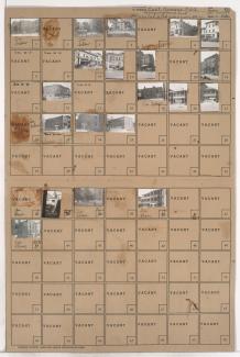
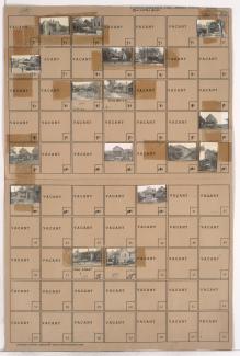
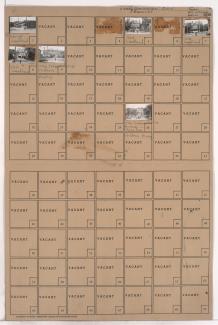
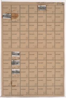
Folder contains photographs of residences and businesses in Northeast Kansas City, from 5th Street south to Pacific Street, and Forest Avenue east to Tracy Avenue. An Italian Evangelical Church, at 505-507 Forest, and Mission, at 1207 5th Street, are among the buildings pictured.
Search
Folder contains photographs of residences, businesses, and apartment buildings in an area of Northeast Kansas City, from Pacific Street south to Independence Avenue, and Forest Avenue east to Tracy Avenue. Pete's Barber Shop, at 1204 Independence, is among the buildings pictured.
Folder contains photographs of residences and businesses in the Guinotte's Bluff addition, from Pacific Street south to Belvidere Avenue, and Troost Avenue east to Forest Avenue. The Fidelity National Bank building can be seen in the background of an image.
Folder contains photographs of residences and businesses in the East Kansas addition, from Missouri Avenue south to Pacific Street, and Charlotte Street east to Campbell Street. Lapetina Brothers Funeral Home, at 536-538 Campbell, is among the buildings pictured. The Fidelity National Building can be seen in the background of one image.
Folder contains photographs of residences and businesses in the East Kansas addition, from Missouri Avenue south to Pacific Street, and Gillis Street east to Troost Avenue. Nuccio Plumbing and Heating Company, at 1025 East Missouri, and Morano Barber Shop, at 547 Gillis, are among the buildings pictured.
Folder contains photographs of residences and businesses in the Columbus Park neighborhood, from Missouri Avenue south to Pacific Street, and Troost Avenue east to Forest Avenue.
Folder contains photographs of residences, businesses, and other buildings in the East Kansas addition, from Missouri Avenue south to Pacific Street, and Campbell Street east to Harrison Street. The Holy Rosary Catholic Church and School, at Campbell and Missouri, and Calcara Market, at 522 Harrison, are among the buildings pictured.
Folder contains photographs of residences and businesses in the Ryan's & Scott's addition, from Missouri Avenue south to Pacific Street, and Tracy Avenue east to Lydia Avenue.
Folder contains photographs of residences and businesses in an area of Kansas City, from Pacific Street south to Belvidere Avenue, and Tracy Avenue east to Lydia Avenue. Emerson (later Garrison) School, at 1309 Pacific, is among the buildings pictured.
Folder contains photographs of residences, businesses, and apartment buildings in the East Kansas addition, from Pacific Street south to Independence Avenue, and Harrison Street east to Troost Avenue. Kansas City Feather Company, at 566 Troost, is among the buildings pictured.
Folder contains photographs of residences, businesses, and apartment buildings in the Columbus Park neighborhood, from Pacific Street south to Independence Avenue, and Campbell Street east to Harrison Street. The Comunale Bakery, at 928-930 East Independence, Independence Avenue Market, at 902 East Independence, and Vella's Barbershop, at 912 East Independence, are among the buildings pictured.
Folder contains photographs of residences and businesses in the Columbus Park neighborhood, from Pacific Street south to Independence Avenue, and from Charlotte Street east to Campbell Street. Feinberg Ice Cream Company, at 814-820 East Independence, and Magady Market, at 812 East Independence, are among the buildings pictured.
Second of two folders containing photographs of residences and other buildings in an area of Northeast Kansas City, from 5th Street south to Pacific Street, and Lydia Avenue east to Paseo Boulevard, and containing a section of Clairmont Avenue.
First of two folders containing photographs of residences and other buildings in an area of Northeast Kansas City, from 5th Street south to Pacific Street, and Lydia Avenue east to Paseo Boulevard, and containing a section of Clairmont Avenue.
Folder contains a photograph of Mercy Hospital, at 414 Highland Avenue, in an area of Northeast Kansas City from 3rd Street Terrace south to Pacific Street, and Paseo Boulevard east to Highland Avenue.
Folder contains photographs of residences and other buildings in the Pendleton Heights neighborhood, from Missouri Avenue and Pacific Street south to Independence Avenue, and Highland Avenue and Dykington Avenue east to Woodland Avenue. Photographed houses include the William Harvey Winants Residence, at 504 Woodland, the Fred C. Marsh residence, at 516 Woodland, and the Charles R. Russell residence, at 520 Woodland. Children's Mercy Hospital, at 1710 Independence Avenue, is among the buildings pictured.
Folder contains a photograph of the Ralph Sanitarium Nurses Home, at 531 Highland Avenue, in the Pendleton Heights neighborhood, from Missouri Avenue south to Pacific Street, and Highland Avenue east to Dykington Avenue.
Folder contains photographs of residences and other buildings in the Pendleton Heights neighborhood, from Pacific Street south to Belvidere Avenue, and Lydia Avenue east to Paseo Boulevard.
Folder contains photographs of residences and other buildings in the Volker neighborhood, from roughly 35th Terrace/Karnes Boulevard and Park Court south to Roanoke Parkway, and Karnes Boulevard east to Wyoming Street. Folder also includes a plat map of the block.
Folder contains photographs of apartment buildings in the Volker neighborhood, from Roanoke Parkway south to 37th Street and Wyoming Street east to West Roanoke Parkway. Folder also includes a plat map of the block.