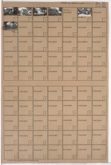
Tax Assessment Block Folder, Kansas City, MO, District 12, Block 246

Folder contains photographs of residences in the Wornall Homestead neighborhood, from 57th Street south to 57th Terrace, and Wyandotte Street east to Main Street.
Street Names
Folder contains photographs of residences in the Wornall Homestead neighborhood, from 57th Street south to 57th Terrace, and Wyandotte Street east to Main Street.

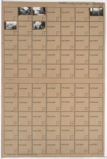
Folder contains photographs of residences in the Wornall Homestead neighborhood, from 57th Terrace south to 58th Street, and Wyandotte Street east to Main Street.

Folder contains photographs of residences in the Wornall Homestead neighborhood, from 57th Street south to 57th Terrace, and Main Street east to Brookside Boulevard.
Folder contains photographs of residences in the Wornall Homestead neighborhood, from 57th Terrace south to 58th Street, and Main Street east to Brookside Boulevard.

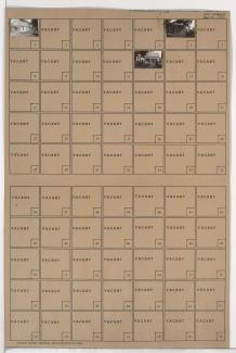
Folder contains photographs of residences in the Country Club District, from 57th Terrace south to 58th Street, and Belleview Avenue east to Summit Street.
Folder contains photographs of residences in the Country Club District, from 57th Street south to 57th Terrace, and Pennsylvania Avenue east to Wornall Road.

Folder contians photographs of residences in the Country Club District, from 57th Terrace south to 58th Street, and Pennsylvania Avenue east to Wornall Road.

Folder contains photographs of residences in the Country Club District, from 57th Street south to 57th Terrace, and Summit Street east to Pennsylvania Avenue.

Folder contains photographs of residences in the Country Club District, from 57th Terrace south to 58th Street, and Summit Street east to Pennsylvania Avenue.

Folder contains photographs of residences in the Country Club District, from 57th Street south to 57th Terrace, and Belleview Avenue east to Summit Street.

Folder contains photographs of residences in the Country Club District, from 57th Terrace north to 57th Street and east to Belleview Avenue.

Folder contains photographs of residences in the Sunset Hill West neighborhood, from 57th Street south to 57th Terrace and 58th Street, and State Line Road east to Ward Parkway.

Folder contains photographs of residences in the Sunset Hill West neighborhood, from 57th Terrace south to 58th Street and east to Ward Parkway.

Folder contains photographs of residences in the Country Club District, from 57th Terrace south to 58th Street and west to Ward Parkway.

Folder contains photographs of residences in the Swope Parkway neighborhood, from 57th Terrace south to 58th Street, and Denver Avenue east to Colorado Avenue. Folder also includes a plat map of the block.
Folder contains photographs of residences in the Swope Parkway neighborhood, from 57th Terrace south to 58th Street, and Hardesty Avenue east to the Blue River.

Folder contains photographs of residences in the Swope Parkway neighborhood, from 57th Terrace south to 58th Street, and Quincy Avenue east to Denver Avenue. Folder also includes a plat map of the block.

Folder contains photographs of residences in the Swope Parkway neighborhood, from 57th Terrace south to 58th Street, and Brighton Avenue east to Quincy Avenue. Folder also includes a plat map of the block.

Folder contians photographs of residences in the Swope Parkway neighborhood, from 57th Street south to 57th Terrace, and Jackson Avenue east to Kensington Avenue.